This site is an online media that delivers all sorts of trivia about the six Tohoku prefectures, from sightseeing and gourmet spots to local customs, history, and more
Fujisato Town is the only town in Akita Prefecture that is home to the Shirakami-Sanchi World Natural Heritage Site. The biggest attraction is the untouched nature
Fujisato Town is the only town in Akita Prefecture that is home to the Shirakami-Sanchi World Natural Heritage Site. The biggest attraction is the untouched nature
Fujisato Town is located in northern Akita Prefecture, bordering Aomori Prefecture to the north. It covers an area of approximately 28,200 hectares (hectares, hereafter referred to as hectares / 282 square kilometers), and is a town rich in nature, with approximately 90% covered in forest. Approximately 4,344 hectares of this area is the Shirakami Mountains, a World Heritage Site, and the entire town is included in the Shirakami-Sanchi area in the broader sense
The Shirakami Mountains are a part of life. The people of Fujisato love and protect the Shirakami Mountains
The lowest elevation in Fujisato Town is just over 110m in the Yasaka district, while the highest point is Mount Fujisato-Komagatake at 1,158m. The Aomori border region, with its chain of high mountains over 1,000m in elevation, is almost entirely registered as a World Heritage Site, the Shirakami-Sanchi Mountains, with the exception of Mount Fujisato-Komagatake. The core zone, measuring 2,466 hectares (on the Akita Prefecture side), is strictly protected and managed, with mountain climbing prohibited. (Only those who apply for and receive permission to enter the core zone on the Aomori Prefecture side can enter.) Surrounding the core zone is a 1,878-hectare buffer zone, part of the World Heritage Site, which allows mountain climbing and serves to protect the core zone
Fujisato Town was formed by the merger of the former Fujikoto Village and the former Kasuge Village, and has a population of approximately 2,400 (Akita Prefecture statistics as of August 2025)
Tara Mine contributed to the prosperity of the Kubota Domain during the Edo period and was mined until the 1950s
The Fujisato area is the most heavily forested area in Akita Prefecture, and as most of it is mountainous, it rarely appears in historical records, except for the Tara Mine, which has been in the spotlight since the mid-Edo period as a mine that produced high-quality lead and zinc
According to one theory, the Tara Mine was founded in the Heian or Kamakura period, but there are also records that it was founded between the Sengoku period and the early Edo period, so it is unclear when it was founded. In the early Edo period, it was known as a silver mine
"Tara Mine" is thought to have been written in the Edo period. "Map of Mount Tara (copyright unknown)" Collection: Akita University Library
Tara Mine is located in the upper reaches of the Fujikoto River, which joins the Yoneshiro River near Niageba (Niageba, Futatsui-cho, Noshiro City), in the middle reaches of the Yoneshiro River; the product was transported to the unloading point on the Fujikoto River and then sent to Noshiro Port on the Yoneshiro River. In 1775, the Kagoyama Smelter was established in Niageba to smelt copper from the Ani Copper Mine, which was the largest producer in Japan at the time, and lead from Tara Mine played an important role as a catalyst in copper smelting
In 1802, the travel writer Sugae Masumi (1754-1829) visited the area and wrote that he was surprised by the scenery of tunnels dug all over the mountains and the large number of people there (published in the Shigeki Yamamoto section of Sugae Masumi's Travelogue).In 1817, it came under direct management of the Kubota Domain, and along with the Ani Mine and Innai Silver Mine (Yuzawa City), it became a major source of revenue for the Kubota Domain
After the Meiji period, the mine was sold to Furukawa Ichibei (1832-1903, miner and founder of Furukawa Mining [now Furukawa Co., Ltd.]), but it was severely damaged in a major flood in 1958 (Showa 33) and was closed
For inquiries, please contact: Fujisato Town Commerce, Industry and Tourism Division
Phone number: 0185-79-2115
*Bear sightings are becoming more frequent. Please be careful and carry bells, whistles, bear repellent spray, etc., and do not travel alone. Also, be careful of hornets
access:
Public transportation: Approximately 50 minutes by car from Futatsui Station on the JR Ou Main Line
By car: Approximately 55 minutes from Futatsui Shirakami IC on the Akita Expressway
Google Map
Hiking trails with beautiful autumn foliage: "Tara Gorge" and "Tara Gorge Scenic Forest"
Tara Gorge is a valley located about 20km upstream on the Fujikoto River, in a forested area with Mt. Sangayama (approximately 952m above sea level) on the left bank and Mt. Fujisato Komagatake towering on the right bank. At an altitude of about 200m, the valley is densely forested with deciduous broadleaf trees such as beech and chestnut, and man-made cedar forests. The surrounding area has been designated as the Tara Gorge Scenic Forest, and is popular as an easy hiking course, especially for its beautiful autumn foliage. This area is not registered as a World Heritage Site
For inquiries, please contact: Fujisato Town Commerce, Industry and Tourism Division
Phone number: 0185-79-2115
*Road closed during winter. Scheduled to reopen around May
*Bear sightings are becoming more frequent. Please be careful and carry bells, whistles, bear repellent spray, etc., and do not travel alone. Also, be careful of hornets
Takedai Nature Observation and Education Forest is a natural forest of deciduous broadleaf trees, including beech, that gives you the feeling of being lost in the Shirakami Mountains. It covers an area of approximately 18 hectares and is located at an elevation of approximately 620m. There are walking paths through the dense forest that are suitable for walking in sneakers. The well-constructed Multipurpose Exhibition Facility within the forest serves as a toilet, rest area, and shelter in case of bad weather, so be sure to check its location before entering the forest
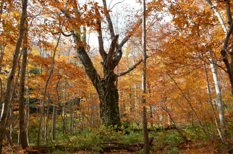
The forest is also home to a 400-year-old beech tree that is said to have been the inspiration for a famous anime and was thought to be 400 years old, but it passed away in March 2022 (Reiwa 4) at the age of 50 and returned to the earth
At the "Dakedai Nature Observation Education Forest," you may encounter not only trees but also rare small animals and flowers. However, autumn is the season of harvest, so please be careful of bears, who especially love beech nuts. This area is not registered as a World Heritage Site
Taketai Nature Observation and Education Forest Information
Facility name: Gakudai Nature Observation and Education Forest
Location: Fujikotozawa National Forest, Fujisato-cho, Yamamoto-gun, Akita Prefecture
For inquiries, please contact: Fujisato Town Commerce, Industry and Tourism Division
Phone number: 0185-79-2115
*Road closed during winter. Scheduled to reopen around May
*Bear sightings are becoming more frequent. Please be careful and carry bells, whistles, bear repellent spray, etc., and do not travel alone. Also, be careful of hornets
To get to Tanashiro Marsh, take the Kuroishizawa trailhead for the Fujisato Komagatake climb, which is about a 10-minute drive from the Taketai Nature Observation Education Forest. After getting off the car, take the old road for about 15 minutes to reach the area. A boardwalk runs through the marsh, where you can enjoy the colonies of Asian skunk cabbage and day lilies from spring to summer. In autumn, the surrounding beech and other deciduous broadleaf trees turn beautiful red, and the marsh, known as "kusa-momiji" (grass maple), is a bit lonely, but is a typical autumn scene
It takes about two hours to reach the summit of Fujisato Komagatake from Tanawashiro Marsh, but you will need proper clothing, shoes, and other equipment. If possible, we recommend asking a mountain guide to show you the way. From the summit, you can see the core of the Shirakami Mountains, covered in virgin beech forest, as well as Mount Iwaki. This is outside the World Heritage Site area
Fujisato Komagatake and Tanawashiro Marsh Information
Facility name: Fujisato Komagatake and Tanawashiro Marsh
For inquiries, please contact: Fujisato Town Commerce, Industry and Tourism Division
Phone number: 0185-79-2115
Winter road closures
*Bear sightings are becoming more frequent. Please be careful and carry bells, whistles, bear repellent spray, etc., and do not travel alone. Also, be careful of hornets
Subari Park is located on the right bank of the Subari Dam, and is a national recreation area with facilities such as a campground, tennis courts, iris gardens, and a nature park center, allowing you to fully enjoy outdoor life. It is also popular for its Suffolk Shirakami rest house, where you can eat locally produced lamb hogget. The surrounding area is covered with a forest of deciduous broad-leaved trees such as beech mixed with cedar, allowing you to enjoy the beautiful changing scenery throughout the seasons, from fresh greenery to autumn leaves
For inquiries, please contact: Fujisato Town Commerce, Industry and Tourism Division
Phone number: 0185-79-2115
Opening period: late April to early November
Closed: Mondays (or the day after a public holiday if Monday is a public holiday)
Mobile phone: Only in front of Suffolk Shirakami
Wi-Fi: Free (inside Furusato Nature Park Center)
*Please check the official website or call for details on opening days, facilities, fees, etc
*Bear sightings are becoming more frequent. Please be careful and carry bells, whistles, bear repellent spray, etc., and do not travel alone. Also, be careful of hornets
(Note) Due to a natural disaster, the road from Subari Park to Kodake and the Kodake Nature Observation Education Forest is currently closed as of October 2025. There are no plans to reopen the road. For more information, please contact the Tohoku Forest Office (phone number: 018-836-2276)
access:
Public transportation: Approximately 30 minutes by car from Futatsui Station on the JR Ou Main Line
By car: Approximately 40 minutes from Futatsui Shirakami IC on the Akita Expressway
Google Map
A blessing from the Shirakami Mountains, this famous waterfall can be seen just off the main road
The abundant spring water in the Shirakami-Sanchi forest, which is home to beech and other deciduous broadleaf trees, irrigates the villages where people live. There are also many waterfalls, and you can see beautiful waterfalls without having to go deep into the forest
Garo Falls and Choshi Falls are located 4-5km from the center of Fujisato Town and can be easily reached on foot
Garo Otaki Falls is located in Garo Otaki Waterside Park, about 5.5 km from the center of Fujisato Town, and has a drop of about 12 meters. It is lit up during the spring and autumn foliage seasons
For inquiries, please contact: Fujisato Town Commerce, Industry and Tourism Division
Phone number: 0185-79-2115
*Bear sightings are becoming more frequent. Please be careful and carry bells, whistles, bear repellent spray, etc., and do not travel alone. Also, be careful of hornets
Choshi Falls is located about 4km from the center of Fujisato Town, with a drop of about 18m. During the Edo period, when Masumi Sugae visited, it was recorded that hot springs were gushing out from the rocks on the right side of the falls. Although the hot springs no longer naturally gush out from the falls, they are still there and are used as the source of the hot springs at the adjacent hot spring inn, Yunosawa Onsen Yumoto Nagaminoyu
For inquiries, please contact: Fujisato Town Commerce, Industry and Tourism Division
Phone number: 0185-79-2115
*Bear sightings are becoming more frequent. Please be careful and carry bells, whistles, bear repellent spray, etc., and do not travel alone. Also, be careful of hornets
The Shirakami-Sanchi World Heritage Center (Fujisatokan) is an exhibition facility located in Fujisato Town at the southern foot of the Shirakami-Sanchi Mountains, and is a must-visit for anyone wanting to learn more about the area
Inside the museum, there is an area that displays and introduces information about the flora and fauna that live there, as well as a large selection of books and a DVD viewing space
There is a nature advisor on-site who is knowledgeable about the Shirakami-Sanchi Mountains, and will provide easy-to-understand explanations about the area even for first-time visitors
Shirakami-Sanchi World Heritage Center (Fujisatokan) Information
Facility name: Shirakami-Sanchi World Heritage Center (Fujisatokan)
Public transportation: Take a taxi from Futatsui Station on the JR Ou Main Line for approximately 20 minutes, or take a local bus bound for Manako for approximately 20 minutes and get off at the Yunosawa Onsen bus stop (not available on weekends, holidays, or during the New Year holidays)
By car: Approximately 30 minutes from Futatsui Shirakami IC on the Akita Expressway
My love of travel led me to work for a travel magazine some time ago, and now I work as a travel writer for an online publication. I have visited all 47 prefectures in Japan, focusing on the Tohoku region, and I enjoy soaking in hot springs and experiencing traditional Japanese culture, including old townscapes, lifestyles, and performing arts and crafts