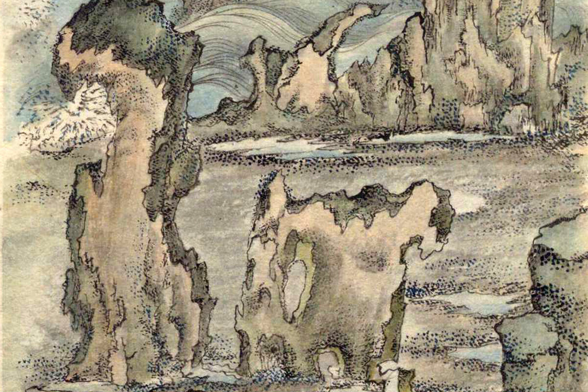
[Part 1] Masumi Sugae's Walk through the Oga Peninsula – Kanpuzan and Honzan, a sacred mountain tour [Akita Prefecture]
table of contents
- 1 Masumi Sugae left behind five travelogues of the Oga Peninsula called "The Five Winds of Oga"
- 2 "Oga's Autumn Wind" - Walking along the southern coast and inland of the Oga Peninsula
- 3 Visit the "Hidden Village of Demons" and "Aratama Pond" at Mt. Kanpu
- 4 Shintama Pond, where a woman once jumped into the water and is said to be home to a giant snake
- 5 From Wakimoto, through Shiosezaki, to the gate of Akagami Shrine
- 6 Visit Nissekiji Temple (Akagami Shrine) and reflect on ancient legends
- 7 Visiting the famous spots at the foot of Mt. Kanpu, we continue our journey from Oga towards Noshiro
- 8 The Oga Peninsula, where Masumi Sugae walked, has been equipped with 90 signposts and information boards for visitors to explore
- 9 Link: Following the Oga Peninsula Walked by Masumi Sugae (3 Parts)
Masumi (1754-1829) was a travel writer from the Edo period who traveled mainly to northern Japan and Hokkaido, and left behind written accounts of the scenery, the lives and customs of the people, accompanied by colored illustrations.
He arrived in Akita at the age of 48, and traveled all over the prefecture, leaving behind many books, until his death at the age of 76. He is also known as Japan's first folklorist, and Sugae Masumi Travelogue, " which was presented at Meitokukan, has been designated an Important Cultural Property of Japan.
Masumi Sugae left behind five travelogues of the Oga Peninsula called "The Five Winds of Oga"
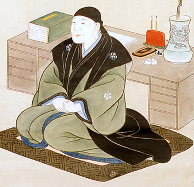
Masumi Sugae first set foot on the Oga Peninsula in 1804. He headed north from Kubota Castle (Akita City), first touring the southern coast of the Oga Peninsula, Mt. Kanpu, and Lake Hachirogata (Ogata Village), before walking towards Noshiro (Noshiro City). He compiled his experiences in the book Autumn Winds of Oga
Masumi was so impressed with the Oga Peninsula that he returned in 1810. His travelogue from that time was compiled into four books: " Spring Breeze of Oga ," " Cool Breeze of Oga ," " Island Breeze of Oga, " and " Cold Breeze of Oga ."
These five volumes, including "Oga's Spring Breeze," "Oga's Cool Breeze," "Oga's Island Breeze," "Oga's Cold Breeze," and the first, "Oga 's Autumn Breeze," are known as the "Five Winds of Oga " and are extremely valuable resources for understanding the Oga Peninsula during the Edo period.
Here, we will follow the footsteps of Sugae Masumi in Oga in three parts, following the "Five Winds of Oga." The first part is "Autumn Winds of Oga," which describes his first visit to the Oga Peninsula in 1804
The Sugae Masumi Travelogue, a nationally designated important cultural property, is privately owned and cannot be viewed, but there are several copies of the book written exactly like the original by later calligraphers that remain and can be viewed at Akita Prefectural Museum, the National Diet Library, the National Archives of Japan, and libraries across the country
This article will be written with reference to manuscripts held by the Akita Prefectural Museum, the National Archives of Japan, and the National Diet Library, as well as a modern translation published in 2000. Unless otherwise noted, dates from the Edo period are those recorded by Masumi (using the old calendar)
reference
- Akita Prefectural Museum Sugae Masumi Library (Manuscript)
- National Diet Library Digital Collection Akita Series Special Collection Vol. 1 (Sugae Masumi Collection Vol. 1/Manuscript)
- National Archives of Japan: Masumi Travelogue (manuscript from 1875)
- Published by Heibonsha, Sugae Masumi Travelogue 5, edited and translated by Uchida Takeshi and Miyamoto Tsuneichi, published on August 9, 2000
- *The quotations from Masumi Sugae's writings are based on "Masumi Sugae's Travels, edited and translated by Takeshi Uchida and Tsuneichi Miyamoto, published by Heibonsha."
"Oga's Autumn Wind" - Walking along the southern coast and inland of the Oga Peninsula
On August 14, 1804, Masumi left his lodgings in the castle town of Kubota, the seat of the Kubota Domain (Akita Domain), and spent the night at Tsuchizaki Port (Tsuchizaka Port, Akita City). The following day, on the 15th, he set out on foot towards the Oga Peninsula
Our first destination was Tenno Village (Tenno, Katagami City), located along Lake Hachirogata. We would use this as a base for a while to tour the Oga Peninsula. Lake Hachirogata was originally a lake at the base of the Oga Peninsula, but most of the lake has now been reclaimed, leaving only a small portion as Lake Hachirogata (Ogata Village)
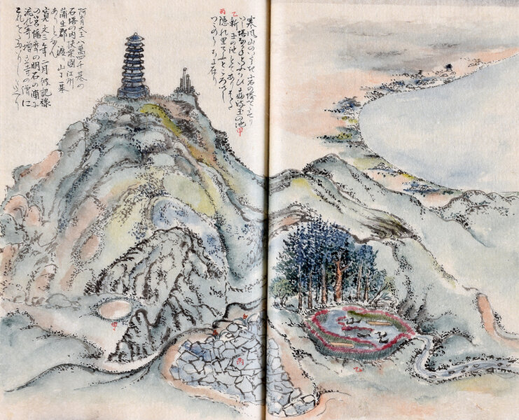
Visit the "Hidden Village of Demons" and "Aratama Pond"
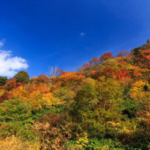
On August 21st, we climbed Mt. Kanpu (335m above sea level) and were deeply moved by the scenery. On the way down, we visited "Ishikura or Kakurego, a place where many rocks have fallen and piled up like a mountain." This place is still a tourist attraction known as " Oni no Hidden Village ," and is said to be where ogres lived.
Mt. Kanpu was originally a volcano that was active from about 30,000 years ago to about 10,000 years ago, but is now inactive and is not registered as an active volcano. The "Hidden Village of Demons" was formed when lava was pushed out from the ground during an ancient eruption, forming a mountain that collapsed when it could not withstand the weight of the mountain. Inside is a space of about 3 tatami mats, which is said to be the home of a demon
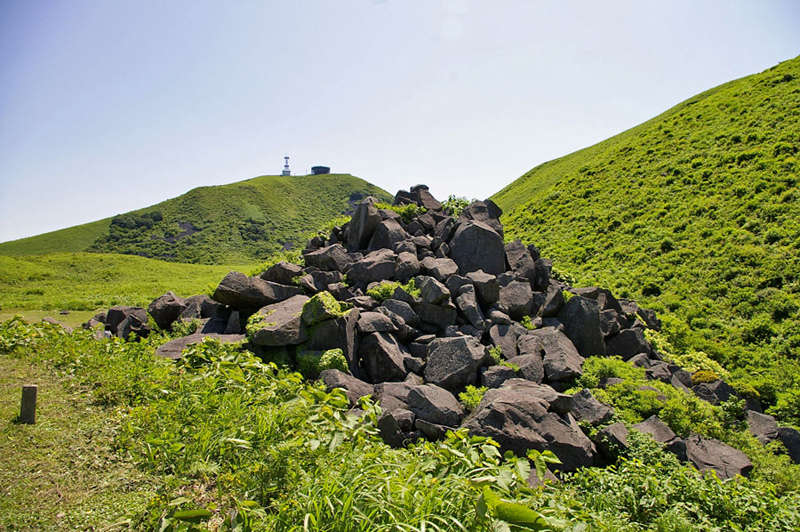
The space existed in the Edo period, and Masumi and his party "all just stuck their heads in and peered in," finding it so creepy that no one wanted to go inside
It is written that nearby there was a stone called "Suzurimizu" (inkstone-shaped stone with a hollow in it that held water), and this inkstone is thought to be the "Kōbō Daishi's inkstone stone," which is said to still be filled with water and never runs dry
INFORMATION
- Facility name: Demon's Hidden Village/Kanpuzan
- Address: 62-1 Kanpuzan, Wakimoto Tominaga, Oga City, Akita Prefecture
- Phone number: 0185-25-3055
- Kanpuzan Rotating Observation Deck/Observation Deck Restaurant
- Opening period: late March to late November
- Closed: Open daily during business hours, from early December to mid-March
- Admission fee:
- Rotating observation deck: Adults 550 yen, Elementary and middle school students 270 yen
- *The revolving restaurant can be used without paying admission
- URL: Mt. Kanpuzan Rotating Observatory/Observatory Restaurant
- access:
- Public transportation: Approximately 20 minutes by Kanpuzan sightseeing taxi (reservation required) from Oga Station on the JR Oga Line
- By car: Approximately 40 minutes from Showa Oga Peninsula IC on the Akita Expressway
GOOGLE MAP
Shintama Pond, where a woman once jumped into the water and is said to be home to a giant snake
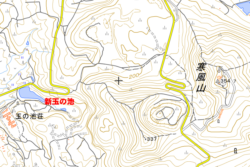
, we stopped off at Pond, at the foot of Mt. Kanpu, where it is said that "a woman named Tamahime once jumped into the water."
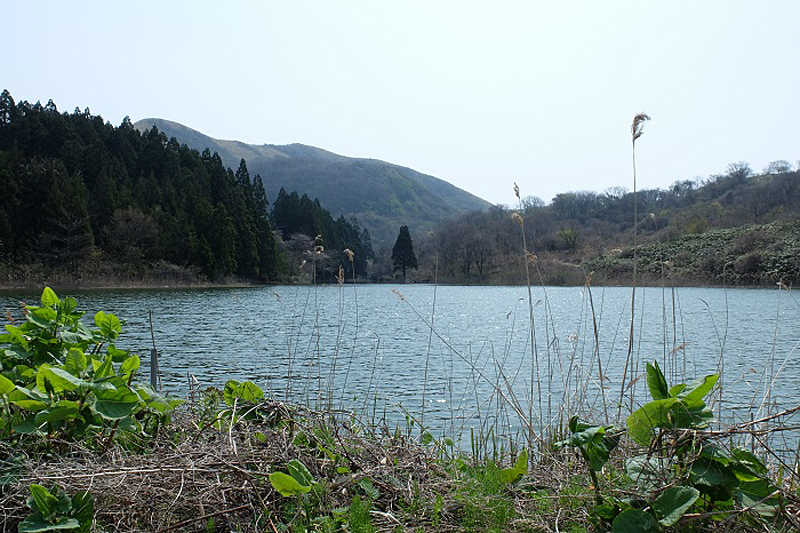
Shintama Pond is still known as a viewpoint of Mt. Kanpu, but the legend that is passed down today is slightly different from the story Masumi heard
According to " Oga Folktales a young girl named Otama, who was being courted by a village headman, threw herself into the pond to escape him and turned into a giant snake ." There is another new legend about Tamanoike. The original Tamanoike was located in the crater of Mount Kanpu, but when the water dried up, the giant snake that lived there moved to a pond at the foot of the mountain.
INFORMATION
- Facility name: Shintama Pond
- Location: Oga City, Akita Prefecture, Oga Nakatakigawa Kanpuzan Yokodori
- Phone number: 0185-24-4700 (Oga City Tourism Association)
- access:
- Public transportation: Approximately 8 minutes by taxi from Hadachi Station on the JR Oga Line, or approximately 1 hour on foot from Sky Park Kanpuzan Observatory
- By car: Approximately 35 minutes from Showa Oga Peninsula IC on the Akita Expressway
From Wakimoto, through Shiosezaki, to the gate of Akagami Shrine
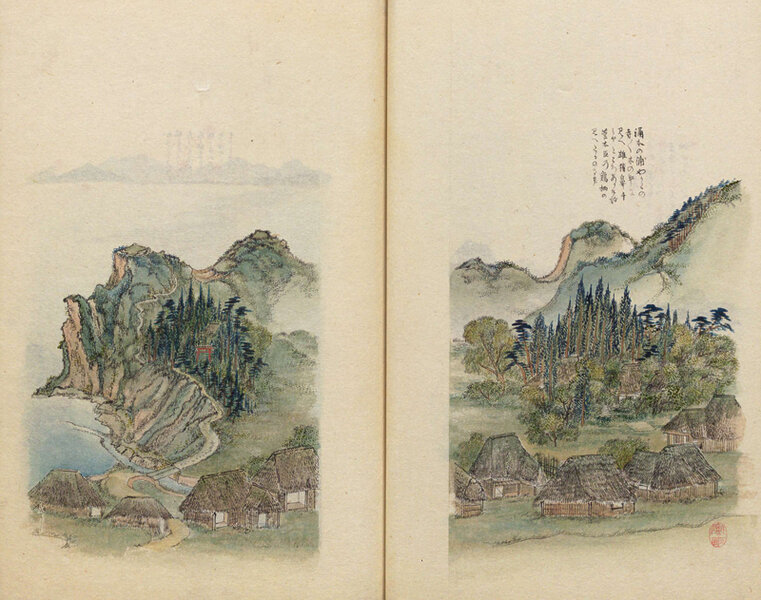
On August 24th, we went to the coastal town of Wakimoto (Wakimoto, Oga City) and visited the medieval castle ruins of Wakimoto Castle Oibanasaki
From Cape Ikuhanazaki, we could see Mount Chokai, Tobishima (Sakata City, Yamagata Prefecture), and Mount Taihei (Akita City, Akita Prefecture), which gave the castle its name, and I was captivated by the view
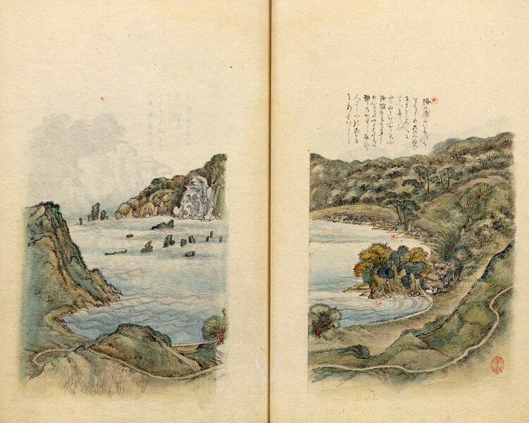
The next day, travel west along the coast, Funakawa (Funakawa Port, Oga City), Onagawa (Onagawa River, Onagawa, Funakawa Port, Oga City), no Ura no Ura , the southernmost port on the Oga Peninsula, where Cape Shiosezaki is located .
Many camellias still bloom at Funakawa Port, and the camellias that bloom around Noto Mountain near the port are said to be at the northernmost limit of their natural growth in Japan, and have been designated a national natural monument
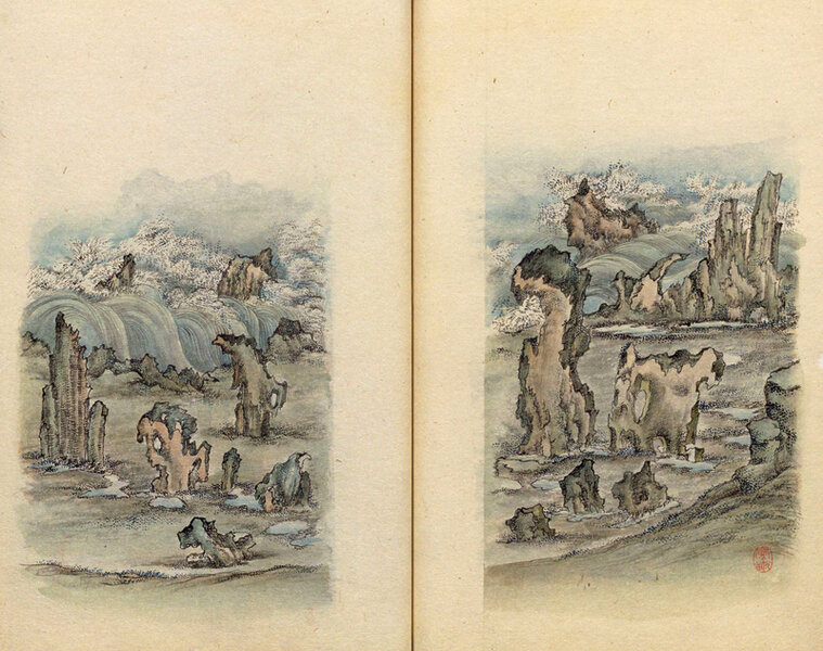
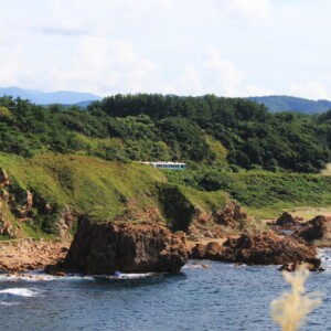
The weather was bad in Obama, so they finally went out around noon on August 27th and saw the strange rock formations at Shiosezaki. Seeing Shiosezaki for the first time, Masumi described the strange rock formations as "a sight that astonished the eyes" and "a landscape that cannot be put into words or written form."
Visit Nissekiji Temple (Akagami Shrine) and reflect on ancient legends
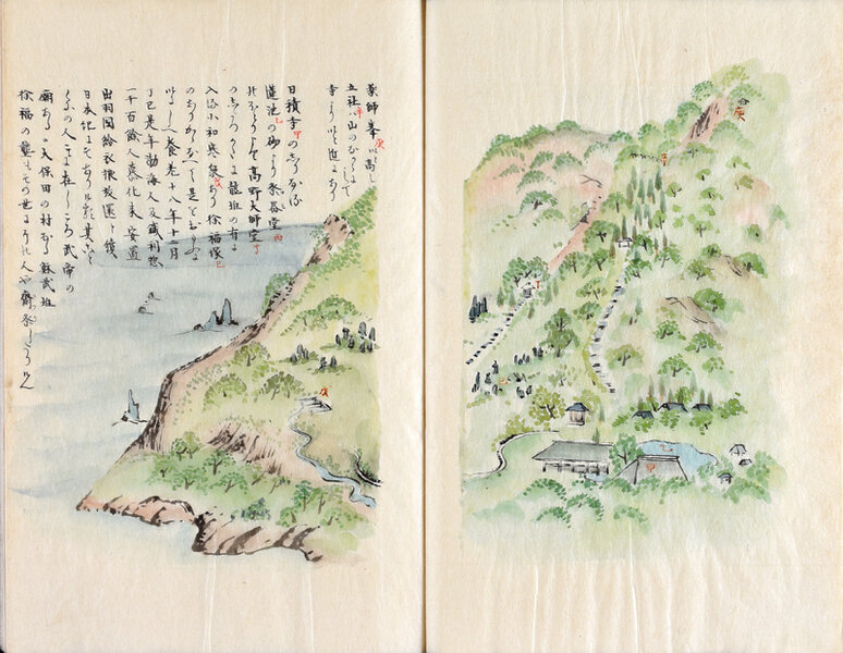
After arriving at Monzen visits Nisshakuji Temple , located halfway up the main temple
As Masumi also wrote, Nissho-ji Temple is a historic temple where the legend of Emperor Wu of Han (an ancient Chinese state) and five bats (the Red God Legend) is passed down
During the Heian period, it flourished as a center for mountain training on the Oga Peninsula, with many branch temples (temples and shrines and lodgings attached to the main temple), but by the Edo period it had become very lonely, as it is written that "only Kisshoin and Chorakuji remain."
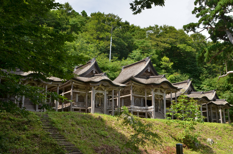
Nissho-ji Temple was abandoned during the Meiji period, but later Akagami Shrine , and remains include the Goshado Hall (a nationally designated important cultural property) built during the Muromachi period, and 999 stone steps that are said to have been built overnight by five demons.
*For details about the legend of the five bats and the 999 stone steps, please refer to The Demons of the Oga Peninsula - Why do Namahage carry blades and punish people? - Are Namahage really gods?]
INFORMATION
- Facility name: Akagami Shrine, Goshado, and 999 stone steps
- Address: 35 Harakawa, front of the main temple gate, Funakawa Port, Oga City, Akita Prefecture (Akagami Shrine)
- Phone number: 0185-24-9220 (Oga City Tourism, Culture and Sports Department, Tourism Division)
- access:
- Public transportation: Take the Oga City Bus Oga Minami Line from Oga Station on the JR Oga Line to the Monzen Parking Lot bus stop
- By car: Approximately 40 minutes from Showa Oga Peninsula IC on the Akita Expressway
GOOGLE MAP
Visiting the famous spots at the foot of Mt. Kanpu, we continue our journey from Oga towards Noshiro
After visiting Nisshakuji Temple, Masumi returned the way he came, visiting several villages and arriving at Tenno Village, the base of his Oga journey, on August 30. After staying there for a while, on September 4 he set out along Lake Hachirogata towards Noshiro
On September 6th, we visited Taki no Kashira, a group of springs where clear water flows from between rocks, located Shibikawa (Shibikawa, Goria, Oga City)
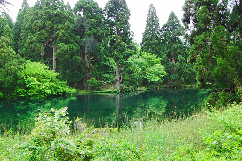
The area around Takino-kashira is the tip of lava that flowed from Mt. Kanpu, and even now, a lot of fresh water flows out from between the rocks. Takino-kashira is the largest of the springs, forming a pond. The spring water is still used as drinking water and agricultural water for Oga City, and is carefully protected
INFORMATION
- Facility name: Takinotashira
- Location: 34 Magurogawa, Goriai, Oga City, Akita Prefecture (Oga City Takinogashira Water Source Purification Plant)
- Phone number: 0185-46-4105
- Tour times: 10:00-15:00
- Closed: Open all year round
- access:
- Public transportation: Approximately 20 minutes by taxi from Oga Station on the JR Oga Line
- By car: Approximately 30 minutes from Showa Oga Peninsula IC on the Akita Expressway
GOOGLE MAP
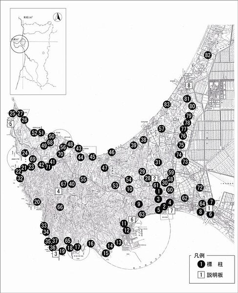
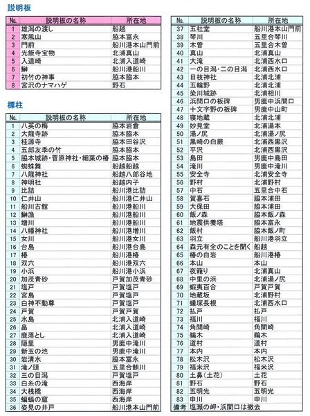
The Oga Peninsula, where Masumi Sugae walked, has been equipped with 90 signposts and information boards for visitors to explore
The path that Sugae Masumi walked around the Oga Peninsula has been maintained as the " Sugae Masumi Path ," with signposts at 83 locations related to her and detailed information boards at 8 locations. Please use this as a guide when exploring the Oga Peninsula.





![Did Namahage really exist? Traces of demons remain throughout the Oga Peninsula - Oga Peninsula and Demon Legends (2) [Akita Prefecture] 1. Namahage Sedo Festival](https://jp.neft.asia/wp-content/uploads/2024/09/1076350e647a6476081bad8cd4fd6159-150x150.jpg)
![[Part 3] Masumi Sugae's walk through the Oga Peninsula - hit by a major earthquake [Akita Prefecture] 1. The Cold Wind of Oga - Namahage Prefectural Museum](https://jp.neft.asia/wp-content/uploads/2024/10/7154afaf7fcdc00890442af025f9b4d1-150x150.jpg)
![[Part 2] Masumi Sugae's Walk around the Oga Peninsula - Fascinated by the strange rock formations along the coast [Akita Prefecture] 1 Shimakaze of Oga - 891-1 Manuscript in the possession of Akita Prefectural Museum](https://jp.neft.asia/wp-content/uploads/2024/10/8dafd7ea0a7bd28f76a6f059db39c9de-150x150.jpg)
![[Oga Peninsula, Akita Prefecture] Strange rock formations on the west coast where ancient legends are passed down Rocky landscape on the west coast of the Oga Peninsula ©Oganavi](https://jp.neft.asia/wp-content/uploads/2024/04/8764aeda3bb4db1829041fa671d1b72d-150x150.jpg)
![[The Mystery of Kamakura] Are Kamakura, a winter feature of Akita Prefecture, connected to the Kamakura Shogunate? Yokote 4_Travel Tohoku 1000](https://jp.neft.asia/wp-content/uploads/2025/08/a2674c8c7497fa159899e9b2a761c38f-150x150.jpg)

![[Oga Peninsula, Akita Prefecture] Full of Viewpoints. Oga Peninsula, a Magnificent Park Created by the Earth 3d84cc3d4a133d89422d448f000c277b](https://jp.neft.asia/wp-content/uploads/2024/04/3d84cc3d4a133d89422d448f000c277b-150x150.jpg)


