[Part 2] Masumi Sugae's Walk around the Oga Peninsula – Fascinated by the Strange Rocks Along the Coast [Akita Prefecture]
table of contents
- 1 Another tour of the Oga Peninsula begins at Kohanji Temple (Masayama Shrine), where the legend of Namahage remains ("Oga's Spring Breeze")
- 2 Enjoy the magnificent view of the west coast of the Oga Peninsula from Happodai
- 3 A stroll around Hatazaki (Nyudozaki), which was very lonely during the Edo period ("Oga no Suzukaze")
- 4 Wandering around the very busy Toga Bay area
- 5 Viewing the complex coastline and strange rock formations of the southwest from a dugout canoe (Oga no Shimakaze)
- 6 Be amazed by the strange rock formations at Kankane Cave and Osanbashi Pier
- 7 The Oga Peninsula, where Masumi Sugae walked, has been equipped with 90 signposts and information boards for visitors to explore
- 8 Link: Following the Oga Peninsula Walked by Masumi Sugae (3 Parts)
Oga Gofu, Masumi (1754-1829) about his travels around the Oga Peninsula in the Edo period , this book introduces the Edo period and present day in a comparative manner.
The second episode resumes the journey around the Oga Peninsula, with " Oga no Harukaze Oga no Suzukaze " and "Oga no Shimakaze touring the west coast .
This article will be written with reference to manuscripts held by the Akita Prefectural Museum, the National Archives of Japan, and the National Diet Library, as well as a modern translation published in 2000. Unless otherwise noted, dates from the Edo period are those recorded by Masumi (using the old calendar)
reference
- Akita Prefectural Museum Sugae Masumi Library (Manuscript)
- URL: Akita Prefectural Museum Sugae Masumi Library
- National Diet Library Digital Collection Akita Series Special Collection Vol. 1 (Sugae Masumi Collection Vol. 1/Manuscript)
- URL: National Diet Library Digital Collections
- National Archives of Japan: Masumi Travelogue (manuscript from 1875)
- URL: National Archives of Japan, Masumi Travelogue
- Published by Heibonsha, Sugae Masumi Travelogue 5, edited and translated by Uchida Takeshi and Miyamoto Tsuneichi, published on August 9, 2000
- *The quotations from Masumi Sugae's writings are based on "Masumi Sugae's Travels, edited and translated by Takeshi Uchida and Tsuneichi Miyamoto, published by Heibonsha."
Another tour of the Oga Peninsula begins at Kohanji Temple (Masayama Shrine), where the legend of Namahage remains ("Oga's Spring Breeze")
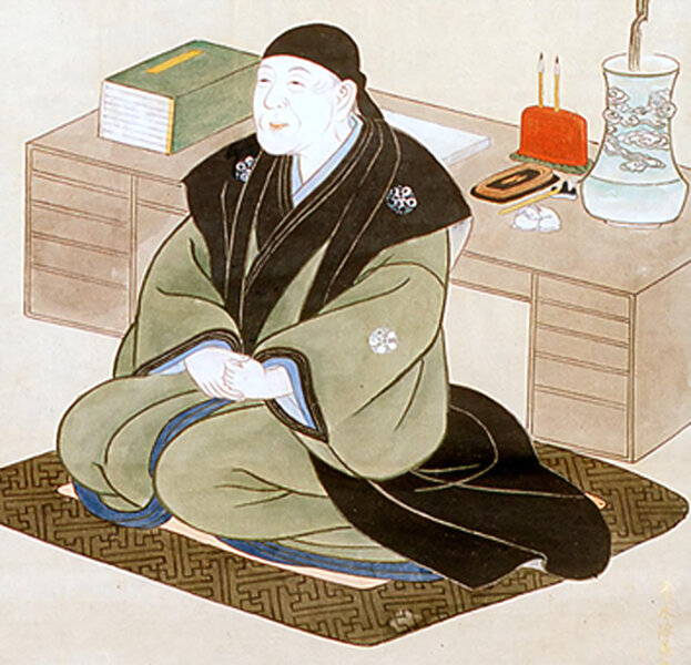
the New Year of 1810 in Yachinaka, Gojome, near the Oga Peninsula , and on March 20th he set out for the Oga Peninsula again.
They headed north along the east coast of Lake Hachirogata, then north to Noshiro, then south along the Sea of Japan, arriving at Sarukawa (Noishi Sarukawa, Oga City), the entrance to the Oga Peninsula, on March 27. However, Masumi became ill, and finally left Sarukawa on April 7, arriving at the foot of Mt. Shinzan (567m) that same day
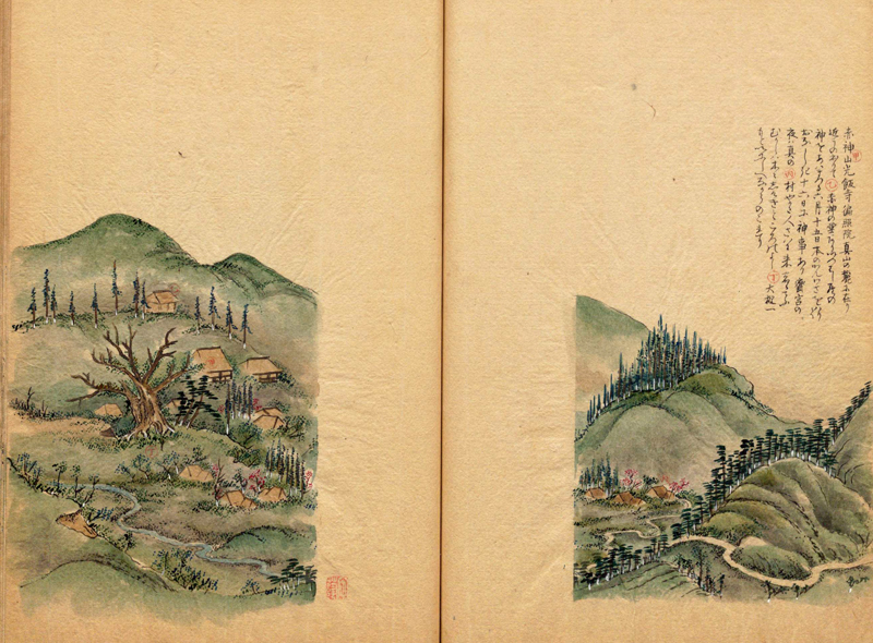
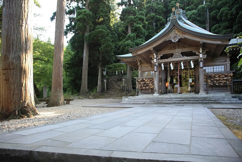
Like the main mountain towering next to it, Mayama is a sacred mountain where the legend of the Akagami remains, and midway up the mountain currently sits Mayama Shrine (known as Koubou-ji Temple until the Edo period, Mayama in Kitaura, Oga City)
Mayama Shrine is known for its deep connection to Namahage, and the shrine grounds are home the Oga Mayama Folklore Museum and the Namahage Museum, as well as the Namahage Sedo Festival, which is held every February.
INFORMATION
- Facility name: Shinzan Shrine / Oga Shinzan Folklore Museum / Namahage Museum
- Address: 97 Mizukuisawa, Kitaurayama, Oga City, Akita Prefecture
- Phone number: 0185-22-5050
- URL: Mayama Shrine / Oga Mayama Folklore Museum / Namahage Museum
- access:
- Public transportation: Approximately 40 minutes by Oga Peninsula Ainori Taxi "Namahage Shuttle" from Oga Station on the JR Oga Line
- By car: Approximately 40 minutes from Showa Oga Peninsula IC on the Akita Expressway
GOOGLE MAP
Enjoy the magnificent view of the west coast of the Oga Peninsula from Happodai
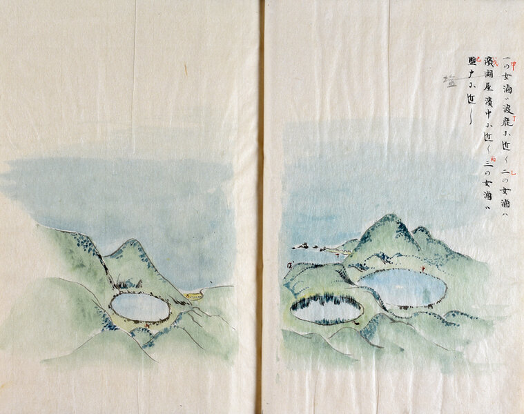
Masumi, who was feeling unwell, stayed in the village of Mayama until April 11th. On the 11th, she visited Kohanji Temple, and finally left Mayama on the 12th, heading Hatazaki (Nyudozaki, Kitaura, Oga City). She Kitanoura (Kitaura, Oga City) and Nomura (Kitauranomura, Oga City) below her, and on the way, she stopped Tadenumanotai (Happodai, Togahama, Shioya Kazuyama, Oga City) Ichinomegata (a nationally designated natural monument), Ninomegata , Sannomegata , Toga no Ura (Toga Bay).
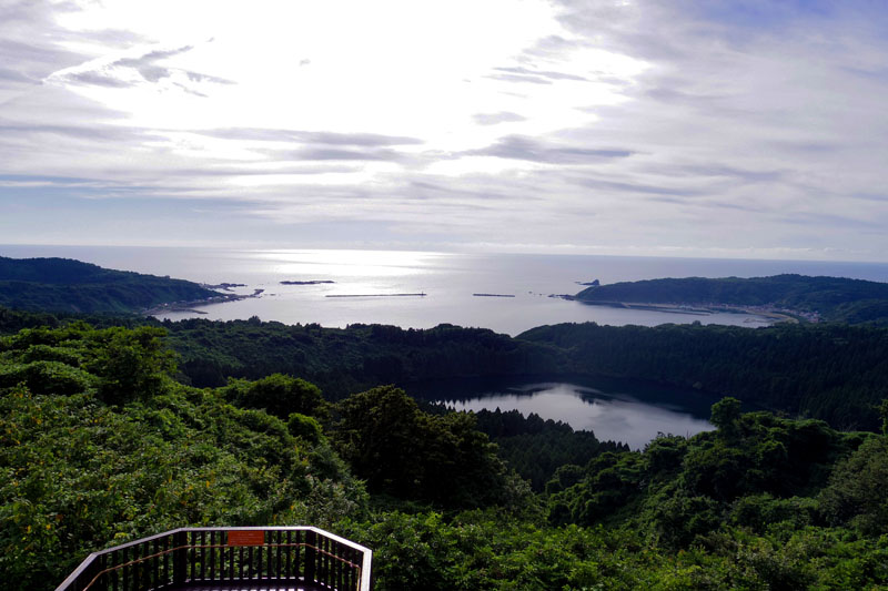
Ninomegata and Toga Bay from Hachimokudai ©Akita Prefecture
INFORMATION
- Facility name: Hachimokudai
- Location: Shioya Kazuyama, Togahama, Oga City, Akita Prefecture
- Phone number: 0185-24-4700 (Oga City Tourism Association)
- access:
- Public transportation: Approximately 20 minutes by taxi or rental car from JR Oga Station
- By car: Approximately 50 minutes from Showa Oga Peninsula IC on the Akita Expressway
GOOGLE MAP
After descending the mountain, Masumi stopped off at Kitanoura, which she could see below, on the 14th, and on the 16th she stopped off at a coastal village before arriving at Yumoto (Kitaura Yumoto, Oga City), where hot springs gush out, on the 22nd. She stayed there for a while
Yumoto, together with the hot springs in the nearby Ishiyama area, is now Oga Onsenkyo . While the hot springs in Ishiyama were discovered during limestone mining in the Meiji era, Yumoto's hot springs were discovered in the Heian period. It seems to have been very popular during the Edo period, and Masumi wrote that the hot springs were " dry and have a hint of ryokuban (green iron) ." "Dry" means salty, and ryokuban is a type of hot spring that contains iron and is characterized by its greenish color. Currently, hot spring inn, Onsen Ryokan Yumoto , is open, and the water quality is listed as being carbonated and weakly saline.
By early May, I was in Yumoto, and "Oga no Harukaze" ended in a village called Yunoshiri, near Yumoto
A stroll around Hatazaki (Nyudozaki), which was very lonely during the Edo period ("Oga no Suzukaze")
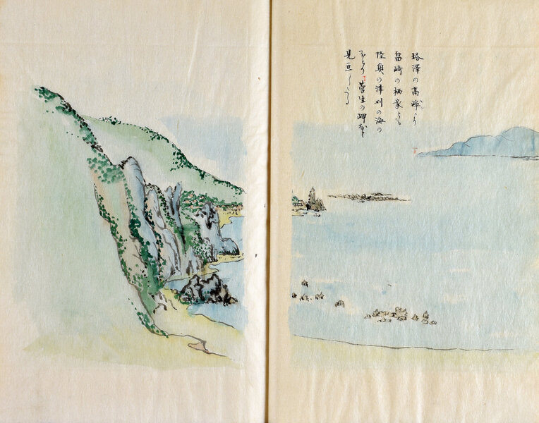
We will walk around the villages on the north coast until mid-June, observing and learning about local daily life, customs, and events. At the end of June, we will finally depart for the west coast
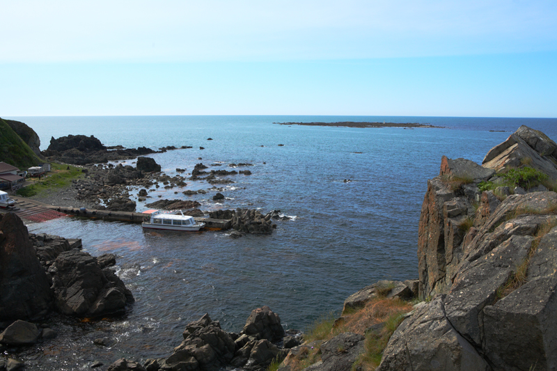
Nyudozaki Konbuura. The flat island floating in the sea is Mizushima ©Oganavi
our first destination Hatazaki (Nyudozaki, Kitaura, Oga City), just after June 20th. Nyudozaki was apparently a poor place where rice could not be grown and where there was a village of fishermen's houses built on top of towering rocks, and the scenery was completely different from the current top tourist destination on the Oga Peninsula.
On June 23rd, we went to Mizushima, which floats off the coast of Nyudozaki, and took a walk. The island has flat rocks just above the water's surface, and it seems that at the time, when the wind blew, it would have been hidden underwater. From the boat on the way back to Mizushima, we could see the steep rocks of Nyudozaki, including the Shishiotoshi (Deer Dropping) rock formation
INFORMATION
- Facility name: Nyudozaki
- Location: Nyudozaki, Kitaura, Oga City, Akita Prefecture
- Phone number: 0185-24-4700 (Oga City Tourism Association)
- access:
- Public transportation: Approximately 30 minutes by Namahage Shuttle from Oga Station on the JR Oga Line
- By car: Approximately 45 minutes from Showa Oga Peninsula IC on the Akita Expressway
GOOGLE MAP
Wandering around the very busy Toga Bay area
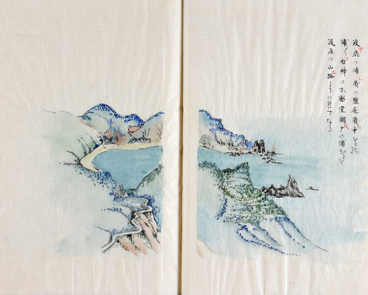
On June 24th, they left Nyudozaki on foot and Toga no Ura (Toga, Oga City), a port town on the west coast along Toga Bay. Toga Bay was originally a volcanic crater and has a beautiful circular shape. As a result, the waves were calm and it was a fairly lively port, with "large ships and small boats coming together to anchor, so there were one or two prostitutes."
Masumi stayed overnight at Toganoura, then headed south along Toga Bay the next day, Shiotohama Beach (Toga Shiohama, Oga City), where he stayed the night. Shiotohama Beach is now where Oga Aquarium is located. " Oga no Suzukaze " ends here, and he continues with "Oga no Shimakaze."
Viewing the complex coastline and strange rock formations of the southwest from a dugout canoe (Oga no Shimakaze)
The journey began on July 13th, departing from Shiodonoura. From Shiodonoura, he boarded a dugout canoe and traveled south along the west coast of the Oga Peninsula, viewing the strange rock formations and leaving behind many drawings
From Shioto onwards, the terrain continues to become complex, with rocks of various shapes lining the cape and several fishing ports in small bays. The boat arrived at our accommodation, a fishing port called Kamonoura (Kamoaosa, Oga City) in the centre of the west coast
Experience Bon Odori at Kamo Aosa
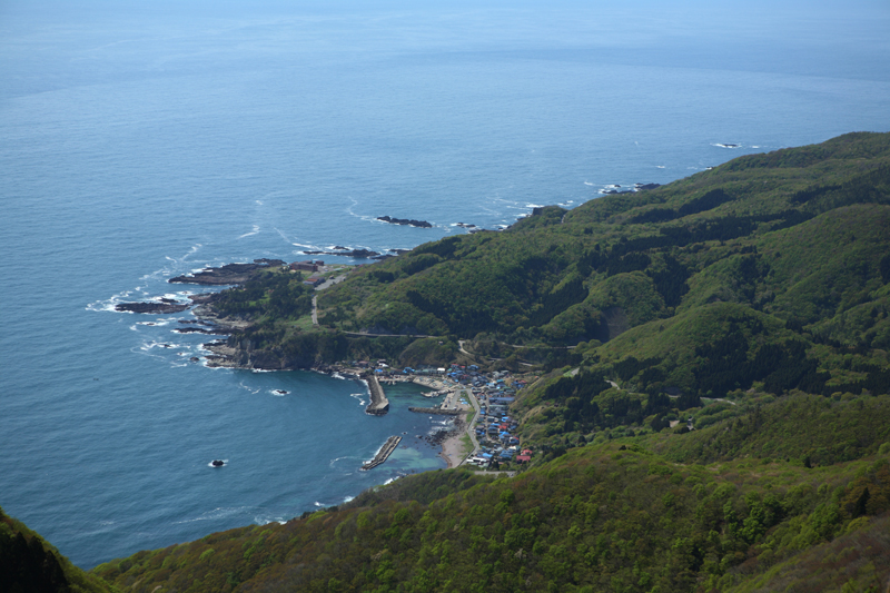
Masumi , " Kamo and Aosa line the streets ," Kamo no Ura is divided into the Kamo district (formerly Kamo Village) to the north and the Aosa district (formerly Aosa Village) to the south, separated by the Kamo fishing port in the center, and even today houses line the shoreline for about 800 meters from north to south. During the Edo period, it is said that during the summer, residents on this beach would sleep "after dark, to avoid the mosquitoes, men, women, and children would all sleep on the sand on the beach, covered with a cloth."
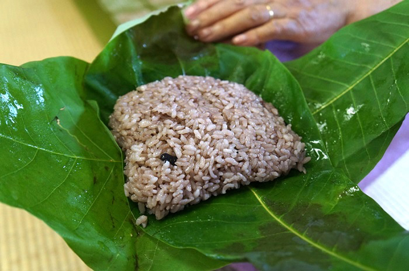
July 14th is Obon (July 13th to 16th / August 13th to 16th in the solar calendar), and from the morning the villagers make red bean rice (azuki bean rice) with boiled fish and vegetables, which they offer to the Buddhist altar. In the evening, Bon dance called "Dadadako" is held jointly by Kamo and Aosuna, and Masumi also went to watch, enjoying the night in Oga.
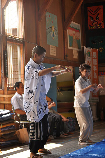
" Dadadako " is a unique name for the Bon Odori dance in Kamo Aosa, which has been performed for a long time, but was discontinued around 1998. However, it was revived in 2010 at the suggestion of a university student, and has continued to be performed to this day.
Be amazed by the strange rock formations at Kankane Cave and Osanbashi Pier
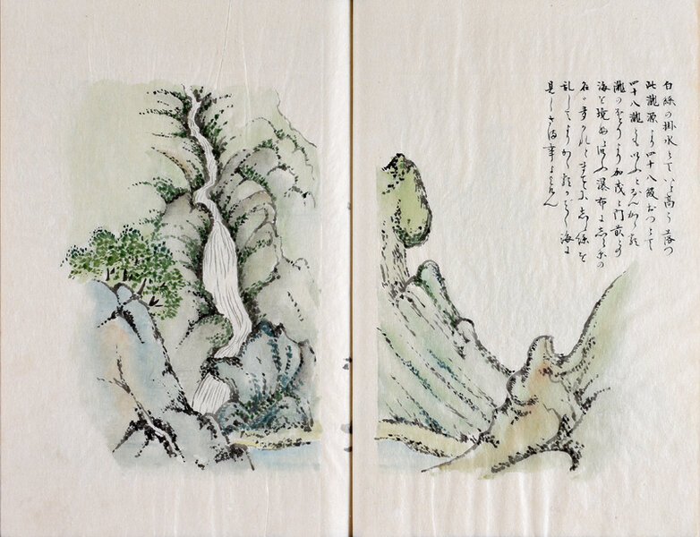
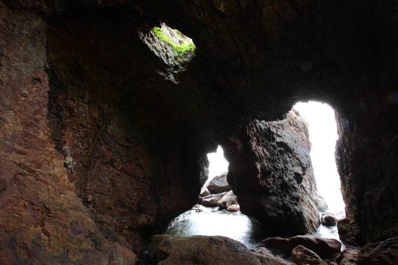
On the 15th, we visited the nearby Shiraito Falls and went inside Kankane Cave Kankane Cave was formed by the erosion of coastal rocks by waves, and it is truly magical when sunlight shines in through the holes in the ceiling.
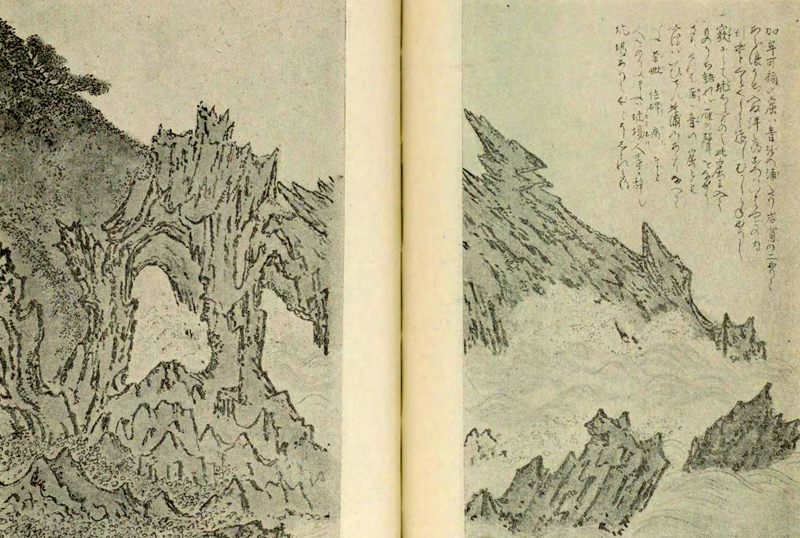
Kankane Cave (Kankane Cave) "Oga no Shimakaze" (Oga Island Breeze) from the Akita Series of manuscripts held at the National Diet Library
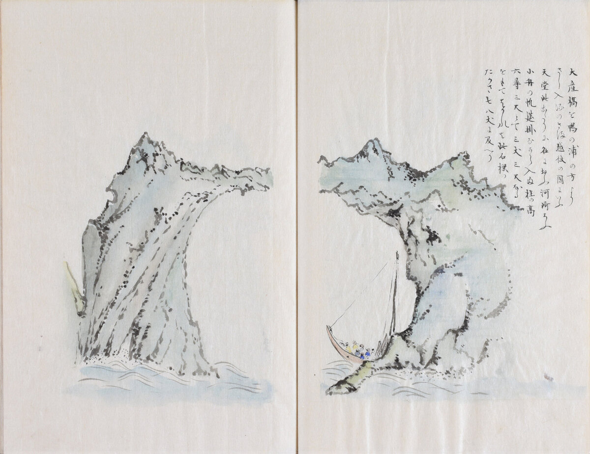
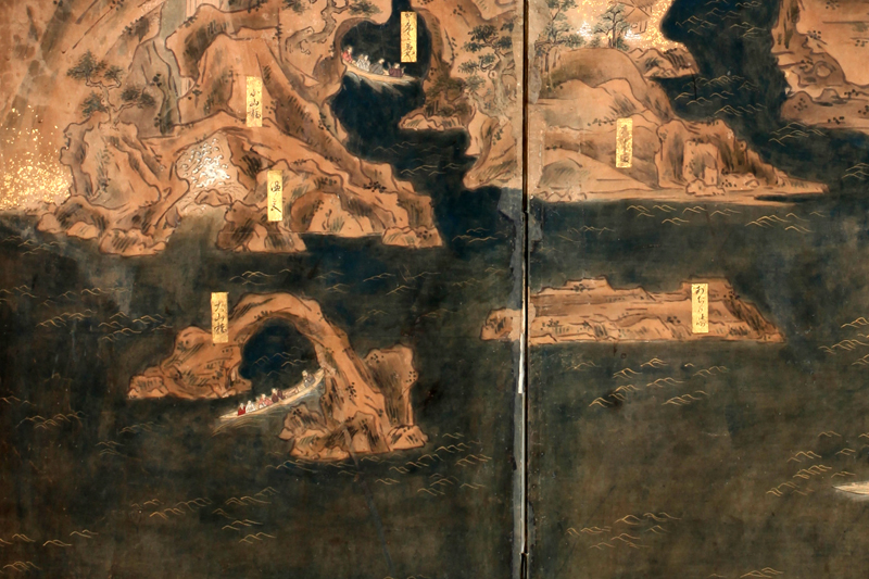
On the 17th, we set sail from Kamo Port and enjoy the strange rock formations and waterfalls along the coast from the boat, all the way to the southernmost gate (in front of the Honzan Gate at Funakawa Port in Oga City). The strange rock formations have been given various names since ancient times based on their shapes, and some of the Daisankyo Bridge (Osanbashi), Butaijima Island Kojaku no Iwaya (Peacock Cave). The boat passes between many small islands and arrives at the gate.
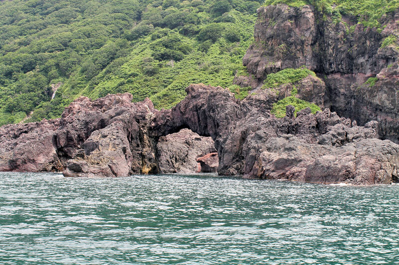
This will be Masumi's second visit to the temple, and she Nisshakuji Temple (also known as Akagami Shrine), which she also visited on her previous visit (August 27, 1804). Nisshakuji Temple is now Akagami Shrine , and its traditions are preserved there. the 999 stone steps , which are said to have been built by an ogre in one night, and the Goshado Hall (a nationally important cultural property), making it one of the most popular tourist destinations on the Oga Peninsula.
For sightseeing on the west coast of the Oga Peninsula the Oga Peninsula Sightseeing Boat , where you can view the strange rock formations and Oga mountains from the sea, just like Sugae Masumi.
INFORMATION
- Facility name: Osanbashi Pier, Butaijima sightseeing boat pier (Oga Peninsula sightseeing boat), Akagami Shrine
- Location: Haraigawa River, in front of the main temple gate, Funakawa Port, Oga City, Akita Prefecture
- Phone number: 0185-38-2050
- Operated by: Oga Pleasure Cruise Co., Ltd
- Price: West Coast Cruise Adults 2,500 yen, Children 1,250 yen
- Operating period: Please inquire (closed during winter)
- URL: Oga Peninsula Sightseeing Cruise
- access:
- Train: Approximately 30 minutes by taxi from Oga Station on the JR Oga Line. Rental cars available near Oga Station
- By car: Approximately 70 minutes from Showa Oga Peninsula IC on the Akita Expressway
GOOGLE MAP
After visiting Nissekiji Temple (Akagami Shrine), Masumi returns to the town in front of the temple, where "Oga's Island Breeze" ends. On July 18th, she departs from the temple and begins "Oga's Cold Wind," a walk along the southern coast. During her journey, she encounters the Oga earthquake. "Oga's Cold Wind" continues in " Part 3: Tracing the Oga Peninsula as Walked by Sugae Masumi
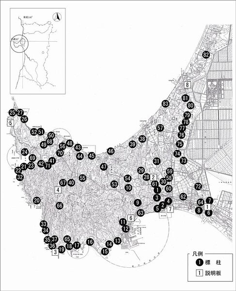
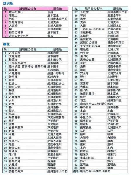
The Oga Peninsula, where Masumi Sugae walked, has been equipped with 90 signposts and information boards for visitors to explore
The path that Sugae Masumi walked around the Oga Peninsula has been maintained as the " Sugae Masumi Path ," with signposts at 83 locations related to her and detailed information boards at 8 locations. Please use this as a guide when exploring the Oga Peninsula.





![[Part 3] Masumi Sugae's walk through the Oga Peninsula - hit by a major earthquake [Akita Prefecture] 1. The Cold Wind of Oga - Namahage Prefectural Museum](https://jp.neft.asia/wp-content/uploads/2024/10/7154afaf7fcdc00890442af025f9b4d1-150x150.jpg)
![[Part 1] Masumi Sugae's Walk through the Oga Peninsula - Kanpuzan and Honzan, a sacred mountain [Akita Prefecture] 1. Strange Rocks, Akikaze, Archives](https://jp.neft.asia/wp-content/uploads/2024/10/af533a619304de93bb8c3974f774074e-150x150.jpg)
![Let's go see the natural Akita cedars [2] A forest of natural Akita cedars with giant trees over 200 years old Shichizayama](https://jp.neft.asia/wp-content/uploads/2025/08/2e1cab44ce484b377d4a0b2675da2274-150x150.jpg)
![[The Mystery of Kamakura] Are Kamakura, a winter feature of Akita Prefecture, connected to the Kamakura Shogunate? Yokote 4_Travel Tohoku 1000](https://jp.neft.asia/wp-content/uploads/2025/08/a2674c8c7497fa159899e9b2a761c38f-150x150.jpg)
