[Part 1] Japan's first nautical chart, "Map of Kamaishi Port in Rikuchukoku," and the development of Kamaishi [Iwate Prefecture]
table of contents
Speaking of mapping Japan, Ino Tadataka conducted a nationwide survey in 1799. So, where was Japan's first nautical chart produced? Which port, sea, and background might spring to mind? Personally, I imagine the first nautical chart was of Dejima, an artificial island built as part of the country's isolationist policy during the Edo period, or Uraga (present-day eastern Yokosuka, Kanagawa Prefecture), where Commodore Perry arrived on his black ships at the end of the Edo period
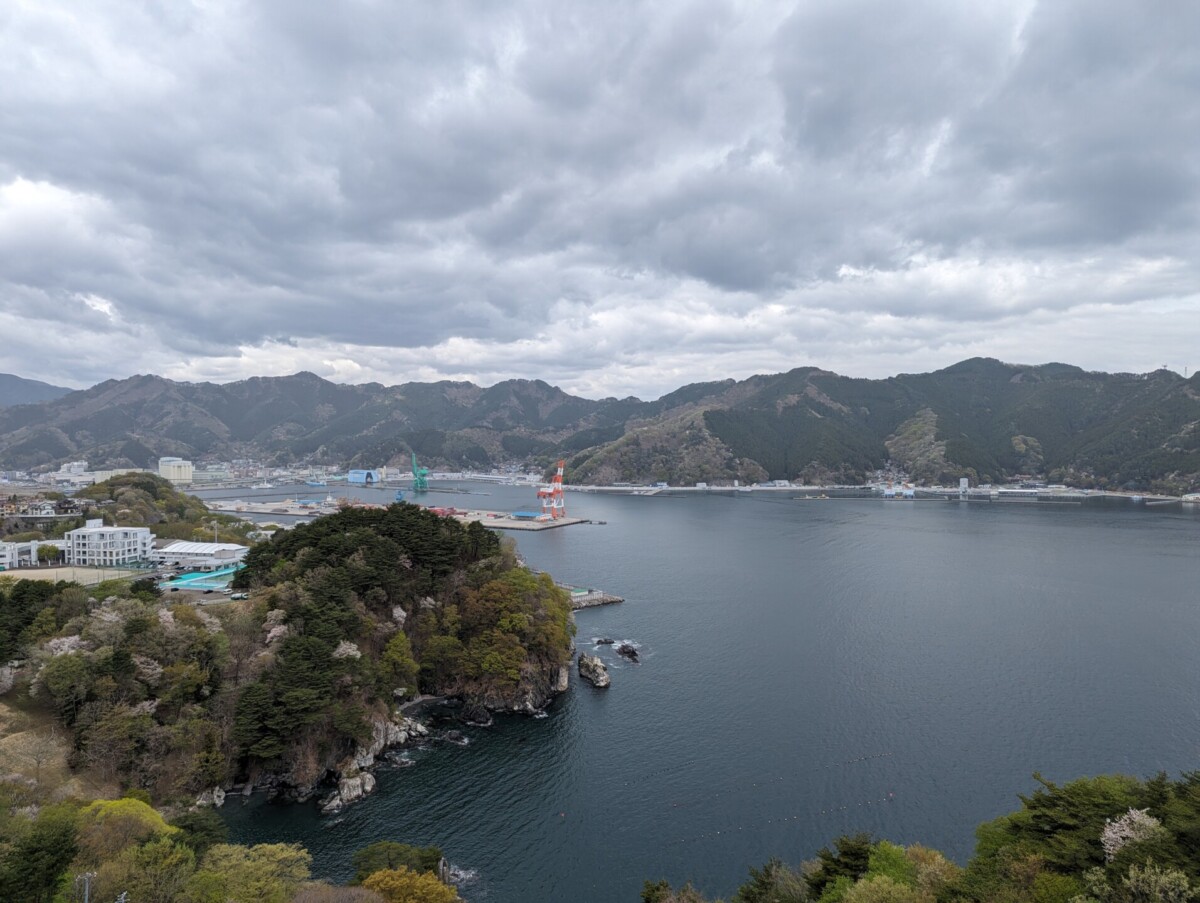
But in fact, that's not the case. Japan's first nautical chart is "Map of Kamaishi Port in Rikuchu Province, " and it shows the current Kamaishi Port in Kamaishi City, Iwate Prefecture.
The process of creating the Japan Sea Chart
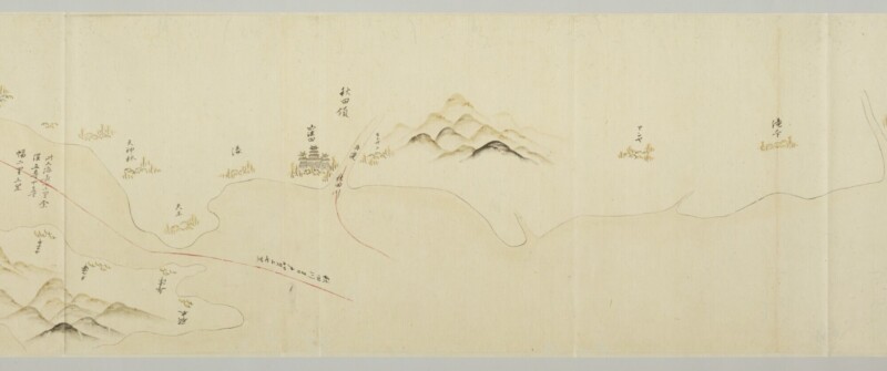
During the Azuchi-Momoyama period, when Toyotomi Hideyoshi was in power, red seal ship trade was thriving, and Portolano charts, which were used in Europe, were produced in Japan. Domestic sailors the Portolano charts to travel to distant southern seas such as Luzon (one of the Philippine islands), Cambodia, and Siam (Thailand).
During the Edo period, Japan was closed to the outside world and travel abroad was prohibited, leading to a period when nautical charts were not needed. Countries that had asked Japan to end its isolation carried out their own surveys and recorded detailed information in their own countries, citing the need for safe navigation. The shogunate became concerned about the national defense of Japan's coastline being revealed by foreigners, and decided to conduct their own surveys and produce the necessary nautical charts
Meanwhile, the West-Makai and East-Makai shipping routes, which started from Sakata Port in Yamagata, developed, and many simple and practical route guide maps for coastal navigation, " Kaihin Shukouzu ," were created and used by ships such as Kitamae-bune.
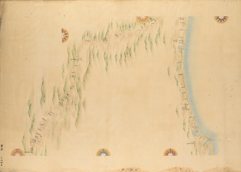
Twenty-one years after Ino Tadataka, mentioned at the beginning of this article, conducted his nationwide survey, he submitted the "Ino Map," a complete map of the coasts of Japan, to the shogunate. The map accurately measured Japan's coastline, and it is said that the British Navy, which arrived at the end of the Edo period, used this map to create modern nautical charts of the Japanese coast
Map of the Port of Kamaishi in Rikuchu Province
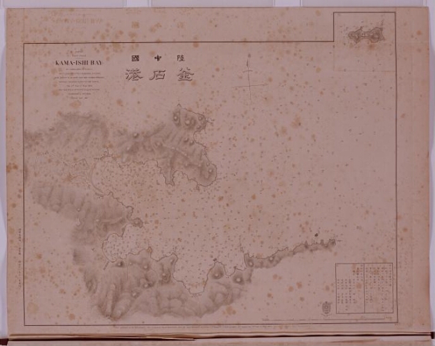
This "Map of Kamaishi Port in Rikuchukoku" is the first nautical chart to be surveyed by the Japanese Navy Hydrographic Bureau (a naval organization responsible for the safety of navigation, including surveying waterways, producing nautical charts, compiling hydrographic guides, and observing weather and sea conditions) , and published in 1872. The unit of water depth used was fathom (a unit at the time called "hiro," which was approximately 1.8m), and considering the historical context, one can imagine the hardships of our predecessors.
So why did Kamaishi Port become Japan's first nautical chart?
Kamaishi was an important iron production center
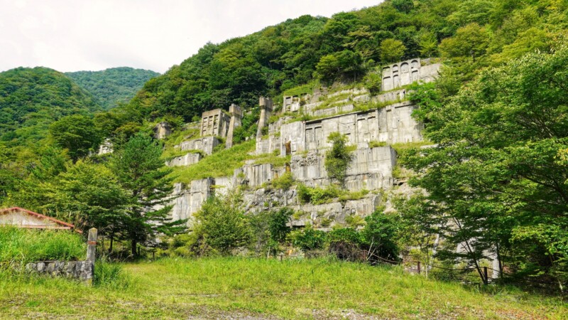
Kamaishi City in Iwate Prefecture is the largest producer of iron ore in Japan, which is essential for steel production, and is also where the Meiji government built a government-run steel mill in 1881
It is believed that Kamaishi Port was chosen as the subject port for the first nautical chart because it was an important port at the time as an intermediate supply point between Tokyo and Hakodate, and because it was located just before the construction of a government-run steelworks, which was a time when nautical charts were being produced domestically
The port town, once bustling with eastern shipping, transformed into a steel-making town, and what was once a small town of less than 5,000 people grew to 14,925 in 1911, and at its peak in 1963 to 92,123, making it the second most populous city in Iwate Prefecture after Morioka
Kamaishi City suffered extensive damage during the Pacific War
In 1945, as the Pacific War reached a critical juncture, major cities across the country were subjected to air raids by B29s, and the onslaught spread to regional cities as well. However, in Kamaishi, an industrial city with iron ore resources in the Ohashi district and the only self-sufficient steelworks in the country, the citizens worked hard to increase wartime production, knowing that they would one day be subjected to air raids
In this situation, the United States launched a naval bombardment of Kamaishi City with three fast battleships, two heavy cruisers, and nine destroyers on July 14 of the same year, in order to "destroy Japan's important industries, disrupt transportation, and lower the fighting spirit of the Japanese people."The United States then launched a second naval bombardment on August 9 of the same year with three fast battleships, four heavy cruisers, and ten destroyers
These two naval bombardments and air raids by carrier-based aircraft reduced Kamaishi to a scorched earth, resulting in many casualties and destroying the steelworks' functions
The number of casualties is still being investigated in Kamaishi City, but the "Kamaishi Naval Gun War Damage Record" published in 1976 listed the names of 753 casualties, and subsequent investigations have now shown that the list of casualties now includes 782
You can see the extensive damage and history of the Pacific War at the Kamaishi City Local History Museum, located right next to Kamaishi Station
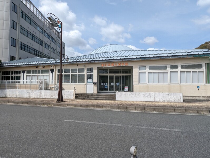
Kamaishi City Local History Museum <Information>
- Name: Kamaishi City Local History Museum
- Address: 15-2 Suzukocho, Kamaishi City, Iwate Prefecture, 026-0031
- Business hours: 9:30~16:30 *Last admission is at 16:00
- Admission fee: 200 yen for adults / 100 yen for groups (20 or more) *Free for infants, elementary and junior high school students, high school students, and those with a disability certificate
- Closed: Every Tuesday *New Year's holiday (December 28th to January 4th)
- URL: https://www.city.kamaishi.iwate.jp/kyoudo/



![[Part 2] Japan's first nautical chart, "Map of Kamaishi Port in Rikuchukoku," and the development of Kamaishi [Iwate Prefecture] PXL_20240419_011206902](https://jp.neft.asia/wp-content/uploads/2024/06/PXL_20240419_011206902-150x150.jpg)
![Let's go see the natural Akita cedars [2] A forest of natural Akita cedars with giant trees over 200 years old Shichizayama](https://jp.neft.asia/wp-content/uploads/2025/08/2e1cab44ce484b377d4a0b2675da2274-150x150.jpg)
![[Mount Chokai-Tobishima Geopark: Nikaho Edition (1)] Kujukushima, which is considered to be on par with Matsushima but became land due to a major earthquake 1Kujukushima Winter 1_Nikaho City Tourism Division](https://jp.neft.asia/wp-content/uploads/2024/10/9832b69b3165ff52241c17ad3f8bf591-150x150.jpg)

![The "Flying Dumplings" are a delicious activity worth seeing! [Ichinoseki City, Iwate Prefecture] Genbikei Gorge bus stop](https://jp.neft.asia/wp-content/uploads/2017/04/IMG_5931-150x150.jpg)
![The definitive Sanriku souvenir, "Bindon" - as delicious as it looks! [Iwate Prefecture] Bottled Don (abalone, scallop, salmon roe)](https://jp.neft.asia/wp-content/uploads/2023/06/IMG_5048-150x150.jpg)
![Ryusendo Cave, one of Japan's three largest limestone caves, is a natural adventure spot! [Iwate Prefecture] Ryusendo Cave (first underground lake)](https://jp.neft.asia/wp-content/uploads/2023/07/PXL_20230512_052246926.NIGHT_-150x150.jpg)
![[Series 2: The Battle of Zenkunen and the Battle of Gosannen] The Battle of Zenkunen returns to war after a ceasefire, with the Kokufu army struggling Taga Castle Ruins](https://jp.neft.asia/wp-content/uploads/2023/11/a0b8b1213124e7a13c7308fa81e053a2-150x150.jpg)
