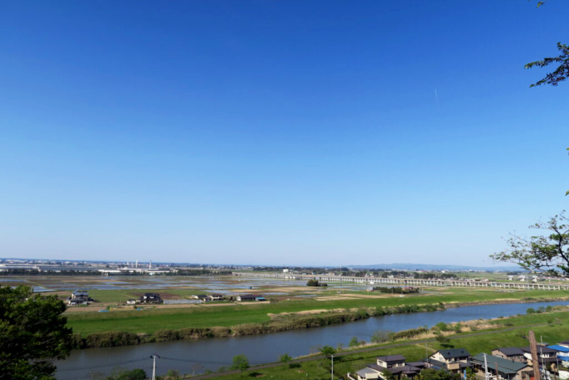
Osaki Kodo, a farmland that lives with water and has been designated a Globally Important Agricultural Heritage System (Miyagi Prefecture)
table of contents
- 1 World Agricultural Heritage Sites recognized by the Food and Agriculture Organization of the United Nations
- 2 Osaki Kōdo has been stable since the Edo period thanks to thorough water management measures
- 3 Water is distributed throughout the Osaki Kodo area using weirs, irrigation channels, and tunnels
- 4 Drought prevention measures using reused water
- 5 Water heated by sunlight is used to prevent cold damage
- 6 Osaki Kodo, Japan's largest migration site for white-fronted geese
- 7 The wisdom of our ancestors born at Osaki Kodo is a water management system that can be used worldwide
Most people outside the local area probably don't know the name "Osaki Kodo."
This rice-producing agricultural region, located in the Eai River and Naruse River basins in northern Miyagi Prefecture, is centered around Osaki City and extends to the towns of Shikama, Kami, Wakuya, and Misato. It was designated a "Japanese Agricultural Heritage System" a "Globally Important Agricultural Heritage System" in 2017
World Agricultural Heritage Sites recognized by the Food and Agriculture Organization of the United Nations
"Globally Important Agricultural Heritage Systems" are sites recognized as World Heritage sites by the Food and Agriculture Organization of the United Nations (FAO) in recognition of the importance of traditional agriculture, forestry, and fisheries in regions around the world that have long practiced agriculture, forestry, and fisheries
In Japan, in addition to Osaki Kodo, a total of 11 regions have been certified, including Sado City in Niigata Prefecture, the wasabi-growing region of Shizuoka Prefecture, the Tanabe region of southern Wakayama Prefecture, and the Kunisaki Peninsula and Usa region of Oita Prefecture
There are many different types of agricultural and fishery products that can be certified as a Globally Important Agricultural Heritage System, and in the case of Osaki Kodo, the rice paddy system that is the result of its skillful water management is the subject of certification
Osaki Kōdo has been stable since the Edo period thanks to thorough water management measures
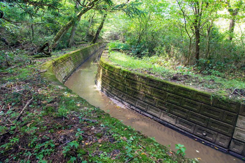
The area where Osaki Kodo spreads is a vast grain-producing region located in the northern part of the Sendai Plain, known as the Osaki Plain, and has been a thriving producer of grains such as rice since ancient times
However, despite suffering from repeated flooding of the Eai River and Naruse River and the harsh climate of the Tohoku region, the people have used their ingenuity to manage the water to keep it in optimal condition

Osaki Kodo is home to many ancient structures that are still in use, including weirs, waterways, tunnels (duguriana, senketsu, zuido), and reservoirs. Many of these were built during the Edo period, and while they are useful for agriculture, they also nurture a wide variety of plants and animals, helping to create a sustainable society
Water is distributed throughout the Osaki Kodo area using weirs, irrigation channels, and tunnels
The water that irrigated Osaki Kodo was sent to the fields through intake weirs built to take water into the Eai River and Naruse River. There are around 1,300 intakes throughout Osaki Kodo, and while many have been renovated into modern facilities, some have been left as they were and are still in use
Minamihara Anaseki is a tunnel over 1,300 meters long that was hand-dug in the early Edo period
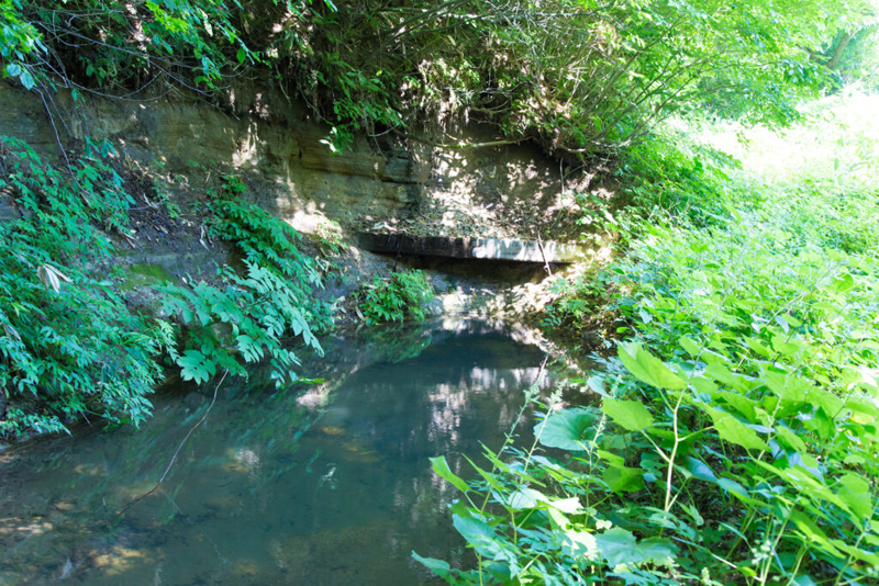
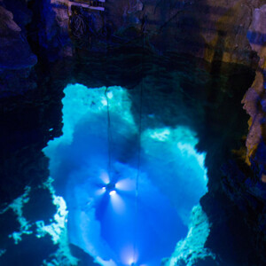
One of these, Minamihara Anaseki (Naruko Onsen area, Osaki city), located at the uppermost reaches of the Eai River system, is an agricultural waterway built in 1644. From the intake to the outlet, it is approximately 1,880m long, with an elevation difference of approximately 20m, and 1,330m of it is tunnel. Midway through the tunnel there is a horizontal hole called "Sama," from which sediment and other debris accumulated inside the tunnel was discharged. There is a walking route at Minamihara Anaseki
Minamihara Anazeki <Information>
- Facility name: Minamihara Anaseki
- Address: 34 Minamihara, Naruko Onsen, Osaki City, Miyagi Prefecture, 989-6835
- Phone number: 0229-23-2281 (Osaki Region Globally Important Agricultural Heritage Promotion Council)
- Official URL: Osaki Kodo – Naruko Onsen area
Google Map
The Arakawa Irrigation Canal, a 33km-long canal from the Edo period
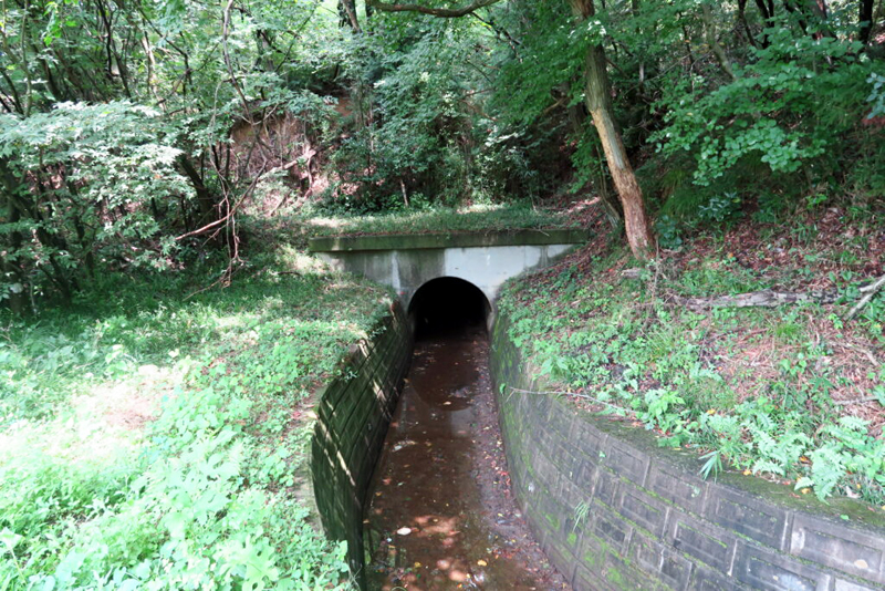
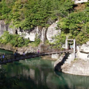
The Sanbongi district of Osaki City, located in the middle reaches of the Osaki Kōdo River, is a hilly area that makes it difficult to draw water from large rivers, so a canal approximately 33km long was dug into the hillside to supply water drawn from a tributary. This Arakawa Seki Irrigation Canal was hand-dug between 1646 and 1649, and involved 12 tunnels, making for a complex undertaking. Advanced techniques were used, including adjustments at reservoirs along the way, and the canal still functions today
Arakawa Weir Canal<Information>
- Facility name: Arakawa Weir Irrigation Canal
- Address: Sanbongi district, Osaki city, Miyagi prefecture
- Phone number: 0229-23-2281 (Osaki Region Globally Important Agricultural Heritage Promotion Council)
- Official URL: Osaki Kodo – Sanbongi area
Google Map
Drought prevention measures using reused water
Water cannot be managed simply by taking it in. Too little water can cause drought, and too much can cause floods and other problems
Droughts occur when there is little snow or no rain during the rainy season. For this reason, rather than discarding water once it has been used, a method of reusing it downstream (reuse water) was devised. Also, because many farmers use a limited amount of water, in some areas water intakes are switched so that water can be shared in turns, a system known as "bansui."
The Genroku cavern, a flood prevention measure that creates fertile farmland
Osaki Kodo was hit by floods every few years, so some kind of countermeasure was necessary. Normally, the marshes and ponds scattered here and there would store water, but when there was too much, the water would overflow the banks, flooding the fields and sometimes even putting human lives at risk. To prevent this, the banks were dug out to create drainage channels (holes). Artificial flood control basins were also built in various places, and functional flood prevention measures that are still relevant today were implemented
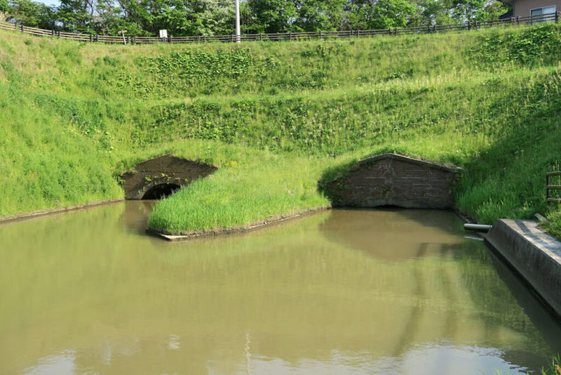
At the lowest point of the Osaki Kōdo River (Osaki City and Matsushima Town), there was a wetland that would turn into a large swamp every time there was heavy rain, causing problems for the people living there. The Sendai domain, which ruled this area at the beginning of the Edo period, thought that reclamation would eliminate flooding and increase arable land, so they dug a tunnel to drain the water into Matsushima Bay. The distance between the swamp, then known as Shinai Numa, and Matsushima Bay was more than 7km, but after five years of work, they dug a staggering 2,578m long tunnel (Genroku Sinkage) and succeeded in draining the water
The Meiji cave turned Shinai Swamp into a completely farmland
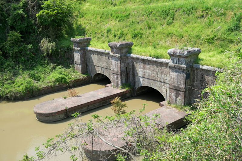
The Genroku Cave, which had been in use for many years, was almost completely filled in during the Meiji period, so a new tunnel was built. It is called the Meiji Cave and is still in use today
Due to the construction of tunnels, river improvements, and the shifting of the flow, Shinai Swamp no longer exists, with only a portion of it now being used as a flood control basin. Instead, a vast area of cultivated land has spread there
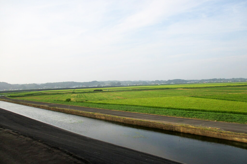
Shinai Numa Reclaimed Land <Information>
- Facility name: Shinainuma reclamation area, Genroku cave and Meiji cave
- Address: Matsushima Town, Osaki City, Miyagi Prefecture
- Phone number: 022-275-9127 (Sendai Regional Development Office, Agriculture and Rural Development Department, Planning and Coordination Team)
- Official URL: Osaki Kodo – Kashimadai area
Google Map
Water heated by sunlight is used to prevent cold damage
The Osaki Kodo area is subject to the cold, humid seasonal winds known as "Yamase," which are unique to the Pacific coast of Tohoku, and cold damage has been a source of concern. As a result, people have used their ingenuity to deal with the "Yamase," and typical methods include "stopping water during the day," "deep water management," and "lukewarm waterways."
"Daytime water stoppage" is a management method for rice paddies in which water is not added during the day, but is added at night or early in the morning, allowing the high daytime temperatures to warm the water and promote rice growth. If water is added during the day, it will remain cold until night, which will hinder growth
"Deep water management" involves filling the seedlings with water to about three-quarters of their height, and using the heat-retaining power of the water heated by the sun to promote growth. Techniques such as "stopping water during the day" and "deep water management" are still scientifically proven to be effective in preventing cold damage to rice, and are used in many regions today. They are truly the wisdom of our ancestors, nurtured by the people of "Osaki Kodo."
Water heated in a warm canal is poured into the rice paddies
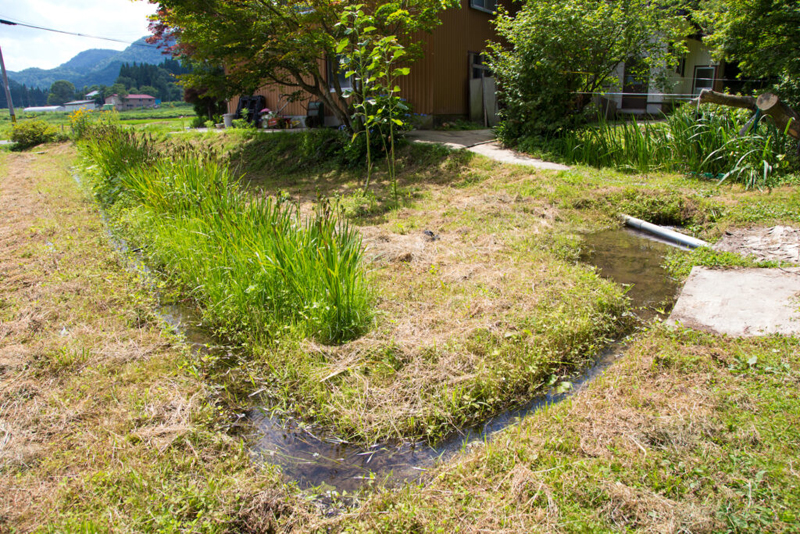
A "warm waterway" is a waterway that diverts water temporarily to raise its temperature before it is brought into the rice paddies. It is used to warm cold water such as melted snow, as well as to prevent "yamase" (wind storms), and is mainly used in the northern part of Osaki Kodo, in areas bordering mountainous regions. There are also "warm ponds" and "warm rice fields" based on the same concept
Osaki Kodo, Japan's largest migration site for white-fronted geese
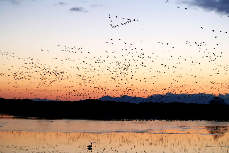
In Osaki Kodo, the residential forests known as "Igune" are effective in preventing fires and winds, and also function as a habitat for a diverse range of living creatures. The birds that make Igune their home travel back and forth between the fields and the rice paddies, helping to eliminate pests. The rice paddies also serve as a wintering ground for greater white-fronted geese, and Kabukuri-numa (Tajiri, Osaki City) is home to over 70,000 greater white-fronted geese, half of the total population of geese that migrate to Japan, and has been designated a national natural monument. In 2017, Kabukuri-numa was recognized as a Ramsar site, an international treaty for the protection of wetlands
Kabukuri Swamp <Information>
- Facility name: Kabukurinuma
- Address: Onuma, Kabukuri, Tajiri, Osaki City, Miyagi Prefecture
- Phone number: 0229-38-1401 (Kabukuri Numakko Club)
- Official URL: Osaki Kodo – Tajiri area
Google Map
The wisdom of our ancestors born at Osaki Kodo is a water management system that can be used worldwide
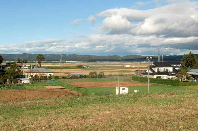
Osaki Kōdo produced cold-resistant and delicious rice varieties such as Sasanishiki and Hitomebore, which in turn produced many fermented foods such as sake, soy sauce, and other fermented foods. Many villages held festivals to give thanks for the crops, and these festivals are still passed down today as folk performing arts
The wisdom of the people who cultivated "Osaki Kodo," which has allowed them to coexist with water in the harsh climate of Tohoku, has been recognized by the world as a Globally Important Agricultural Heritage System. Furthermore, in the 21st century, when climate change is starting to disrupt the Earth, the water management measures that have been used for a long time, such as those for "Osaki Kodo," are once again attracting global attention
Osaki Kodo <Information>
- Name: Osaki Kōdo
- Address: Osaki City, Iroma Town, Kami Town, Wakuya Town, Misato Town, Miyagi Prefecture
- Phone number: 0229-23-2281 (Osaki Region Globally Important Agricultural Heritage Promotion Council)



![[Miyagi Prefecture] Professional sports in Miyagi Prefecture lead the Tohoku region! [Introduction to professional sports in the six Tohoku prefectures] Ball 2](https://jp.neft.asia/wp-content/uploads/2023/04/56074127fe3f0a7b84f64671c4fd5a8d-150x150.jpg)
![[Tome City, Miyagi Prefecture] A mysterious forest with a thousand-year history and faith in the warding off evil spirits | Kaminuma Hachiman Shrine IMG_2749](https://jp.neft.asia/wp-content/uploads/2023/08/IMG_2749-150x150.jpeg)
![Osaki Hachiman Shrine in Tajiri, Osaki City [Miyagi Prefecture], the main shrine of Sendai's national treasure, Osaki Hachiman Shrine Osaki Hachiman Shrine's worship hall](https://jp.neft.asia/wp-content/uploads/2024/09/PXL_20240911_035448667-150x150.jpg)
![Fire Prevention Tiger Dance: A traditional performing art that conveys the wish to protect the town from strong winds and fires [Miyagi Prefecture] Fire Prevention Tiger Dance](https://jp.neft.asia/wp-content/uploads/2025/05/IMG_2811-1-1-150x150.jpg)
![[Craft Beer in Miyagi Prefecture (Northern Area)] 5 Breweries with Unique Flavors! Craft beer](https://jp.neft.asia/wp-content/uploads/2022/07/23026745_m-150x150.jpg)
![[Miyagi Prefecture] Summer Scenery: 4 Stunning Sunflower Fields in Miyagi 230016](https://jp.neft.asia/wp-content/uploads/2023/05/230016-150x150.jpg)

![[Miyagi] Enjoy seasonal flower fields from spring to autumn! 3 recommended spots Flower Fields](https://jp.neft.asia/wp-content/uploads/2016/11/3627151788_c654957a1e_b-150x150.jpg)
