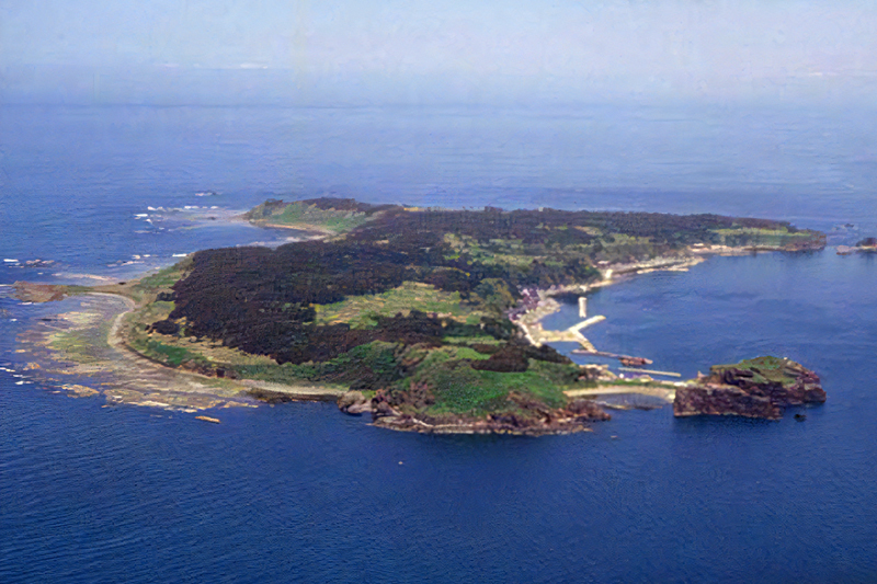
[Mt. Chokai-Tobishima Geopark: Tobishima] Tobishima, which prospered during the Edo period due to the Kitamaebune shipping
table of contents
- 1 Tobishima Island, where people have lived since the Jomon period
- 2 Tobishima Island is attracting attention as part of the "Mount Chokai-Tobishima Geopark"
- 2.1 Kashiwagiyama and the coastal promenade
- 2.2 Gotorohama Beach is characterized by its mille-feuille cliffs
- 2.3 Misumi Island, where traces of a former volcano remain
- 2.4 Araki Coast, selected as one of the "100 Best Beaches in Japan"
- 2.5 Hanatozaki Observatory, the easternmost point where you can also see Mt. Chokai
- 2.6 "Tekiana" where human bones from the Heian period were discovered
- 3 Take the regular ferry from Sakata Port to Tobishima
- 4 Articles related to Mt. Chokai and Tobishima Geopark
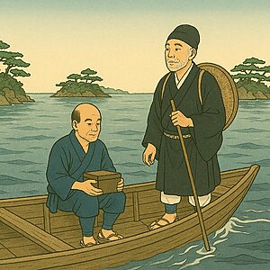
Tobishima Island Yamagata Prefecture's only remote island , located in the Sea of Japan off the coast of Sakata City . It has an area of approximately 2.75 square kilometers and a circumference of about 10 kilometers. Its population is 169 (as of December 2022), and fishing is its main industry. During the Edo period, it was a bustling port where Kitamae ships could wait for the wind, and it is said that as many as 400 ships stopped off there annually.
The warm Tsushima Warm Current flows around the island, making it warm throughout the year, with an average annual temperature of over 12°C and less than 10cm of snow.The island is home to natural scenery that reveals the island's origins and remains from the Jomon period, making it a place where you can enjoy exploring nature as part of the Chokai-Tobishima Geopark
Tobishima Island, where people have lived since the Jomon period
Tobishima separated from the Eurasian continent about 19 million years ago, and it is said that undersea volcanic deposits rose due to crustal movement, and then over millions of years, due to erosion by waves and wind, it took on its current shape. Due to its proximity to the mainland, relatively warm climate, and abundant seafood, people lived on the island during the Jomon period. Pottery from the Jomon period dating back about 6,000 years has been discovered at ruins on the island
It was called "Todo Island" because there were many sea lions living there
Although there are no accurate records remaining from the Heian period through the Muromachi period, human bones believed to date back to the Heian period have been found at a site known as "Tekiana."
It began to be called "Tobishima" in the early Edo period, and before that it had been called several names such as Miyakojima, Oshima, Wakarejima, and Todojima. "Todoshima" is said to have been named because there were many Japanese woodpeckers living there, and the name "Todoshima" appears frequently in old documents from the Edo period, and it is said that "Tobishima" was derived from "Todo."
One theory is Tobishima was formed when part of the mountain that was thrown off when Mt. Chokai erupted , but this is merely a myth.
During the Edo period, squid was used as tax
After the Sengoku period, the lords of Tobishima changed from the Yuri clan, the Muto clan, the Mogami clan, and the Sakai clan. During the Edo period, the first lord, the Mogami clan, began collecting money from the islanders by selling squid as annual tax in the form of a "squid tax."
Later, Sakai, who became the lord of the Shonai domain, continued the squid tax, but changed it to require payment of the squid itself
Katsuura Port flourished as a port where Kitamae ships waited for the wind to blow
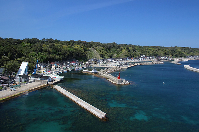
From the Edo period through to the Meiji period, Tobishima was said to have been the port of call for 400 to 500 Kitamaebune ships each year
In an era before railroads or trucks, Kitamae-bune ships made a huge fortune traveling between Osaka, Tohoku, and Hokkaido, calling at ports along the Sea of Japan coast. However, Sakata Port, the original loading and unloading port, was susceptible to the effects of northwesterly seasonal winds, and ships could not enter the port in bad weather. For this reason, Katsuura Port on Tobishima Island, located off the coast of Sakata and not exposed to northwesterly winds, was the perfect port for waiting out the wind
Sakata has been hit by major fires and earthquakes in the past, and there are almost no ship registers remaining that record the Kitamae ships that called at the port and their crews
It was not known what kind of ships were in port and how many of them were there, but because Tobishima was spared from major fires and disasters, passenger ship registers remained at the 13 boathouses there during the Edo period and the 9 there after the Meiji period. These are valuable documents because it is believed that these ships entered Sakata Port as they were.
Tobishima Island is attracting attention as part of the "Mount Chokai-Tobishima Geopark"
Tobishima is said to have been formed over 10 million years ago, and is home to strangely shaped rocks and caves formed by undersea volcanic deposits and the wash of waves, and is also home to many legends. It has been the "Mount Chokai-Tobishima Geopark" .
Kashiwagiyama and the coastal promenade
Located near Katsuura Port at the southern tip of Tobishima Island, it is home to a series of rock formations, including Tateiwa and Kashiwagiyama, which act as windbreaks for the port. A promenade has been set up along the coast, where Sai no Kawara , which is strewn with volcanic rocks, and rocks where traces of lava flow can be seen.
Tobishima daylilies grow wild on Mt.

Tobishima daylilies are flowers found only on Tobishima and Sado Islands, and are a member of the Hemerocallis family.
The large colony in Onogame on Sado Island is famous, but it is said that they once bloomed all over Tobishima. Recently, their numbers have decreased, and conservation efforts are being carried out
Gotorohama Beach is characterized by its mille-feuille cliffs
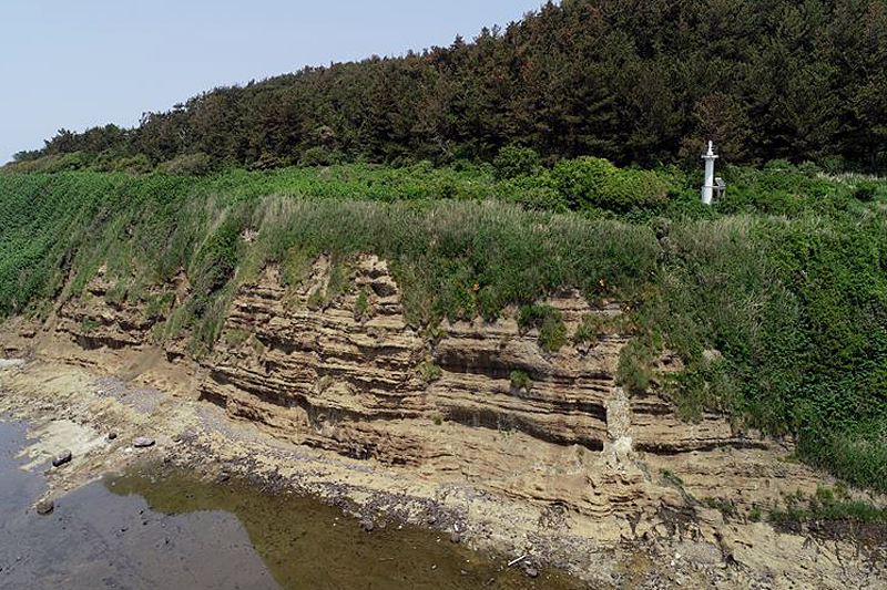
Gotorohama Beach in the southwestern part of the island, there is a 20m high cliff with layers resembling a mille-feuille. These cliffs are made up of alternating layers of volcanic bombs and ash erupting from an underwater volcano, indicating that Tobishima was once underwater.
Misumi Island, where traces of a former volcano remain
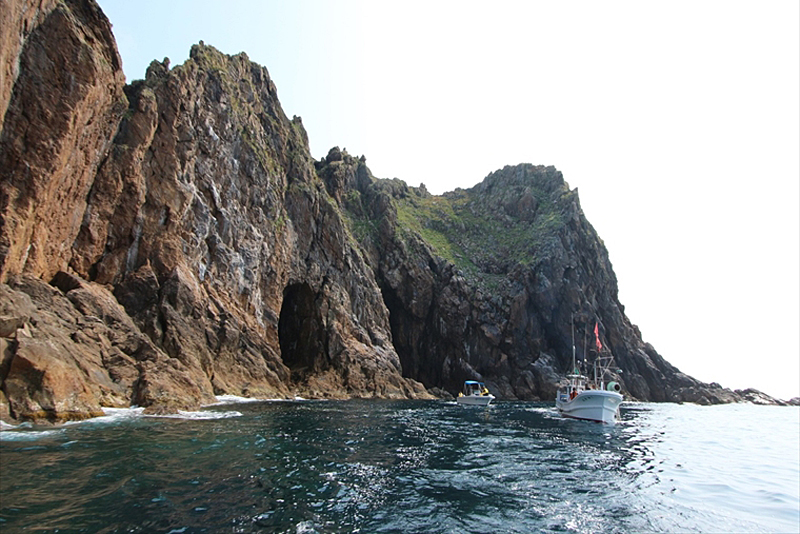
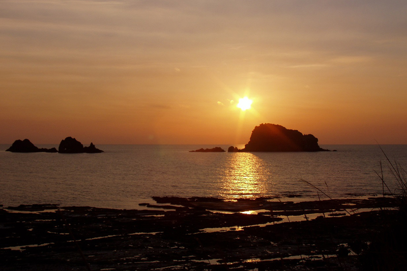
Oshakujima is a small island made of rugged rocks located about 1 km west of Tobishima, and is made of rhyolite, a rock formed when magma solidified on or near the surface of the earth.
A cave formed by wave erosion on the north side golden rock surfaces known as "dragon scales," and has been worshipped by islanders and sailors as a sacred place where the dragon god resides.
Araki Coast, selected as one of the "100 Best Beaches in Japan"
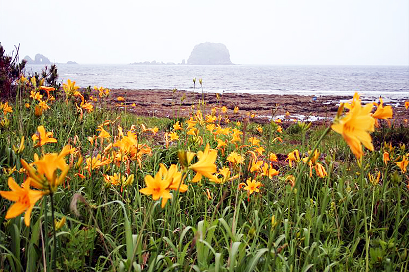
Made of pumice and tuff that erupted from an undersea volcano, Arasaki Coast is a beautiful beach with a beautiful sunset over the Sea of Japan, and was selected as one of the "100 Best Beaches of Japan." The surrounding area is also home to Tobishima Daylilies, making it Tobishima's most scenic spot.
one of the "100 Best Beaches in Japan, " the "Bell of the Beach" was erected on a hill overlooking the coast.
Hanatozaki Observatory, the easternmost point where you can also see Mt. Chokai
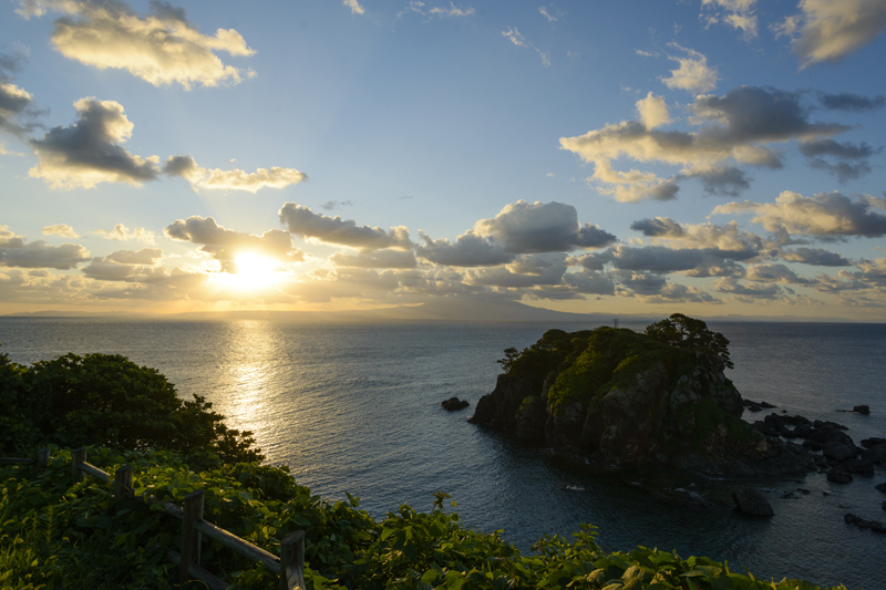
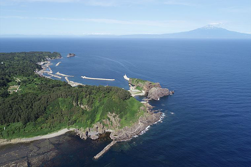
Cape Hanato, located at the easternmost tip of Tobishima, is a scenic spot overlooking Mount Chokai to the north and Katsuura Port to the south. There is a covered observation deck where you can enjoy the view.
"Tekiana" where human bones from the Heian period were discovered
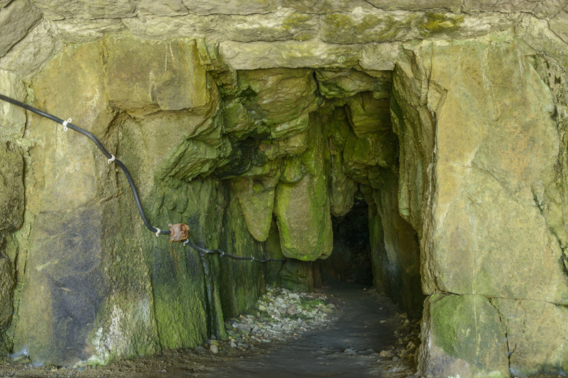
"Tekiana" is a cave located between Katsuura Port and Cape Hanatozaki, where 22 human bones and artifacts estimated to date back to the Heian period were discovered in 1964 (Showa 39). Many mysteries remain, such as why people lived there during the Heian period.
Take the regular ferry from Sakata Port to Tobishima
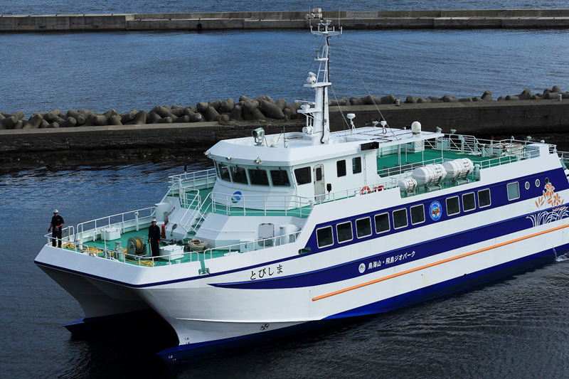
Tobishima has been attracting attention recently, having been certified as part of the "Mount Chokai-Tobishima Geopark."
The island is about 75 minutes away from Sakata Port regular ferry Tobishi . Enjoy exploring the mysterious formations of the Earth while taking in the spectacular views.
Tobishima <Information>
- Address: 2-5-6 Senba-cho, Sakata City, Yamagata Prefecture [liner terminal]
- Phone number: 0234-22-3911 (Liner Business Office)
- Regular ferry fare: Adult one-way 2,140 yen, Children (elementary school students and infants) 1,070 yen
- Opening hours: Regular ships operate 1 to 3 times a day
- *Flights may be canceled due to weather conditions. Please call to confirm
- access
- 75 minutes from Sakata Port to the regular ferry Tobishima, Tobishima Katsuura Port
- parking
- Located in front of the ferry terminal (large vehicles accepted)
- URL: "Tobishima" operation status




![[Mount Chokai-Tobishima Geopark: Yuza and Sakata] The Shonai Plain is blessed with the bounty of Mount Chokai b5339749745ac9c7a01a8bb8dc81755e](https://jp.neft.asia/wp-content/uploads/2023/05/b5339749745ac9c7a01a8bb8dc81755e-150x150.jpg)
![[Mount Chokai-Tobishima Geopark: Yurihonjo Edition] See the geological layers from when Japan was part of the Eurasian continent b5c46a18bc0cc79de0e9ad08084eaa5b](https://jp.neft.asia/wp-content/uploads/2024/04/b5c46a18bc0cc79de0e9ad08084eaa5b-150x150.jpg)
![[Mt. Chokai-Tobishima Geopark: Nikaho (2)] Coexistence with nature brought about by the wisdom of our ancestors 1 Nikaho Plateau, 2000, Nikaho City Cultural Properties Protection Division](https://jp.neft.asia/wp-content/uploads/2024/10/28389310d744abdc1b4ca5d863e123e7-150x150.jpg)
![[Mount Chokai-Tobishima Geopark: Nikaho Edition (1)] Kujukushima, which is considered to be on par with Matsushima but became land due to a major earthquake 1Kujukushima Winter 1_Nikaho City Tourism Division](https://jp.neft.asia/wp-content/uploads/2024/10/9832b69b3165ff52241c17ad3f8bf591-150x150.jpg)
![The Wooden Toy Museum is housed in an abandoned school! Access it by toy train [Yurihonjo, Akita Prefecture] 02 Mt. Chokai Wooden Toy Museum](https://jp.neft.asia/wp-content/uploads/2018/11/cce286efc423e9c7e7b7514902aaaac3-150x150.jpg)
![Learn about the history of Nikaho City, which was formed by the merger of three towns connected to the Nikaho clan [Akita Prefecture] 10 Kujukushima Akita Prefecture 800](https://jp.neft.asia/wp-content/uploads/2024/10/5ce06ecf5220abbacd746be7687e94f4-150x150.jpg)
