This site is an online media that delivers all sorts of trivia about the six Tohoku prefectures, from sightseeing and gourmet spots to local customs, history, and more
Yurihonjo City is a municipality that occupies about 70% of the Yuri region, which is spread at the foot of Mount Chokai (2,236m) , dividing the Dewa region from north to south . Its area is 1,200 square kilometers, accounting for about 10% of Akita Prefecture, making it the largest city in Akita Prefecture. 75% of its area is covered by forests, and the plains are only found along the Sea of Japan coast at the mouth of the Koyoshigawa River, a first-class river that flows through the center of the city .
During the Edo period, three small domains— Honjo, Kameda, and Yashima—held power separately. After the Meiji Restoration , Honjo Prefecture, Kameda Prefecture, and Yashima Prefecture were established, but they were soon incorporated into Akita Prefecture.
Mount Chokai, towering south of Yurihonjo City, is a rare free-standing peak that rises from 0m above sea level over the Sea of Japan. Since ancient times, it has been revered as a mountain that breathes fire, and today it is loved by people as a mountain where traces of volcanic activity and precious natural beauty remain
Chokai-Tobishima Geopark is made up of four areas. The Yurihonjo area is themed around the mysteries of the Earth
The Chokaisan-Tobishima Geopark encompasses the Yurihonjo area , as well as the Sakata area (Sakata City/Yamagata Prefecture), the Yuza area (Yuza Town/Yamagata Prefecture), and Tobishima (Sakata City) to the south , centered around Mount Chokai . The Nikaho area (Nikaho City/Akita Prefecture) to the north each displays its own unique character. In the Yurihonjo area, which stretches across the northeast, you can experience the mysteries of the Earth, such as the exposure of geological strata from long before Mount Chokai was formed, when the Japanese archipelago was still part of the Eurasian continent.
Ishizawa Falls: Flowing through layers of rock from the time when the Japanese archipelago was part of the Eurasian continent
"Ishizawa Great Waterfall" is located in the Ishizawa Valley , in the mountains of the Sasamori Hills in the central part of Yurihonjo City, where geological strata dating back about 30 million years are exposed for approximately 8 km
30 million years ago, Japan was still attached to the eastern edge of the Eurasian continent, and of course there was no Sea of Japan. The Japanese archipelago separated from the continent about 20 million years ago, so this stratum is 10 million years older than that
At that time, the Earth was erupting from all over, and the geological formations of Ishizawa Gorge are andesite, which is lava that flowed out from surrounding eruptions and cooled and solidified. The gorge is lined with cliffs made of andesite, and there are viewpoints such as "Ishizawa Great Waterfall" and "Byobu Rock ." Near Byobu Rock , you can also see columnar jointing , which is a cliff with vertical cracks formed during the process of lava solidification . The gorge is closed to traffic during the winter (December to late April), so it is not possible to visit during that time.
Ishizawa Falls and Byobuiwa Rocks <Information>
Location: Nishinokado, Oyanagi, Yurihonjo City, Akita Prefecture
Train: Approximately 40 minutes by car from JR Ou Main Line Ugo-Honjo Station (Road closed from December to late April)
By car: Approximately 25 minutes from Honjo IC on the Nihonkai Tohoku Expressway, or approximately 40 minutes by car from JR Ugo-Honjo Station (Road closed from December to late April)
Toilet: Yes
Shops and rest areas: None
Google Map
Akata Falls, where two streams join and fall from above the fault
Akata Great Fallsis a 23-meter-high waterfall located in the northern part of Yurihonjo City. The upper part of the waterfall is bifurcated, withthe larger stream called "Otoko-taki"andthe other stream called "Me-taki" (female waterfall). The geology of this area is complex and intricate, and the white rocks at the top are rhyolite formed approximately 2,300 to 5 million years ago, when this area was at the bottom of the sea, from lava of an underwater volcano that cooled and solidified. The waterfall is said to have formed on a fault running north to south.
The "Great Buddha of Akada" is a large statue of Kannon (Goddess of Mercy) standing approximately 9 meters tall (approximately 7.878 meters excluding the pedestal) and enshrined in the Great Buddha Hall of Chokokuji Temple , a temple that was the center of Akada, which has long been a training ground for Shugendo practitioners (mountain ascetics). Along with Chokokuji Temple in Nara Prefecture (Sakurai City, Nara Prefecture) and Chokokuji Temple in Kamakura (Kamakura City, Kanagawa Prefecture) , it is counted as one of the three great Hase Kannon of Japan and is known as "the Great Buddha of Akada."
Hase-dera Temple is said to have been founded in 1775 by Zen Master Zesan of the Soto sect, and served as a place of prayer for the Kameda Domain, which ruled this area during the Edo period. The principalimage, a standing statue of the Eleven-Headed Kannon Bodhisattva, was destroyed along with the Great Buddha Hall in a great fire in 1888 (Meiji 21). The current Kannon statue was restored in 1892 through a donation from a benefactor, and the Great Buddha Hall was also rebuilt in 1893 (Meiji 26). Hase-dera Temple is the 8th temple on the Akita Prefecture Thirty-Three Kannon Pilgrimage, and the Eleven-Headed Kannon Bodhisattva statue is a designated cultural property of Yurihonjo City.
Train: From JR Ou Main Line Ugo Honjo Station, transfer to Honjo Office and take the bus bound for Akada Daibutsu for approximately 30 minutes, or take a taxi from JR Ou Main Line Ugo Iwatani Station for approximately 7 minutes
By car: Approximately 17 minutes from Honjo IC on the Nihonkai Tohoku Expressway
Google Map
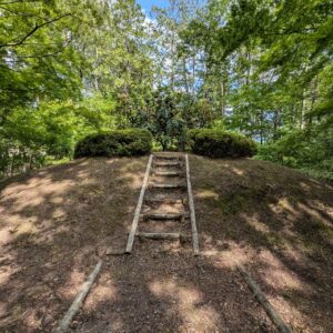
Shinzan Park is a hill formed by the uplift of new andesite rocks 8 million years ago
Shinzan Park is a park located on a small hill overlooking the town at the mouth of the Koyoshi River . The geological strata in this area were formed about 8 million years ago when it was still the bottom of a shallow sea, and volcanic ash and lapilli erupted by an underwater volcano accumulated and were exposed when the area was uplifted over 100,000 years ago. The rock layer of volcanic ash and other rocks is about 200m thick and is called "new andesite." You can touch the new andesite in Tsubakimori within the park
Shinzan Park is home tothe Shinzan Shrine, and every January, the"Naked Pilgrimage,", is held there. Shinzan Park is located at an altitude of approximately 100 to 140 meters, and in spring, it is a popular park where visitors can enjoy cherry blossoms for an extended period, from Somei Yoshino cherry trees in the 100-meter area to mountain cherry trees in the 140-meter area.
Niiyama Park<Information>
Location: Ishiwaki Kamichoronuma, Yurihonjo City, Akita Prefecture
Hottai Falls is a waterfall located in the Tamada Valley , the source of the Koyoshi River, on the slopes of Mount Chokai . It has a drop of approximately 57 meters and is a famous waterfall selected as one of "Japan's Top 100 Waterfalls."
It is said that Houtai Falls was formed when a single sheet of lava flowed out during the eruption of Mt. Chokai about 100,000 years ago and dammed up a river. The lava that created the waterfall is called "Houtai Lava," and you can walk on it. It has been designated as a Place of Scenic Beauty and a Natural Monument by Akita Prefecture
Hōtai Falls<Information>
Location: Hyakutaku, Chokai-cho, Yurihonjo City, Akita Prefecture
Phone number: 0184-57-2205 (Yurihonjo City Tourism Association Chokai Branch)
access:
Train: Approximately 50 minutes by car from Yajima Station on the Yuri Kogen Railway
By car: Approximately 70 minutes from Honjo IC on the Nihonkai Tohoku Expressway
Toilet: Yes
Parking: Available
Google Map
Kuwanokidai Marsh, where the lily flowers that gave rise to the name "Yuri" bloom
Kuwanokidai Marshlandis located at an altitude of approximately 700m on Mount Chokai and was formed by the accumulation of rock avalanches that occurred in ancient, prehistoric times. Covering an area of 8 hectares (about the size of two Tokyo Domes), the marshland has well-maintained boardwalks, allowing visitors to enjoy trekking while taking in views of Mount Chokai.
The wetlands are home to a profusion of wetland flowers, including skunk cabbage and cotton grass , offering beautiful sights throughout the seasons. In early summer in particular, you can see clusters of white cotton grass , the Nikko daylily (said to be the origin of the name "lily") , and rhododendrons , creating a stunning contrast of white and orange across the wetlands.
Kuwanokidai Marshland<Information>
Location: Arazawa, Yajima-cho, Yurihonjo City, Akita Prefecture
Botsumeki Spring water gushes forth on the slopes of Mt. Yashio , which rises to an elevation of 713m, on the opposite bank of the Koyoshi River that flows at the foot of Mt. Chokai . The spring water flows out at a rate of approximately 900 tons per day, and the water temperature remains around 9°C throughout the year. It is neutral (pH 6.9) and extremely soft water with a hardness of 19. Due to its smooth taste, it is used not only as local tap water but also in local craft beer. There are theories that "Botsumeki" is a variation of the Ainu word for "foaming" or that it originates from the Akita dialect word "botsumegu," meaning water gushing out, but the exact origin is unknown. The area around the spring is a park, and many people visit to collect water.
Botsumeki Spring Water<Information>
Location: Higashiyuri Kurobuchi, Yurihonjo City, Akita Prefecture
The Yurihonjo area of the Chokaisan-Tobishima Geopark boasts numerous geosites where you can enjoy the natural beauty of Mt. Chokai , including the Kameda Fudo Falls with a drop of approximately 25 meters and a width of approximately 10 meters , the rare Katakinuma Marsh located at a low elevation of 30 meters , and the Yurihara Plateau (Higashi-Yurihara) with its oil and natural gas fields. Why not visit Yurihonjo City to experience the "present" state of the Earth, which has been changing over many years?
My love of travel led me to work for a travel magazine some time ago, and now I work as a travel writer for an online publication. I have visited all 47 prefectures in Japan, focusing on the Tohoku region, and I enjoy soaking in hot springs and experiencing traditional Japanese culture, including old townscapes, lifestyles, and performing arts and crafts


] Coexistence with nature brought about by the wisdom of our ancestors")

] Kujukushima, which is considered to be on par with Matsushima but became land due to a major earthquake")
")