This site is an online media that delivers all sorts of trivia about the six Tohoku prefectures, from sightseeing and gourmet spots to local customs, history, and more
The area developed as a logistics port on the Yoneshiro River, and its role remains today as an address: "Nigyoba, Futatsui-cho, Noshiro City" (Akita Prefecture)
The area developed as a logistics port on the Yoneshiro River, and its role remains today as an address: "Nigyoba, Futatsui-cho, Noshiro City" (Akita Prefecture)
The Yoneshiro River runs from east to west through the center of Noshiro City
The river originates at Mt. Nakadake (1,024m above sea level), which straddles Akita, Aomori, and Iwate prefectures, passes through Kosaka Town, Kazuno City, Kitaakita City, Odate City, and other areas, before emptying into the Sea of Japan in Noshiro City. The river basin is home to Akita cedar forests and the Shirakami Mountains, a World Heritage Site, and the timber cut down there was transported to Noshiro on the Yoneshiro River and shipped all over the country
Additionally, since the Edo period, mines such as Osarizawa Mine (Kazuno City), Kosaka Mine (Kosaka Town), and Ani Copper Mine (Kitaakita City) have been developed in the surrounding area, and they play an important role in transporting their products
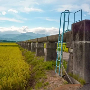
A relay station on the Yoneshiro River. This is where cargo was unloaded and reloaded
About 35km from its mouth, the Yoneshiro River makes a large, hairpin-like bend. Furthermore, several large tributaries, including the Fujikotogawa River from the north and the Anigawa River from the south ,join the river in this area , creating a complex current that has long been known as the most treacherous section of the Yoneshiro River.
Several docks were built in this area, but the largest port was built at the confluence with the Fujikoto River
Towards the end of the Sengoku periodNiageba, and it grew into such a large settlement that it was still known as Niageba Village (Niageba, Futatsui-machi, Noshiro City). Akita cedar transported from the Yoneshiro River and its tributaries was assembled into large rafts at Niageba and sent out to Noshiro Port at the river mouth.
Furthermore, the residents' daily necessities were transported from Noshiro Port to the loading dock in large sailing boats called " nagabune, " and from there they were transferred to smaller boats called " zuaibune " and transported upstream.
When Fujiwara Yasuhira was fleeing from Minamoto no Yoritomo, he threw away his helmet and armor near the loading dock
Archaeological investigations suggest that people lived along the Yoneshiro River near Niageba during the Jomon period. The Nihon Shoki (Chronicles of Japan) records that in 658 during the Asuka period, Abe no Hirafu of the Yamato court passed through this area when he marched to conquer the Tohoku region, an uncivilized land that the court called Emishi .
It is believed that in the latter half of the Heian period, powerful clans such as the Kiyohara clan and the Oshu Fujiwara clan took turns controlling Futatsui
Fujiwara no Yasuhira (1155-1189), the last head of the Oshu Fujiwara clan, was attacked by Minamoto no Yoritomo (1147-1199) for sheltering Minamoto no Yoshitsune (1159-1189), and fled north from Hiraizumi in Oshu( Hiraizumi Town, Iwate Prefecture)
At that time, he threw his helmet at Kiriishi (Kiriishi, Futatsui-machi, Noshiro City), which is close to the loading area, and his armor at Usui (Usui, Futatsui-machi, Noshiro City). It is said that the villagers took pity on Yasuhira and built a shrine to the helmet at Kiriishi and a shrine to the armor at Usui to mourn him
Phone number: 0185-73-5075 (Futatsui Town Tourism Association)
access:
Public transportation: Approximately 7 minutes by taxi from Futatsui Station on the JR Ou Main Line
By car: Approximately 5 minutes from Futatsui Shirakami IC on the Akita Expressway
Google Map
The most difficult part of the Yoneshiro River is near the loading dock
The area around the loading dock, said to be the most dangerous spot on the Yoneshiro River, was dangerous not only because of the river current but also for land travel
The riverbanks are high cliffs, so to proceed further, one must either traverse a steep mountain path or cross the Yoneshiro River by boat. This ferry crossing is only a little over 1 km from the loading point to the neighboring village of Kotsunagi (Kotsunagi, Futatsui-machi, Noshiro City), but because the river's current is complex, it takes about as long as walking one ri (4 km), hence it was called the " One-Ri Ferry ."
It is said that the processions of the Tsugaru clan, who were on alternate attendance to Edo, used the Ichiri no Watashi Ferry to travel between the two domains
The other mountain path"Beast's Slope," and was rarely used.
During the Meiji era, in 1881 (Meiji 14), the road was developed for Emperor Meiji's tour of the Tohoku region (an inspection of the Tohoku area), and the Emperor and his entourage traveled along this road to their next destination. While resting along the way, the Emperor received a letter from the Empress expressing her concern for his tour. Upon reading it, the Emperor was deeply moved and named the place " Kimimachi-zaka" (meaning "Your Town Slope ")
Currently, the area, including the surrounding area, is a popular park known as " Kimimachizaka Prefectural Natural Park ."
Kimimachizaka Prefectural Natural Park <Information>
Facility name: Kimimachizaka Prefectural Natural Park
Address: 51 Kotsunagiizumi, Futatsui-cho, Noshiro City, Akita Prefecture
Phone number: 0185-73-5075 (Futatsui Town Tourism Association)
access:
Public transportation: Get off at Futatsui Station on the JR Ou Main Line, take the Futatsui Community Bus for about 9 minutes, then go to the Futatsui Roadside Station bus stop (community buses do not operate on Sundays and holidays), then walk for about 5 minutes, or take a taxi for about 5 minutes
By car: Approximately 10 minutes from Futatsui Shirakami IC on the Akita Expressway, or approximately 15 minutes from Odate Noshiro Airport IC on the Akita Expressway
Google Map
The Satake clan of the Kubota domain secured financial resources for the domain through the sale of Akita cedar
The Satake clan, appointed as the rulers of the Akita region during the Edo period, focused on the Akita cedar trees in the Yoneshiro River basin
Akita cedar, which had attracted attention as a building material since the time of Toyotomi Hideyoshi, including its use in the construction of Fushimi Castle in Kyoto , reached its peak popularity during the Edo period when it was also used in the construction of Edo (present-day Tokyo). Nijoba flourished greatly as a central collection point for Akita cedar, along with Noshiro Port.
However, forest resources rapidly decreased because a large amount of Akita cedar was used for reconstruction following the Meireki fire that occurred in Edo in 1657. Feeling a growing sense of crisis, the Kubota domain created a system to restrict logging and made efforts to protect resources, but their efforts were not very successful
On the other hand, the Kubota domain was proactive in developing mines, discovering many mines in the mountains surrounding the loading docks. In the 1660s, the Ani Copper Mine , which would later be called the largest copper mine in Japan, and the Daira Mine (Fujisato Town, Akita Prefecture) , which had been known for a long time, began full operation. The products produced were collected at loading docks where tributaries converged, just like Akita cedar, and then transported to Noshiro Port.
This helped to improve the finances of the Kubota domain, but it left them with one major problem: despite its high production volume, the Ani Copper Mine was contaminated with impurities, which resulted in it being unpopular with the Edo Shogunate
The Kubota Domain (Akita Domain) then planned to build a new smelter in Nijoba Village
Kagoyama Smelter, a state-of-the-art smelter constructed at the loading dock
In addition to being a shipping port for copper mine products, the loading dock was also a collection point for timber (cedar) used to generate heat to melt the ore needed for smelting. Furthermore, the Tara Mine, located upstream of the Fujikoto River, produced lead, which was needed as a catalyst to separate copper and silver. Also, as it was a large settlement, there was no need to worry about manpower
In 1775, the new smelter was completed on Mount Kagoyama in Niageba Village and named " Kagoyama Smelter ."
To construct this smelter, the Kubota domain heard that there was a scholar in Edo who knew the latest smelting techniques for extracting copper, and they invited him to Akita. That person wasHiraga Gennai(1728-1780), a scientist who invented the electric generator, as well as a physician and mining consultant.
Gennai stayed in Ani for about a month and taught a smelting method called "Nanban-fuki" (also known as Nanban-shibori), which uses lead to remove silver and impurities from crude copper
The Kagoyama Smelter, which adopted the Nanban-buki method, succeeded in producing near-pure copper and silver, bringing great profits to the Kubota domain. In particular, the Kagoyama Smelter is said to have made a significant contribution to the domain's financial maintenance by illegally producing silver and copper coins that were valid only within the domain
Kagoyama Smelter, which operated as a smelter until the early Meiji period
The Kagoyama smelter was closed in 1894 (Meiji 27) when Furukawa Mining, which owned the Ani Mine at the time, constructed the state-of-the-art Shinonome smelter in Mukai-Noshiro, near Noshiro Port
At the site of the Kagoyama Smelter, there are remains of a reservoir, stone walls of residential areas, and Kagoyama Shrine, but no buildings remain
Location: Kagoyama, Futatsui-cho, Noshiro City, Akita Prefecture
Phone number: 0185-73-5075 (Futatsui Town Tourism Association)
Visit: Free
access:
Public transportation: Get off at Futatsui Station on the JR Ou Main Line, then take a community bus or taxi for approximately 10 minutes
By car: Approximately 10 minutes from Futatsui Shirakami IC on the Akita Expressway
Google Map
The cargo terminal developed as a base for water transportation, but in the Meiji period, the method of distribution changed from water transportation to land transportation
In 1901 (Meiji 34), a station on the Ou Main Line was opened in Futatsui (Futatsui Ota area, Noshiro City), near the cargo terminal. At the same time, the line was extended to Noshiro Station (now Higashi-Noshiro Station), and the distribution hub shifted from the cargo terminal to the area around Futatsui Station
The village of Nijoba existed as an independent municipality until 1955 (Showa 30), when it merged with Futatsui Town, which was centered around Futatsui Station, and became part of Futatsui Town.Furthermore, in 2006, Futatsui merged with Noshiro City to form Noshiro City, and the village now retains its name as Nijoba, Futatsui Town, Noshiro City
My love of travel led me to work for a travel magazine some time ago, and now I work as a travel writer for an online publication. I have visited all 47 prefectures in Japan, focusing on the Tohoku region, and I enjoy soaking in hot springs and experiencing traditional Japanese culture, including old townscapes, lifestyles, and performing arts and crafts


, which was said to be the best in Japan during the Edo period and supported the Kubota Domain")