


Are the tiles in the arcade in front of Sendai Station the remains of a waterway from the Edo period? Investigating the mystery that was also featured on Bura Tamori!
The Sendai Station Shopping Arcade is a popular tourist spot with many people coming and going, but there is actually a mystery about this shopping arcade that is not well known even to the people of Miyagi Prefecture
The mysterythe "patterns on the arcade tiles."concernscertainspot, and there are rumors that it's related to a waterway from the Edo period, but is that true? This time, we'll unravel the mystery, starting with the tiles in front of Sendai Station!
What is the mystery of Sendai city featured on Bura Tamori?
The mystery I'll be discussing today concerns the tiles on the floor of the arcade in front of Sendai Station. This mystery also appeared in the NHK program "Buratamori" in the episode titled " Sendai - Was Date Masamune a 'Geography Maniac'!?"
Reference link:NHK Archives – Videos of the areas visited by Buratamori: "Sendai"
By investigating the mystery of the tiles, we can get a glimpse into the construction of Sendai Castle and the development of the castle town by Date Masamune, but what does this mean?
Where are the tiles in the arcade in front of Sendai Station?
The tiles in question are located at"Hapina Nakakecho Shopping Street"and"Chris Road Shopping Street".
Enter the Hapina Nakakecho Shopping Street from the Aeru side of the Sendai Station Commercial Building, and walk to the area where the ramen restaurant Ichiran and Joyo Bank Sendai Branch are located
![Nakakecho (a tributary of the third tributary) [Remains]](https://jp.neft.asia/wp-content/uploads/2022/05/43998_com.jpg.webp)
It's easy to spot as the tiles on the arcade floor are in a diagonal line that runs across the arcade, unlike the rest of the area
The Yotsuya Irrigation Canal once flowed through the area where the arcade is now located
The mysterious tiles that suddenly appear in the arcade are apparently modeled after the "Yotsuya Waterway." From here, we will explain the overview of the Yotsuya Waterway and why there was a waterway in the location of the arcade
What is Yotsuya Irrigation Canal?
The tiles in question indicate that the Yotsuya Canal once flowed through this area. The Yotsuya Canal was an irrigation channel built during the Edo period to supply water to the castle town, and construction began at the command of Date Masamune

Waterways had a wide range of uses, including firefighting, water for washing clothes, and industrial water for waterwheels. After the Meiji era, with the development of water and sewage systems, they ceased to be used for domestic purposes and were gradually converted into underground culverts.
Furthermore, since the Showa era, when the advent of automobile society meant that covers on waterways became necessary, only a handful of waterways remain above ground
Yotsuya Irrigation Canal Monument <Information>
- Name: Monument of the Yotsuya Irrigation Canal Past and Present
- Address: Aeru Square, 1-3-1 Chuo, Aoba-ku, Sendai City, Miyagi Prefecture, 980-0021
Google Map
Why was an irrigation canal built into the current arcade?
The reason Date Masamune ordered the construction of an irrigation canal, even undertaking large-scale construction, was due to the location of the castle town. Thecurrent urban area, which became the castle town, is located on the river terrace of the Hirose River. While this has the advantage of being less susceptible to flood damage, it alsohas the disadvantage of not being able to secure a water supply.

Therefore, they decided to draw water from the upper reaches of the Hirose River to secure water for daily life that was not available on the river terraces.The upper reaches of the Hirose River start about 3km west of the center of the castle town, and branch out into several tributaries that flow throughout the castle town
During the Edo period, the town was divided into sections using the Yotsuya Canal as a boundary. The tiled area shown here was divided into Nakakecho (on the side of the Hapina Nakakecho shopping street), where samurai lived, and Shindenmacho (on the side of the Chris Road shopping street), where townspeople lived
3 Spots Where You Can Feel the Remnants of the Yotsuya Irrigation Canal
Although most of it can no longer be seen, there are other spots besides the arcade where you can still feel its remnants. We will introduce some particularly easy-to-find places, so if you are interested, please go and check them out
Iroha Yokocho
By diverting the Yotsuya irrigation canal, water permeated the gravel layer and became a source of well water for the castle town

Even today, a well remains in "Iroha Yokocho," and although the water is not potable, it is still possible to get water from it
Iroha Yokocho <Information>
- Name: Iroha Yokocho
- Address: 2-3-28 Ichibancho, Aoba-ku, Sendai City, Miyagi Prefecture, 980-0811
Google Map
Oritate, Aoba Ward
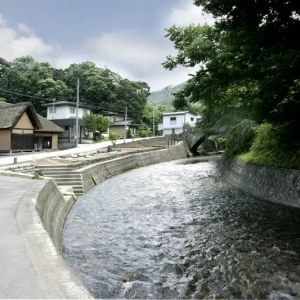
In Oritate, Aoba Ward , there is the "Yotsuya Weir" . It is the intake and opening of the Yotsuya Canal, and the shape of the canal is still clearly visible today.
Yotsuya Weir <Information>
- Name: Yotsuya Weir
- Address: 1-15 Oritate, Aoba-ku, Sendai City, Miyagi Prefecture, 982-0261
Google Map
Yahata, Aoba Ward

In Yahata, Aoba Ward, various traces of the Yotsuya Canal remain, scattered throughout the area , including places where aqueducts were built to allow the canal to cross streams , the remains of washing areas, and information boards about civil engineering heritage sites

Former Yotsuya Irrigation Washing Station <Information>
- Name: Yotsuya Irrigation Canal Boiling Point
- Address: 2-chome Yahata, Aoba-ku, Sendai City, Miyagi Prefecture, 980-0871
Google Map
The boiling ground <Information>
- Name: Yotsuya Irrigation Canal Boiling Point
- Address: 5-9-10 Yahata, Aoba-ku, Sendai City, Miyagi Prefecture, 980-0871
Google Map
Hijirizawa Kakehi <Information>
- Name: Yotsuya Irrigation Canal, Hijirizawa Hanging Canal
- Address: 6-14 Yahata, Aoba-ku, Sendai City, Miyagi Prefecture, 980-0871
Google Map
Information sign for the Yotsuya Irrigation Canal
- Name: Civil Engineering Heritage: Yotsuya Irrigation Canal Information Board
- Address: Yahata, Aoba-ku, Sendai City, Miyagi Prefecture, 980-0871
Google Map
See the remains of the Yotsuya Irrigation Canal with your own eyes
This time, we have explained the relationship between the tiles in the arcade in front of Sendai Station and the Yotsuya Irrigation Canal. You can get a sense of Date Masamune's achievements and the lives of the people who lived in the castle town through the irrigation canal, so be sure to pay attention when you pass through the arcade
A freelance writer from Miyagi Prefecture. She loves words and letters and is an avid reader who reads more than 15 books every month. Her recent hobby is finding cafes where she can enjoy reading and sweets that go well with books
Other articles

[Part 2] Masumi Sugae's walk along the Oga Peninsula – along the coast...

Why do Namahage carry knives to punish people?.

A nationally famous mountain worship site that symbolizes life, death, and rebirth...

The 10th journey of the anime "That's Journey" is...

The name is similar to that famous nationwide product? Furukawa's famous and exquisite snack...

The "Chagu Chagu Umakko" festival, a seasonal early summer event in Iwate, is a colorfully decorated...

[Miyagi Prefecture] Introducing 5 exquisite sweets only locals know about!

[Fukiage, Miyagi Prefecture] "Onikobe Onsenkyo" is a little-known hot spring spot...
[Kaminoyama City, Yamagata Prefecture] Ushu Street, used by 13 feudal lords during the Edo period...

[Part 1] Aizu samurai cultivated apples! Japan's first privately-owned apple grower...

Starting in 2026, Yokote Kamakura will be held on the second Friday of February...
