This site is an online media that delivers all sorts of trivia about the six Tohoku prefectures, from sightseeing and gourmet spots to local customs, history, and more
The Shimokita Peninsulais the northernmost peninsula of Honshu, jutting out into the Pacific Ocean from Aomori Prefecture.
oftenKintaro's axeoraxe. Cape Oma (Oma Town, Aomori Prefecture), the northernmost point of the Shimokita Peninsula, is located about 8 minutes in latitude and 15 km north of Cape Shirakami (Matsumae Town, Hokkaido), the southernmost point of Hokkaido, across the Tsugaru Strait (1 minute of latitude is 1,852 m = 1 nautical mile).
* Cape Oma 41 degrees 32 minutes north latitude / Cape Shirakami 41 degrees 24 minutes north latitude
Osorezan, an active volcano that represents the Shimokita Peninsula, is a sacred place where the souls of the dead gather
The Shimokita Peninsula is a peninsula formed by volcanoes that belong to the Nasu Volcanic Belt, which stretches from Rishiri Island in Hokkaido south to Mount Asama in Nagano Prefecture
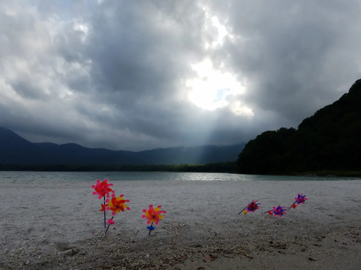
Paradise seen from hell (Lake Usori)
The most representative volcano on the Shimokita PeninsulaMount Osorezan, which has a caldera lake (Lake Usori, officially known as Lake Usoriyama) with a diameter of 3 km at its center, and an outer rim consisting of several lava domes. The highest peak of the outer rim is Mount Kamafuseyama (elevation 878 m).
Lake Usori, where hot springs gush out and turn the water brown
The desolate, rocky landscape surrounding the crater of the old volcano, permeated with the scent of sulfur dioxide,hell, while the white sandy beaches along Lake Usoriparadise. For approximately 1,200 years,a sacred place where the souls of the dead gather.
The presence of Itako , who are said to be able to summon the souls of the dead , further enhances the sense of awe and awe-inspiring spirituality of this place.
The symbol of hell: Pond of Blood Hell
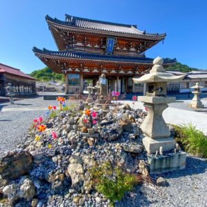
Osorezan Bodaiji Temple <Information>
Facility name: Osorezan Bodaiji Temple
Address: 3-2 Usoriyama, Tanabe, Mutsu City, Aomori Prefecture
Hotokegaura: A spectacular natural monument created by a volcano
The landscape of towering rocks and unusual formations, commonly found along the western coast of the Shimokita Peninsula, was created by volcanic activity. In particular, Hotokegaura (Sai Village) is a spectacular sight designated as a national scenic spot and natural monument
Hotokegaura is home to a series of strangely shaped rocks with names such as Gohyaku Rakan (500 Arhats), Nyorai no Kubi (Nyorai's Head), and Byobu Rock
We recommend taking a sightseeing boat to see the magnificent scenery from the sea
Located directly west of the sacred Mount Osore, Hotokegaurathe place where the dead depart for the afterlifeand the entrance to the return of souls summoned back by Itako (female shamans). The rocks and beaches there are given Buddhist names. During the green season, sightseeing boats operate, allowing visitors to view the scenery from the sea.
Natural Monument "Monkeys of the Shimokita Peninsula and their northernmost habitat"
The Shimokita Peninsulamarks the northernmost limit of Honshu's habitat, and also the northernmost limit for many animals found on Honshu. These include the Asiatic black bear, Japanese serow, Japanese deer, wild boar, Japanese red fox, and Japanese macaque. Conversely, animals found in Hokkaido, such as the brown bear, Hokkaido deer, red fox, and Hokkaido squirrel, do not inhabit areas south of the Shimokita Peninsula.
This is because the Tsugaru Strait is approximately 450m deep at its deepest point and about 130m even at its shallowest point, and because Honshu and Hokkaido have never been connected by land, and because the ocean currents are strong, it is believed that the animals inhabiting Honshu and Hokkaido are completely different. Thomas Brakeston, a British zoologist who was staying in Japan, noticed this difference and presented it to the scientific community in 1883 (Meiji 16). For this reason, the dividing line of animal species inhabited by the Tsugaru Strait is called the Brakeston Line
Shimokita Peninsula: The world's northernmost Japanese macaques expand their habitat
The Shimokita Peninsula is the northernmost limit for some animals, and while monkeys and wild boars are not found in Hokkaido, the Japanese macaques that live on the Shimokita Peninsula are not only the northernmost primates in Japan, but also the northernmost primates in the world outside of humans
The Japanese macaques of the Shimokita Peninsula became known nationwide in the 1960s when they were spotted on the coast of the Wakinosawa area in the southwest
In 1970, the capture of monkeys was banned throughout the Shimokita Peninsula, where there were four groups at the time, and three of the groups living in the Wakinosawa area were designated as national natural monuments in order to protect their wild state
A survey conducted in the 1970s confirmed six groups of approximately 230 individuals, but their habitat was limited to the west coast area, including Wakinosawa
However, a survey conducted in March 2000 showed that the number had increased to 20 groups of approximately 800 individuals, and they could be spotted throughout the Shimokita Peninsula. Now, some 20 years later, the number has increased to an astonishing 2,500 individuals
Japanese macaques are originally animals that live in the south, but they have gradually adapted to Japan's climate and are now able to live in the extremely cold Shimokita Peninsula. Of course, conservation policies are involved in the rapid proliferation of Japanese macaques on the Shimokita Peninsula, but it is certain that a major factor is that global warming has made the average temperature higher, making it more livable
the world's northernmost monkey population, are now facing significant problems in their relationship with humans due to their large population. One of these problems is damage to agricultural crops. While the Japanese macaques remain important to the people of Shimokita, they have also become, in a sense, hostile animals. It may be time to reconsider how humans and macaques can coexist peacefully, including through conservation policies.
Wakinosawa Wild Monkey Park: See the northernmost Japanese macaques
Wakinosawa Monkey Park (Wakinosawa,Mutsu City) is a facility where visitors can see about 50 Japanese macaques. Located on the grounds of the Wakinosawa Roadside Station, it offers the chance to see these "northernmost Japanese macaques" raised in a near-wild environment.
Wakinosawa Monkey Park <Information>
Facility name: Wakinosawa Monkey Park
Address: 201-211 Wakinosawa 7-biki, Mutsu City, Aomori Prefecture
Phone number: 0175-44-3252 (Wakinosawa Roadside Station "Tara no Sato Refresh Center")
Opening hours: 10:00-15:00
Admission fee: Adults 200 yen, elementary, junior high and high school students 100 yen
Closed: Open all year round
Google Map
Nature, animals, gourmet food, hot springs... The Shimokita Peninsula is full of charm
The entire Shimokita Peninsula is designated as the "Shimokita Geopark" and also as a national park (Shimokita Peninsula National Park) . It is a geopark where you can encounter natural formations created by volcanoes such as "Osorezan" and "Hotokegaura," as well as animals that live at the northernmost limits of their habitat, including Japanese macaques .
Other recommended points include the exquisite seafood, such as tuna from Oma and scallops from Mutsu Bay, brought by the complex ocean currents surrounding the peninsula, and the hot springs brought about by the volcanoes. Why not take a trip to the fascinating Shimokita Peninsula?
My love of travel led me to work for a travel magazine some time ago, and now I work as a travel writer for an online publication. I have visited all 47 prefectures in Japan, focusing on the Tohoku region, and I enjoy soaking in hot springs and experiencing traditional Japanese culture, including old townscapes, lifestyles, and performing arts and crafts


![What day is it today? Tohoku Edition [0804]](https://jp.neft.asia/wp-content/uploads/2026/02/0804-150x150.png.webp "[What day is it today? | Tohoku Edition] What day is August 4th?")
")
 [Aomori Prefecture]")
![What day is it today? Tohoku Edition [0803]](https://jp.neft.asia/wp-content/uploads/2026/02/0803-150x150.png.webp "[What day is it today? | Tohoku Edition] What day is August 3rd?")
![What day is it today? Tohoku Edition [0805]](https://jp.neft.asia/wp-content/uploads/2026/02/0805-150x150.png.webp "[What day is it today? | Tohoku Edition] What day is August 5th?")