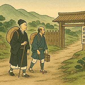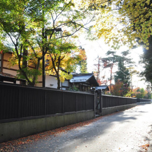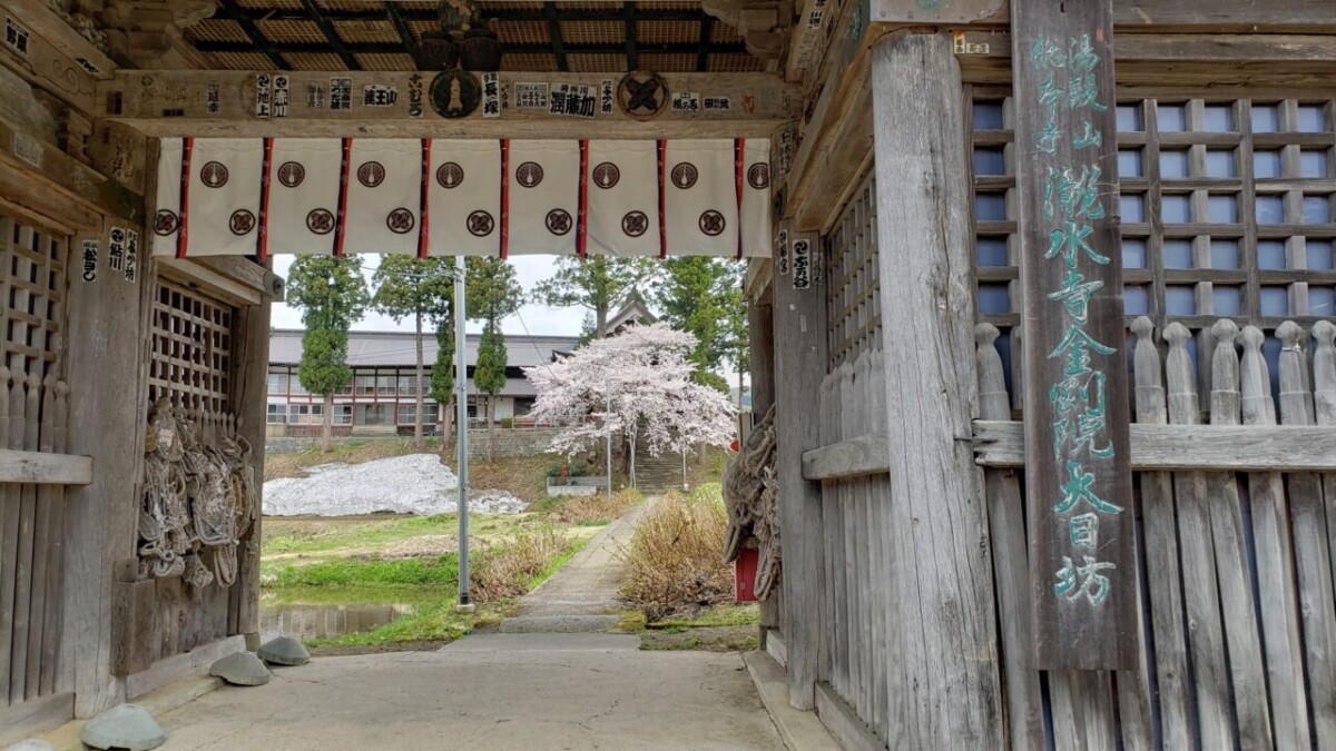
The Rokujuri-goe Highway, which passes through the foot of Mount Yudono, is a pilgrimage route to the Dewa Sanzan mountains
table of contents
- 1 The Rokuju-ri-goe Highway was sometimes used as a military road
- 2 Many common people from Edo made the pilgrimage to Dewa Sanzan
- 3 The Boshin War caused the villages along the road to be devastated, and pilgrimages to Dewa Sanzan also declined
- 4 Many ruins remain on the forgotten old road
- 5 Shrines and temples from the heyday that still remain along the Rokujurigoe Highway
- 5.1 Hondojiguchinomiya Yudonosan Shrine, one of the four temples of Mount Yudono that has now become a shrine
- 5.2 Hondojiguchinomiya Yudonosan Shrine <Information>
- 5.3 The head temple of the four Yudono-san temples, "Yudono-san Sohonji Ryusui-ji Dainichibo"
- 5.4 Takusui-ji Temple Dainichibo <Information>
- 5.5 Currently, the central temple of Mount Yudono is "Yudonosan Churenji Temple."
- 5.6 Shurenji Temple<Information>
- 6 Tamugimata Village, which flourished as a post town for pilgrims to the Dewa Sanzan mountains
The Rokujurigoe Kaido is a highway that runs from Yamagata to Tsuruoka on the Ushu Kaido, and it is said to have been named the Rokujurigoe Kaido because it crosses several mountain passes at the foot of the Dewa Sanzan mountains
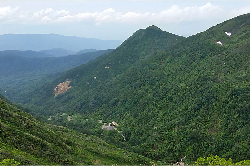
It is not clear when the "Rokuju-ri-goe Kaido" began to be used, but since Mount Haguro, one of the Dewa Sanzan mountains, was founded in 593 and Dainichibo, the main temple of Mount Yudono, was established by Kobo Daishi in 807, it appears that it was in use around that time
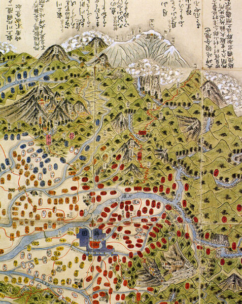
The Rokuju-ri-goe Highway was sometimes used as a military road
During the Asuka period, the Tohoku region was known as Emishi, and there were many areas beyond the reach of the Yamato Imperial Court. As a result, the Imperial Court sent in troops to expand its control. The road used for this was the Rokuju-ri-goe Kaido, which seems to have played a major role as a military road
From the late Heian period through the Muromachi period, when the Emishi came under the control of the Yamato court, it served as a religious route taken by pilgrims of the Dewa Sanzan faith, and later, during the Sengoku period, when warring lords were stationed in various regions, it once again became a route of war
During the Edo period, the Rokujurigoe Kaido came to be used by the Shonai Domain (Tsuruoka City) and the Akita Domain as a route for alternate attendance to Edo, and also played an important role as a trade route connecting the Shonai region and the Mogami-Murakami region
Many common people from Edo made the pilgrimage to Dewa Sanzan
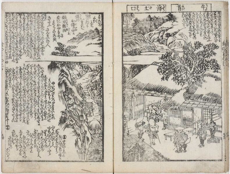
During the long period of peace, pilgrimages to Ise Shrine and the Dewa Sanzan mountains became popular, and many common people from Edo flocked to these places. Post stations were established in the villages at the foot of Mt. Yudono, such as Matsune, Oami, Tamugimata, Shizu, Hondouji, and Shiraiwa, and they became very lively
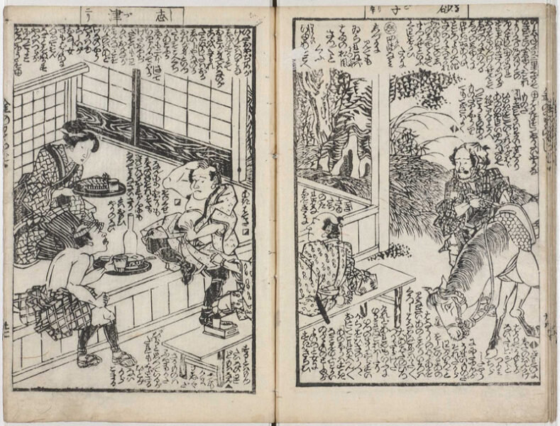
This scene is described in a passage in "Kane no Waraji" (Golden Straw Sandals) by Jippensha Ikku, a comic writer whose representative work is "Tōkaidō Chu Hizakurige," published in 1801: "After traveling about four ri along the Tsurugaoka highway, you will come to Mt. Yudono on the right, and after passing a place called Sasagoya you will arrive at Tamugi Inn. All the way around here, from Hondō-ji Temple to the foot of Yudono, it is said to be 60 ri from Ōami to Hondō-ji Temple. Passing Tamugi-mata, there is Dainichibo, a large temple that is the head priest of Yudono Mountain. From here there is the Ōami Inn checkpoint, and it is one and a half ri from there. Travelers who stop at Ōami and stay the night are probably migratory birds on the mountain trails. From there you pass Matsune and you arrive at Tsurugaoka Castle Town," and the passage includes illustrations of the bustling road and post stations
The Boshin War caused the villages along the road to be devastated, and pilgrimages to Dewa Sanzan also declined
In 1868, when the Edo period gave way to the Meiji period, the Boshin War broke out, a fierce battle between the forces of the new Meiji government and the forces of the former Shogunate, who were trying to protect the Edo Shogunate. The Shonai clan, along with the Aizu forces from Fukushima, fought against the new government forces as part of the former Shogunate forces. The Rokujirigoe Kaido was used as a route for the government forces to march, and fierce battles took place between the Shonai clan forces who were fighting back. The settlements along the road suffered devastating damage, and after the war the Meiji government issued an order to separate Shinto and Buddhism, which led to a complete decline in pilgrimages to the Dewa Sanzan mountains
In 1899 (Meiji 32), a new road was constructed on the Rokujurigoe Kaido, a mountainous road that was inconvenient for cars to use. After several renovations, it finally became National Route 112 in 1953 (Showa 28). This greatly improved the infrastructure from Yamagata City and Sagae City to Tsuruoka City, and it also became possible to travel to the Dewa Sanzan mountains by car or bus. On the other hand, the old Rokujurigoe Kaido became a forgotten road with very few people walking on it
Many ruins remain on the forgotten old road
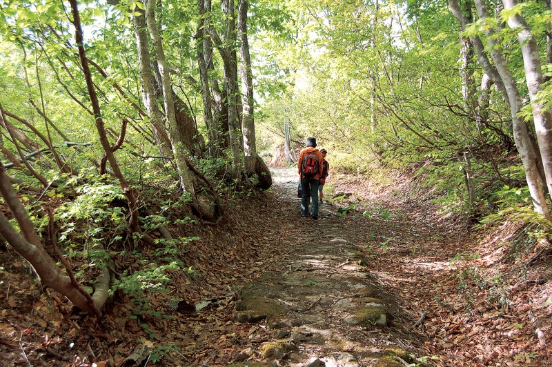
The old road at the foot of Mt. Yudono, which deviates from National Route 112, was left behind and escaped development, leaving many old ruins behind. There are also ancient temples and shrines that are deeply connected to Mt. Yudono, and it is now once again in the spotlight as the "Rokuju-ri-goe Highway." The road, which had once been difficult to pass, has been improved, and many people now visit it as a hiking and trekking course
The Rokujurigoe Kaido stretches for about 30km just at the base of Mt. Yudono. It takes at least three days to walk the entire course in one go. For this reason, there are several day trip courses available, and you can also request a guide to take you there
The route set up in Nishikawa Town, located in the eastern part of the "Rokujurigoe Kaido"
■Ipponkizawa ~ Shizuguchi Tomebansho Ruins ~ Ishitobigawa Bridge Approximately 6.8km / Travel time: Approximately 5 hours
Ishitobigawa Bridge - Doshinbozaka - Yakeyama Ridge - Otsutsuki Pass - Former Yudono-san Hotel: Approximately 6.6 km / Travel time: Approximately 5 hours
Between the former Yudono-san Hotel and the former Sasagoya hut, Hosogoe Pass, Kobo-chaya, and Arigoe-zaka: Approximately 6.6 km / Travel time: Approximately 5 hours
■Tamakimata Arigoshizaka - Yanagishimizu - Sainokami Pass - Inari Pass - Churenji Temple: Approximately 6.6km / Travel time: Approximately 5 hours
■ Churenji Temple - Otakiyama Oiwakeishi - Koshin Tower - Matsune Hachiman Shrine Approximately 6.4km / Required time: Approximately 5 hours
(Period: June to November. Guide fee: from 15,000 yen per day)
Additionally, the Tsuruoka City Asahimura Tourism Association in the western area also introduces several short courses
*The Rokujurigoe Kaido is a mountainous road, so sections may be closed due to weather, etc. Please always check with Nishikawa Town (0237-74-84-0566) or Asahimura Tourism Association (0235-53-3411) for the latest information
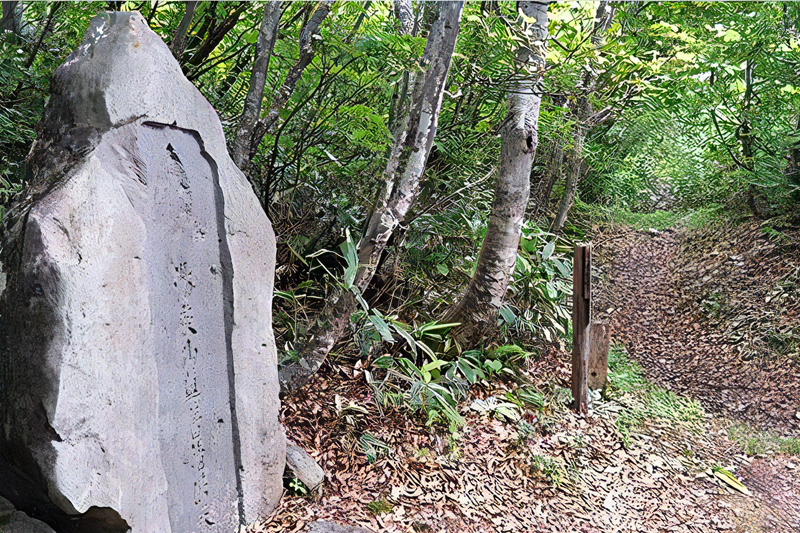
Shrines and temples from the heyday that still remain along the Rokujurigoe Highway
Along the Rokujurigoe Kaido, there are important temples and shrines related to the Dewa Sanzan mountains. We will introduce some of them
Hondojiguchinomiya Yudonosan Shrine, one of the four temples of Mount Yudono that has now become a shrine
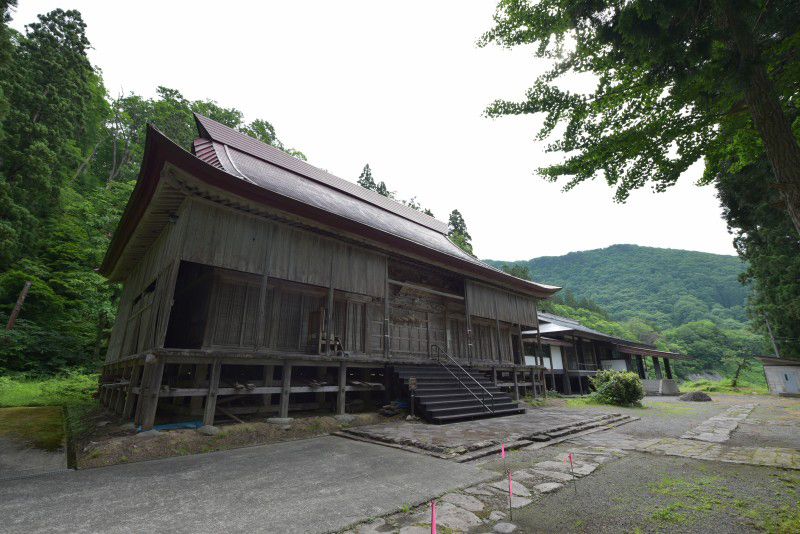
Hondojiguchinomiya Yudonosan Shrine was originally Gekkozan Hondoji Temple, founded by Kobo Daishi in 809, and was converted to Yudonosan Shrine under the Shinto-Buddhist separation law of the Meiji era. Hondoji Temple is one of the four Yudonosan temples founded by Kobo Daishi, and during the Edo period it was also a place of prayer for the Tokugawa Shogunate
The shrine building was rebuilt after being burned down during the Boshin War, and it became a hot topic that Buddhist statues from the temple era that had been scattered when Shinto and Buddhism were separated were returned for the first time in 130 years
Hondojiguchinomiya Yudonosan Shrine <Information>
- Name: Hondojiguchinomiya Yudonosan Shrine
- Address: 381 Daikokumori, Hondouji, Nishikawa-machi, Yamagata Prefecture
- Phone number: 0237-74-3565
- Visiting hours: 9:30-16:30
- Admission fee: 300 yen
- access:
- Train: Approximately 25 minutes by taxi from JR Sazawa Line Sazawa Station
- By car: Approximately 7 minutes on National Route 112 from Nishikawa IC on the Yamagata Expressway
- URL: Hondojiguchinomiya Yudonosan Shrine
Google Map
The head temple of the four Yudono-san temples, "Yudono-san Sohonji Ryusui-ji Dainichibo"
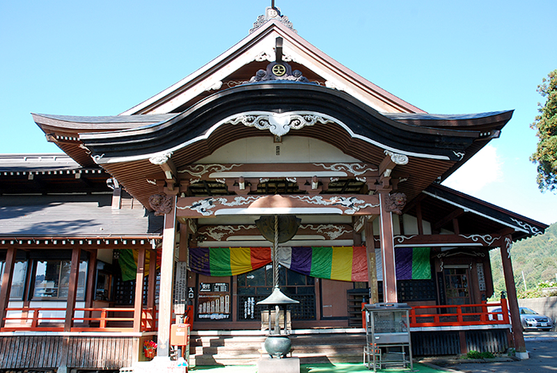
Ryusuiji Dainichibo, the head temple of Mount Yudono, was founded by Kobo Daishi in 807 and is the head temple of the four temples of Mount Yudono. Because Mount Yudono was a mountain off-limits to women, it was built as a temple where women could worship. When Shinto and Buddhism were separated, it remained as a temple, and it protects cultural assets such as the principal image of worship created by Kobo Daishi himself, the self-mummified monk Shinnyokai Shonin, and the Gilt Bronze Standing Statue of Shaka Nyorai, a nationally designated Important Cultural Property
Takusui-ji Temple Dainichibo <Information>
- Name: Yudonosan Main Temple, Ryusui-ji Temple Dainichibo
- Address: 11 Oami Nyudo, Tsuruoka City, Yamagata Prefecture
- Phone number: 0235-54-6301
- Visiting hours: 8:00-17:00 (reception until 16:30)
- Admission fee: Adults 500 yen, Junior high school students 400 yen, Elementary school students 300 yen
- access:
- Train: Take the bus bound for Yudonosan from Tsuruoka Station on the JR Uetsu Main Line for about 45 minutes, then get off at Oami bus stop and walk for about 20 minutes
- By car: Approximately 30 minutes from Gassan IC on the Yamagata Expressway on National Route 112
- URL: Yudonosan Sohonji Temple, Ryusui-ji Temple Dainichibo
Google Map
Currently, the central temple of Mount Yudono is "Yudonosan Churenji Temple."
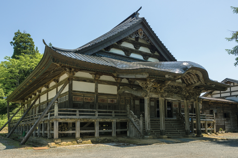
Yudonosan Churenji Temple is one of the "Four Temples of Mount Yudono" founded by Kobo Daishi in 825. It flourished as the head temple of the main entrance to Mount Yudono, and in the Edo period, like Dainichibo, it was a place of worship for women. After the separation of Shinto and Buddhism, it fell into decline for a time, but has since returned to being a central temple of Mount Yudono, attracting many worshippers. It is also known for being the home of the sokushinbutsu (self-mummified monk) of Tetsumon Kaishonin
Shurenji Temple<Information>
- Name: Yudonosan Churenji Temple
- Address: 92-1 Nakadai, Oami, Tsuruoka City, Yamagata Prefecture
- Phone number: 0235-54-6536
- Visiting hours:
- May to October: 9:00 to 17:00
- November to April: 10:00 to 16:00
- Open all year round
- Admission fee: Adults 500 yen, Children 300 yen
- URL: Yudonosan Churenji Temple
Google Map
Tamugimata Village, which flourished as a post town for pilgrims to the Dewa Sanzan mountains
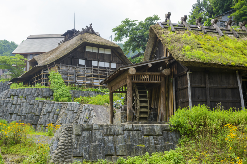
Tamugimata is one of the post towns on the Rokujurigoe Kaido. During the Edo period, many travelers visiting Mount Yudono visited this mountain village. However, after the Meiji period, fewer people visited this mountain village, and it became completely deserted
Meanwhile, in Tsuruoka, during the Meiji period, the production of silk fabric, which would later be called "Samurai Silk," began. However, since raising silkworms (sericulture), the source of silk thread, was not practiced in Tsuruoka, the people of Tamugimata turned to sericulture to make a living. As a result, they remodeled their homes for sericulture, building very unusual tall buildings with four floors and three stories and thatched roofs
The former Shibuya family residence, which remains almost completely intact, has been relocated to the Chido Museum in Tsuruoka City and is preserved as a national important cultural property
Tamumata<Information>
- Name: Tamumata
- Location: Tamagimata, Tsuruoka City, Yamagata Prefecture
- Phone number: 0235-53-2111 (Tsuruoka City Hall Asahi Building)
- Train: Approximately 1 hour 20 minutes by bus bound for Tamugimata from Tsuruoka Station on the JR Uetsu Main Line (2 buses per day)
- By car: Approximately 2.5 km from Yudonosan IC on the Yamagata Expressway
Google Map
Related Information
- Dewa Ancient Road Rokujurigoe Kaido (Tsuruoka City Asahimura Tourism Association)
- Phone number: 0235-53-3411
- URL: Tsuruoka City Asahimura Tourism Association
- Nishikawa Guide: Rokujurigoe Highway (Nishikawa Town Gassan Asahi Tourist Information)
- Phone number: 0237-74-0566 (Nishikawa Town Commerce, Industry and Tourism Division)
- URL: Nishikawa Town Gassan Asahi Tourist Information
- Scenic Roads of the Tohoku Region: Dewa no Kodo Rokujuri-goe Kaido (Tohoku Regional Development Bureau, Ministry of Land, Infrastructure, Transport and Tourism)
- URL: Tohoku Region Scenic Highway Dewa Ancient Road Rokujuri-goe Highway


![[Kaminoyama City, Yamagata Prefecture] Narageshuku, a post town on the Ushu Kaido road used by 13 feudal lords during the Edo period Narageshuku](https://jp.neft.asia/wp-content/uploads/2023/06/f78e23352609b6986737197999be71c6-150x150.webp)
![[Fukushima Prefecture] Is the northern town of Koorimachi the birthplace of the Date clan? 1401-009](https://jp.neft.asia/wp-content/uploads/2022/12/1401-009-150x150.jpg)
![[Yamagata Prefecture] Tsuruoka's silk weaving industry, built by trading swords for hoes 5182039_m](https://jp.neft.asia/wp-content/uploads/2023/02/5182039_m-150x150.jpg)
![[Misato Town, Akita Prefecture] Rokugo Springs: 120 Springs That Have Enriched People's Lives 24946543_m](https://jp.neft.asia/wp-content/uploads/2023/02/24946543_m-150x150.jpg)
![The "Flying Dumplings" are a delicious activity worth seeing! [Ichinoseki City, Iwate Prefecture] Genbikei Gorge bus stop](https://jp.neft.asia/wp-content/uploads/2017/04/IMG_5931-150x150.jpg)
![Oyu Stone Circle: A stone circle from Japan's Jomon period! [Akita Prefecture] afa86939a1f3e49c2a7ae110b4ddb2b4_m](https://jp.neft.asia/wp-content/uploads/2017/08/afa86939a1f3e49c2a7ae110b4ddb2b4_m-150x150.png)
