[Fukushima Prefecture] Is the northern town of Koorimachi the birthplace of the Date clan?
table of contents
- 1 The lord who ruled the Koori region during the Kamakura period took the name "Date"
- 2 Koori Nishiyama Castle was abandoned due to a dispute between parents and children
- 3 Appears in "Oku no Hosomichi" (The Narrow Road to the Deep North). Koori-juku, where Matsuo Basho passed through
- 4 Oiwake, the junction of the Oshu Kaido and Ushu Kaido
- 5 The former Date County Office from the Meiji period, designated as an Important Cultural Property of Japan
- 6 Handa Silver Mine was once one of Japan's three largest mines and boasted the largest silver production in the country
- 7 The huge landslide at Mt. Handa and the abandoned Handa Silver Mine
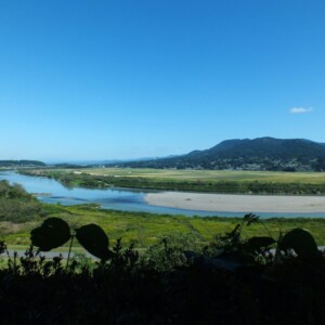
Koori Town, Date District, Fukushima Prefecture is a town located in the northern part of the Nakadori region (central part) of Fukushima Prefecture.
Koori was on the Tosando road, one of the main highways in ancient times (Kofun period to Heian period) and the Middle Ages (Kamakura period to Azuchi-Momoyama period), which connected Kyoto with the Tohoku region (Mutsu Province and Dewa Province ) .
Since the Edo period, the Tosando the Oshu Kaido was the junction with the Ushu Kaido, which heads towards Akita, it developed greatly as a post town called Koori-juku
The origin of the place name "Kouori" is unknown, but one theory is that the characters "koori" and "kuwaori" were used because the county office of Date County (Koori no Miyake, the county office under the ancient Ritsuryo system) was located there. It is said that the "Kouori clan" was born when the "Date clan" split off during the Kamakura period
The lord who ruled the Koori region during the Kamakura period took the name "Date"
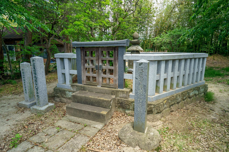
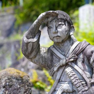
The Date clan is said to have originated when Hitachi Nyudo Nensai Tomomune, who achieved success in the Oshu War led by Minamoto no Yoritomo (1189, the battle in which Yoritomo annihilated the Oshu Fujiwara clan in Hiraizumi), took the name Date when he was given Date County
Date Masamune famous as the first lord of the Sendai domain , was the 17th generation lord counting from Tomomune.
Date Tomomune is said to have first settled in Takako (present-day Date City), and later moved to Kogori, where he also built a tiled temple. This temple became Tomomune's family temple and housed his grave. Successive heads of the family moved their castles to several locations within the domain, but the 14th head, Tanemune, Kogori Nishiyama Castle and moved his base from Yanagawa Castle. Things from Tanemune's time remain around the current site of the main castle.
Tomomune Date's Grave <Information>
- Facility name: Grave of Date Tomomune (ancestor of the Date clan)
- Address: Fukushima Prefecture Date County Koorimachi Oaza Manshoji Shimomanshoji
- Phone number: 024-582-2403 (Kouori Town Education and Culture Division, Lifelong Learning Section)
Google Map
Koori Nishiyama Castle was abandoned due to a dispute between parents and children
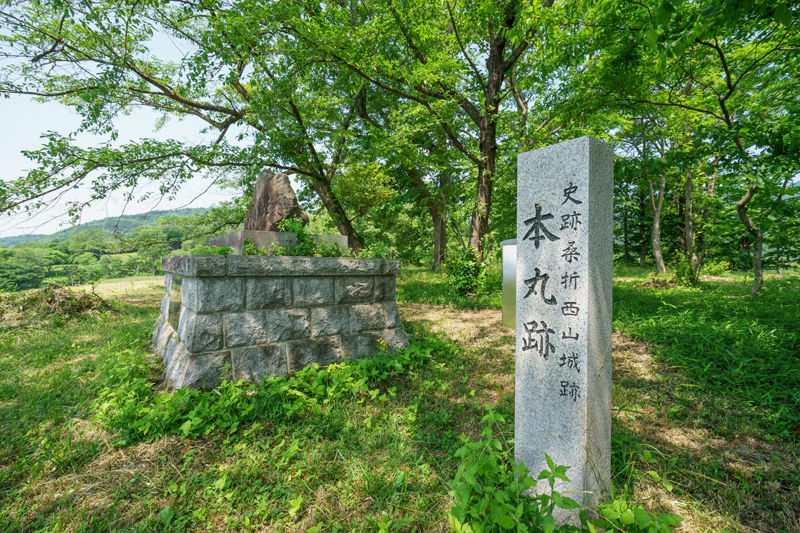
Kuwaori Nishiyama Castle built by the 14th head of the Date clan , was a castle during Tanemune's heyday during the Sengoku period, and consisted of the main castle, second castle, middle building, and western building located on Takadateyama, which is 193 meters above sea level.
The main keep housed the buildings where Tanemune conducted his political affairs, and the castle was quite large for its time, with the entire structure fortified with moats and earthworks. It seems that residences for his vassals were built around the castle
However, Tanemune came into conflict with his son Harumune, and was defeated in a battle between father and son ( the Tenbun Rebellion , 1542-1548), leading to his leaving Kogori Nishiyama Castle. Harumune, who succeeded him as head of the family, was also ordered by the Muromachi shogunate to abandon Kogori Nishiyama Castle, so he moved to Yonezawa (Yamagata Prefecture).
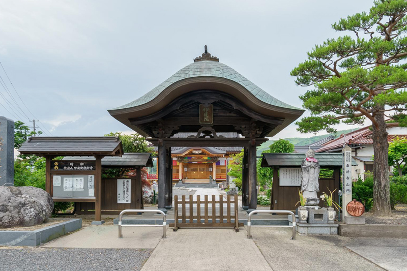
Currently, not a single building remains at the Koori Nishiyama Castle Ruins The Koori Temple Sanmon Gate , is said to be the gate of Nishiyama Castle that was relocated to the site after the castle was abandoned, and is designated an Important Cultural Property of Fukushima Prefecture.
Koori Nishiyama Castle Ruins <Information>
- Facility name: Koori Nishiyama Castle Ruins
- Address: Fukushima Prefecture, Date County, Koori Town, Oaza Manshoji, Honmaru, and other areas
- Phone number: 024-582-2403 (Kouori Town Education and Culture Division, Lifelong Learning Section)
- Free to visit
- Cultural Assets: Nationally Designated Historic Sites
Google Map
Kooriji Temple <Information>
- Facility name: Kooriji Temple Gate
- Address: 32 Shinmachi, Koorimachi, Date County, Fukushima Prefecture
- Phone number: 024-582-2690 (Kouoriji Temple)
- Free to visit
- Cultural property: Fukushima Prefecture designated important cultural property
Google Map
Appears in "Oku no Hosomichi" (The Narrow Road to the Deep North). Koori-juku, where Matsuo Basho passed through
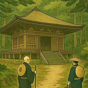
In his book "Oku no Hosomichi," Matsuo Basho wrote that after visiting Iizuka (Iizaka Onsen), he traveled by horseback to Koorijuku on his way to Sendai. He had a terrible experience at Iizaka Onsen and headed to Koorijuku in poor health. At Hoenji Temple in Koorijuku, there remains a rice planting mound that was later built by his disciples
Oiwake, the junction of the Oshu Kaido and Ushu Kaido
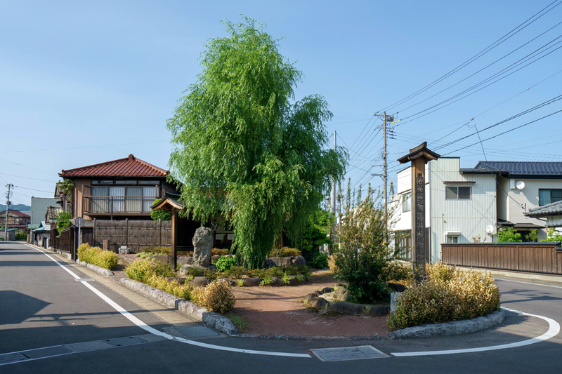
"Oshu-Ushu Kaido Oiwake" is a re-creation of the junction of the Oshu Kaido and Ushu Kaido roads, which was constructed in 2006. Within the site, gazebos and guide signs are set up around guideposts from the Edo period
Oshu/Ushu Kaido Oiwake <Information>
- Facility name: Oshu-Ushu Kaido Oiwake
- Address: 1 Oiwake, Yachi, Koori-machi, Date-gun, Fukushima Prefecture
- Phone number: 024-582-2403 (Kouori Town Education and Culture Division, Lifelong Learning Section)
Google Map
The former Date County Office from the Meiji period, designated as an Important Cultural Property of Japan
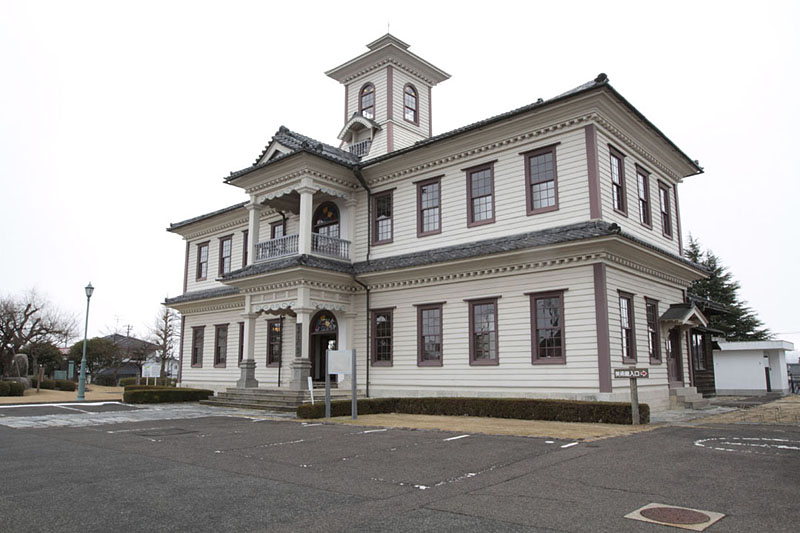
Koori was a bustling area not only on the main road but also thanks to the water transport of the nearby Abukuma River, and as a collection point for silk thread and silkworm eggs produced in Date County from the mid-Edo period onwards. In 1883 (Meiji 16), the Date County Office was established here, making it the political and economic center of the Date region
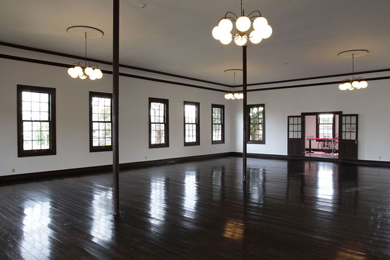
The Date County Office was abolished in 1926 (Taisho 15), but the building continued to be used as a prefectural branch office, eventually ceasing its role in 1969 (Showa 44)
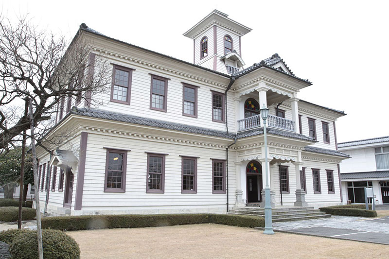
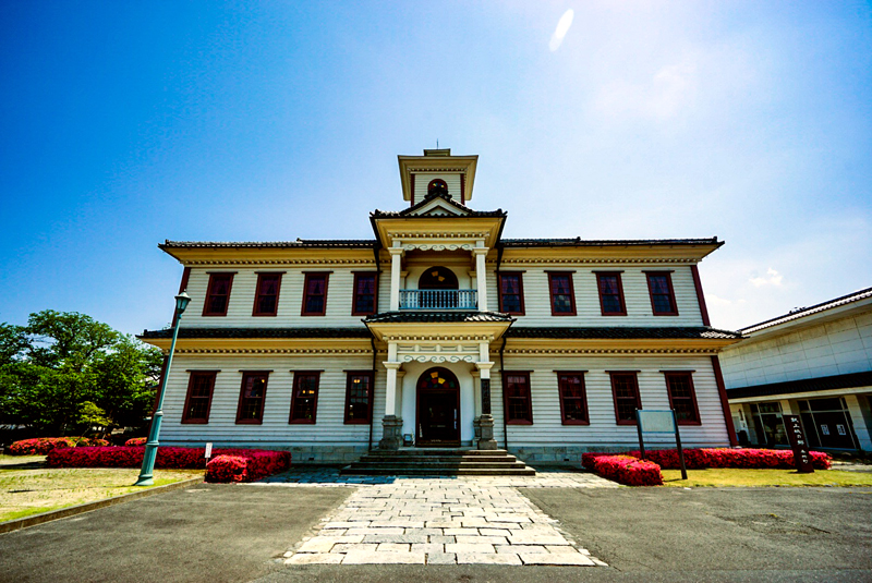
At first glance, the building appears to be Western-style architecture, but it is a hybrid of Japanese and Western architecture (Gyofu Kenchiku), incorporating Japanese architectural elements such as the gambrel roof of the balcony. The central tower was dismantled and removed during the Meiji period, but was restored in 1979 (Showa 54). This building is one of the largest remaining county offices, and due to its extremely high cultural value as a hybrid of Japanese and Western architecture from the early Meiji period, it was designated an Important Cultural Property of Japan in 1977 (Showa 52)
The former Date County Office was partially damaged in the Great East Japan Earthquake in 2011 (Heisei 23) and the earthquake off the coast of Fukushima Prefecture in 2021 (Reiwa 3), and has been undergoing restoration work. However, the work is scheduled to be completed in December 2022 (Reiwa 4), after which the building is scheduled to reopen
Former Date County Office <Information>
- Facility name: Former Date County Office
- Address: 12 Jinya, Koorimachi, Date County, Fukushima Prefecture
- Phone number: 024-582-5507 (Kouori Town Cultural Memorial Hall)
- Opening hours: 9:00-17:00 (last entry 16:30)
- Admission fee: Free
- Closed: Mondays (or the following day if Monday is a public holiday), and the day after a public holiday
- Cultural property: Nationally designated important cultural property
Google Map
Handa Silver Mine was once one of Japan's three largest mines and boasted the largest silver production in the country
Mount Handa (863m above sea level) in Koori was once home to the Handa Silver Mine, which was so productive that it was called one of Japan's three largest mines, alongside Sado Gold Mine (Niigata Prefecture, a candidate for World Heritage Site status) and Ikuno Silver Mine (Hyogo Prefecture, a Heritage Site of Modernization)
Handa Silver Mine is said to have been discovered in the Heian period, and was mined by the feudal lords and feudal lords who ruled the area from the Sengoku period to the early Edo period, providing a source of revenue for the lords. In the mid-Edo period, it became a territory of the Edo Shogunate, and talented magistrates and engineers were dispatched from Sado Gold Mine and Iwami Silver Mine, which led to a significant increase in production, and a large town was established around the silver mine
From the latter half of the Edo period, the mines were depleted and production declined, but in the Meiji period, Godai Tomoatsu, a native of Satsuma, introduced modern technology to redevelop the mine, bringing it back into its golden age. During this period, it became the largest silver mine in Japan
The huge landslide at Mt. Handa and the abandoned Handa Silver Mine
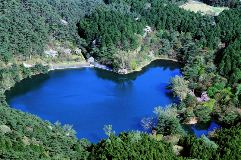
However, something strange happened at Mt. Handa, where the silver mine is located: a landslide. Signs of this began to appear around 1891 (Meiji 24), and large-scale landslides occurred between 1901 (Meiji 34) and 1903 (Meiji 36). The resulting Handa Shinuma swamp burst its banks in 1919 (Meiji 43), causing great damage to the Handa Silver Mine, but it was rebuilt on a smaller scale. Management was later taken over by Nippon Mining, but the mine was closed in 1950 (Showa 25), and no new profitable ore veins were found, leading to its final closure in 1976 (Showa 51)
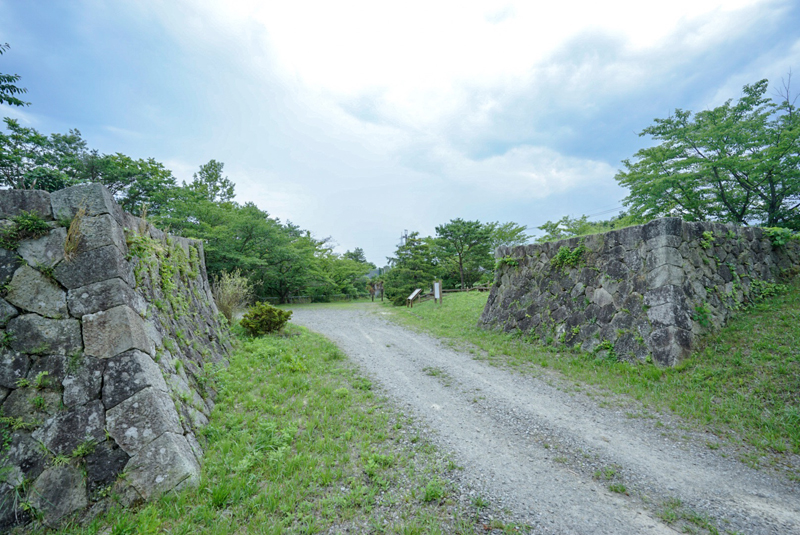
The Handa Silver Mine Historical Site Park is the site where the remains of the trolley tracks that transported ore from the Handa Silver Mine and the stone walls that built the bridges remain. The area around Handa Pond, where Mt. Handa collapsed and broke its banks, underwent erosion control work over the long period of 67 years, and the surrounding area was developed into Handayama Nature Park, where nature walks such as hiking and trekking are popular
Handa Silver Mine Historical Site Park <Information>
- Facility name: Handa Silver Mine Historical Park
- Address: Minamihanda, Jorobashi, Koori-machi, Date-gun, Fukushima Prefecture
- Phone number: 024-582-2403 (Kouori Town Education and Culture Division, Lifelong Learning Section)
- Free to visit
- Facility name: Handayama Nature Park
- Address: Around Handayama, Koori-cho
- Phone number: 024-582-2126 (Kouori Town Industrial Promotion Division, Agriculture and Forestry Promotion Section)
Google Map
Koori Town Tourism Information
- Phone number: 024-582-2111
- URL: Kori Town Tourist Information


![[Fukushima Prefecture] Experience an amazing peach experience! Locals recommend direct sales stores and varieties 1198339_m](https://jp.neft.asia/wp-content/uploads/2024/07/1198339_m-150x150.jpg)
![The "Nambu Magariya" is a unique residence of the Nanbu clan, which was well aware of the importance of horses [Iwate Prefecture] 1906769_m](https://jp.neft.asia/wp-content/uploads/2022/06/1906769_m-150x150.jpg)
![[Yamagata Prefecture] Tsuruoka's silk weaving industry, built by trading swords for hoes 5182039_m](https://jp.neft.asia/wp-content/uploads/2023/02/5182039_m-150x150.jpg)
![From Kurozuka Cave to Bunchi Suriishi. Matsuo Basho visits the legendary rock formations [Fukushima Prefecture] 2016_07_MG_7167](https://jp.neft.asia/wp-content/uploads/2022/11/2016_07_MG_7167-150x150.jpg)
![[Fukushima Prefecture] Fukushima's professional sports teams are striving to reach the top! [Introduction to professional sports in the six Tohoku prefectures] J Village](https://jp.neft.asia/wp-content/uploads/2023/04/c3a282962d69a598924c98e02998cd1c-150x150.jpg)
![[Craft beer in the northern Nakadori area of Fukushima Prefecture] 4 different fruit beers to choose from! Craft beer](https://jp.neft.asia/wp-content/uploads/2022/06/31921056_m-150x150.jpg)

