[The History of Hachirogata Reclamation ①] Japan's second largest lake became a vast rice field [Ogata Village, Akita Prefecture]
table of contents
- 1 The Oga Peninsula, where the original form of its current appearance was formed 2,000 years ago
- 2 Hachirogata was formed when the river carried sand
- 3 Hachirogata is a treasure trove of seafood. Traditional fishing methods that disappeared due to land reclamation
- 4 The vast waters of Lake Hachirogata were pumped out to create rice paddies. Reclamation projects were planned many times
- 5 After World War II, the Hachirogata reclamation project was realized with technical cooperation from the Netherlands
- 6 20% of the Netherlands' land area was created through land reclamation
- 7 A reclamation plan created by Dutch expert Professor Jansen and others
- 8 The Hachirogata reclamation project was made possible through the cooperation of fishermen who depend on Hachirogata for their livelihood
- 9 It will take 20 years to complete the reclamation project. The newly emerged land is 2.5 times the size of the area inside the Yamanote Line
The Oga Peninsula, where the original form of its current appearance was formed 2,000 years ago
Before the Oga Peninsula took on its current shape, the surrounding land emerged from beneath the sea about 20,000 years ago during the Ice Age. As ice increased in the Northern Hemisphere and Antarctica, sea levels dropped and land was created. When the Ice Age ended, sea levels began to rise, and about 6,000 years ago, the entire peninsula was submerged again, except for a small island offshore. 6,000 years ago was the late Jomon period, when the Earth's temperature was at its highest, and it is said that sea levels were 2-3 meters higher than they are today
The Earth began to cool again about 4,000 years ago. As a result, sea levels gradually dropped, and an offshore island (Okajima) grew larger and larger, narrowing the gap between it and the mainland. Sand carried by the Yoneshiro River to the north ( mouth of which is in Noshiro City) and the Omono River (mouth of which is in Akita City) developed into a sand spit (a long, narrow rise made of sand carried by water currents), and around 2,000 years ago, Okajima and the mainland became connected. This was the birth of the Oga Peninsula.
Hachirogata was formed when the river carried sand
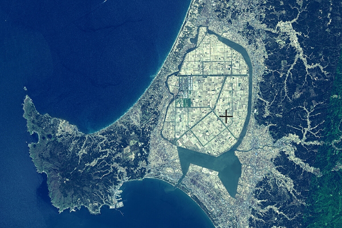
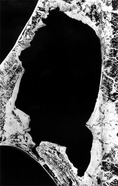
Although Oga became a peninsula, a shallow area of seawater remained inside the sandbar. This is Lake Hachirogata. Although it was only about 4-5 meters deep at its deepest point, it covered an area of approximately 22,000 hectares (220 square kilometers, approximately 12 km east to west and 27 km north to south), making it the second largest lake in Japan after Lake Biwa
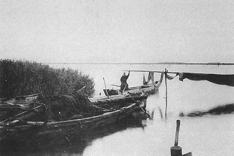
Hachirogata is a treasure trove of seafood. Traditional fishing methods that disappeared due to land reclamation
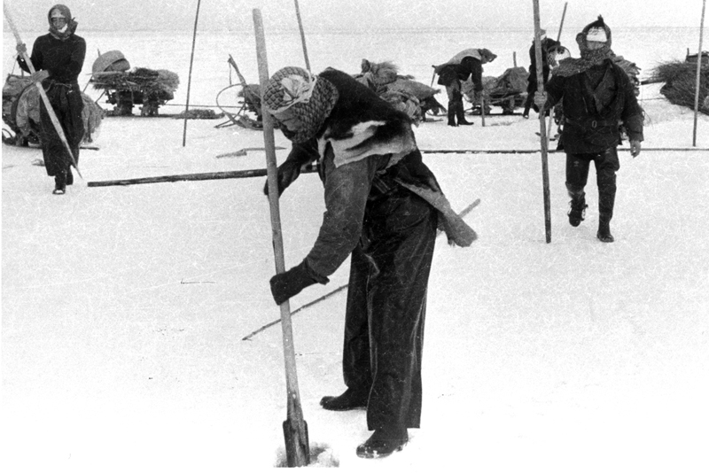
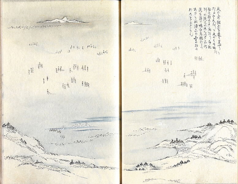
Because Lake Hachirogata is a brackish lake, it is home to many different kinds of fish and has long been a popular fishing area. In winter, a traditional winter activity was " ice fishing ,"
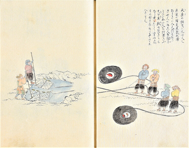
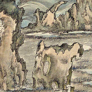
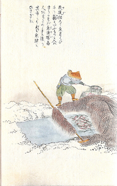
"Ice fishing" is a traditional fishing method that has been practiced since before the Edo period, and the Edo period travel writer Sugai Masumi left detailed illustrations of it in his book " Hio no Mura-gimi
The vast waters of Lake Hachirogata were pumped out to create rice paddies. Reclamation projects were planned many times
For the people of the Oga region, who have little arable land and often suffer from rice shortages due to cold weather damage, turning the shallow waters of Hachirogata into farmland has long been a wish. Reclaiming parts of Hachirogata to create farmland appears to have been done for quite some time, but in the late Edo period, Watanabe Onomatsu of the Hachirogata Canal Plan and began working on large-scale farmland development. The Hachirogata Canal Plan, which was carried out between 1822 and 1826, is said to have completed the creation of 20 hectares of farmland by reclaiming the shores of Hachirogata.
Even after the transition from the Edo period to the Meiji period, plans to turn the entire Hachirogata into farmland were launched several times
In 1872 (Meiji 5), Shima Yoshitake, who was appointed the first governor of Akita Prefecture , announced a plan to develop Lake Hachirogata, solicited donations from ordinary residents, and even Okubo Toshimichi , but the plan never came to fruition.
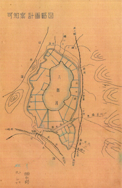
In 1923 (Taisho 12), Kachi Kanichi Ministry of Agriculture and Commerce (a national government agency that combined the functions of today's Ministry of Agriculture, Forestry and Fisheries and the Ministry of Economy, Trade and Industry) drew up a Hachirogata Land Use Plan and began preparations such as field surveys as a national project, but this too was shelved due to budgetary constraints. The Kachi plan called for turning just over 50% of Hachirogata into farmland through reclamation, with the remainder of the lake being left as a residual lake in the center of the reclaimed land to be used for agricultural water and as a flood control reservoir.
As the Showa era began, plans were made in the 1930s for the Kanamori Plan to use Lake Hachirogata as industrial land, and the Morooka Plan, which was a modification of the Kachi Plan, but both were scrapped with the outbreak of the Pacific War
After World War II, the Hachirogata reclamation project was realized with technical cooperation from the Netherlands
Japan's defeat in World War II brought about a severe food shortage. Massive increases in rice production were urgently needed, and the government Isahaya Bay (Nagasaki Prefecture) and Lake Inbanuma (Chiba Prefecture). Hachirogata was included in these plans, and the Kano Plan, which was similar to the current one, was presented, but construction did not begin due to opposition from local fishermen and project costs. However, the political situation surrounding the post-war recovery meant that the path to realizing this dream became clear.
Japan struggled to deal with the Allied nations. Despite numerous issues with each country, such as territorial claims and reparations, the San Francisco Peace Treaty was signed in San Francisco, USA, on September 8, 1951 (Showa 26). During the negotiations, one of the conditions for peace proposed by the Netherlands was that "Dutch technology be utilized in Japan."
The Japanese government was at a loss as there was no technology from the Netherlands to choose from, but one day, an official from the Ministry of Construction (now the Ministry of Land, Infrastructure, Transport and Tourism), Jun Shimokawabe (then 26 years old, later Vice Minister of Land, Infrastructure, Transport and Tourism), realized that the Netherlands was a leader in land reclamation, and proposed to then Prime Minister Shigeru Yoshida that " Lake Hachirogata could be reclaimed with Dutch technology ." This was the moment that the Hachirogata reclamation project, which had been thought to be impossible, suddenly began to move towards realization.
20% of the Netherlands' land area was created through land reclamation
Since the 13th century, the Netherlands has actively engaged in land reclamation, expanding its territory. Most of the country is flat, facing the North Sea to the west. Since the coastline is almost at the same elevation as sea level, the country has been plagued by seawater erosion and flooding caused by storms since ancient times. Land reclamation was conceived as a way to stop the flooding and further expand the country's land area
Two methods that can be considered for draining water and creating new land are "reclamation" and "reclamation." "Reclamation" literally means "filling holes, coasts, ponds, etc. with new soil and sand," which basically means piling up the soil higher than the original water level. This requires a huge amount of soil and sand to create a large area of land
On the other hand, "reclamation" simply involves draining the water and using the resulting land as is. While it may seem easier than "filling in" because it only involves draining the water, the problem is that the new land is lower than the water level. Building sturdy levees and drainage facilities in case of an emergency requires extensive experience and technical skill. In the case of the Netherlands, reclamation was chosen because the sea facing the country was shallow and there was an overwhelming lack of soil and sand to transport for landfill. Initially, reclamation projects began gradually, but over the next 700 years up to the 20th century, an astounding 8,100 square kilometers of new land (about 20% of the Netherlands' land area, or about 12 times the size of Lake Biwa) was created, demonstrating exceptional experience and technical skill
A reclamation plan created by Dutch expert Professor Jansen and others
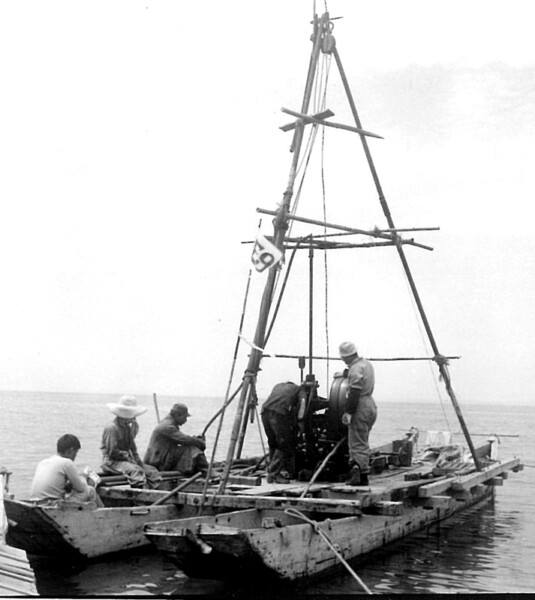
Land reclamation has been practiced in Japan for a long time. It is said that land reclamation began in the Ariake Sea during the Asuka period, and farmland was expanded through land reclamation all over the country. However, even in the mid-Showa period, there was no experience of a large-scale land reclamation project like Hachirogata
After the San Francisco Peace Treaty was signed, Japanese engineers went to study in the Netherlands. In 1954, Peter Philips Jansen , and his team arrived in Japan, marking the start of the Hachirogata reclamation project.
The Hachirogata reclamation project was made possible through the cooperation of fishermen who depend on Hachirogata for their livelihood
Hachirogata has been a lake rich in fishery resources since ancient times, and after the end of the war, approximately 3,000 households and 20,000 people earned their living from fishing. For fishermen, the reclamation of Hachirogata was a matter of life and death, and naturally, a major opposition movement arose
The Ministry of Agriculture and Forestry (now the Ministry of Agriculture, Forestry and Fisheries) and Akita Prefecture, desperate to increase farmland in order to achieve food self-sufficiency, persistently negotiated with opposing fishermen, and in August 1957 (Showa 32), a compromise was reached, and in December of that year the " Memorandum on the Implementation of Fisheries Compensation Issues Associated with the Hachirogata Lagoon Reclamation Project " was signed. It was agreed that a total of 1.69 billion yen would be paid as compensation to the fishermen, and full-scale construction of the reclamation project began.
It will take 20 years to complete the reclamation project. The newly emerged land is 2.5 times the size of the area inside the Yamanote Line
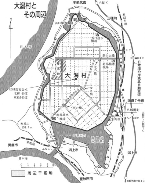
The reclamation project, which turned 80% of Hachirogata into farmland, began with the construction of a 52km long levee. Once the levee was completed, powerful pumps were used to drain the water inside the levee to the outside. Ogata Village was established in 1964, and drainage was completed in 1966 (Showa 41). After that, various construction works, including the conversion to farmland, were carried out, and the national Hachirogata reclamation project was completed in March 1977 (Showa 52). The reclaimed area was approximately 15,666 hectares (approximately 157 square kilometers), all of which belongs to Ogata Village.
Ogata Village <Information>
- Location: Ogata Village, Minamiakita District, Akita City
- Phone number: 0185-45-2111
- reference
(Continued in "The History of Hachirogata Reclamation 2")


![[The History of Hachirogata Reclamation ③] The land is below sea level… Water management is a lifeline [Ogata Village, Akita Prefecture] The Southern Pumping Station almost completely blocks off the regulating reservoir (right) and the Western Receiving Channel (left). The long channel in the middle is the Central Main Drainage Channel. ©Oga Peninsula-Ogata Geopark](https://jp.neft.asia/wp-content/uploads/2024/07/WIA8xMbfFUTs8kQ1720954526_1720954532-150x150.jpg)
