This site is an online media that delivers all sorts of trivia about the six Tohoku prefectures, from sightseeing and gourmet spots to local customs, history, and more
The reclamation of Lake Hachirogata took 21 years, from 1957 to 1977, to create a vast area of land measuring 15,666 hectares. A new village called Ogata Village was established there, and approximately 1,100 households and 3,000 people (as of June 1, 2023, according to the Ogata Village website) live there, primarily engaged in rice cultivation.
Japan is a small country surrounded by the sea, with little flat land, and has a chronic shortage of farmland. The only way to increase farmland is to clear mountains, or to fill in lakes and shallow coastlines with soil or drain them to create farmland
Reclamation is the process of enclosing part of the sea or lake with a dike, draining the water, and using the resulting land
" Land reclamation " is a method of reclaiming land from shallow seas and lakes by building dikes to pump out the water and using the land at the bottom. Because land reclamation does not require transporting large amounts of soil and sand, it can create vast areas of land. Much of it is done to expand agricultural land. It has a long history, with the first example believed to have been carried out in the Ariake Sea during the Asuka period. Other large-scale reclaimed land areas include Kojima Bay (Okayama Prefecture) and Isahaya Bay (Nagasaki Prefecture) in the Seto Inland Sea , Kahoku Lagoon (Ishikawa Prefecture), and Lake Inbanuma (Chiba Prefecture). The last land reclamation project was the " National Isahaya Bay Reclamation Project ," which was completed in March 2008 (as of 2024).
"Reclamation" is the process of filling in coastlines and oceans to create new land
On the other hand, land reclamation , which involves filling in seas and lakes with earth and sand , has also been widely practiced since ancient times. Land reclamation is mainly used to expand land, increase port facilities, or create artificial islands for use in towns, factories, airports, and other facilities. In the past, it was also used for gun batteries. It is believed that the first artificial island was Kyogashima , built off the coast of Kobe City, Hyogo Prefecture, by General Taira no Kiyomori at the end of the Heian period (the exact location is unknown).
of reclaimed land,Dejima(Nagasaki Prefecture),Odaiba(Tokyo),Port Island(Hyogo Prefecture),Kansai International Airport(Osaka Prefecture), andHaneda Airport. What is surprisingly little known is that Ginza and Tsukiji (Tokyo) were created during the Edo period, reclaimed from Tokyo Bay in front of Edo Castle by feudal lords from all over Japan who transported soil and sand from Kanda Hill behind Edo Castle. As of 2024, many large-scale land reclamation projects are still underway in Tokyo Bay, Osaka Bay, and Henoko in Okinawa Prefecture.
Water management is the most important aspect of reclamation
The reclamation of Lake Hachirogata involved draining about 70% of the center of the lake, leaving the lake water around it as it was. The work began by building a dike surrounding the reclaimed land and draining the water from inside. The reason the lake water was left outside the dike was to regulate the flow of water from rivers and other sources, and to ensure that there would be enough water for agriculture and daily life once the reclamation was complete
The role of the levee is to prevent water from entering from outside. Since reclamation simply involves draining water, the elevation of the newly created land is roughly the same as or lower than the water level. Therefore, unexpected water entering from outside can kill the reclaimed land. Drainage pumps have been installed in several places on the levee. Drainage pumps are used to drain water from within the reclaimed land to the outside, and even after the reclamation is completed, they are still used to drain excess rainwater, agricultural water, water for daily use, etc
The dike construction was 51.5 km long, leaving a large residual lake (regulating pond) of 4,000 hectares on the south side of the outer perimeter. The rest of the reclaimed land is surrounded by a channel-like lake surface (a water-receiving channel)
Building the embankment was extremely difficult. The lake bottom was a soft ground. The sludge from the lake bottom was used as the foundation for the embankment
Hachirogata Lake was shallow and had a flat lake bottom, making it suitable for land reclamation. However, the lake bottom was extremely soft, with soft sludge piled up to 50 meters deep. In order to start reclamation work, a levee had to be built on top of the ground, which meant the project itself could not begin. Japan's technology was not enough to handle this, but the Netherlands, a leader in land reclamation, had a construction method that could solve this difficult problem
Building a levee requires a large amount of soil and sand, but there are not many mountains around Lake Hachirogata from which to obtain the soil. However, this sludge layer was useful for this purpose. It was discovered that the sandy sludge at the bottom of the lake could be used to build a levee. However, simply piling up sand would easily break, so the surface was paved with asphalt to increase its strength
Purchased a small hill near the historical site of Mikurahana to secure reinforcing rocks
Even though the dike was reinforced with asphalt, it was still not perfect. Therefore, in order to strengthen the dike and reduce the force of the waves, it was decided to lay large stones at the base of the dike (riprap construction). A major problem was where to procure the enormous amount of rocks needed for the long dike, but this was a top priority for the government. So they ended up buying a nearby mountain
The land purchased to reinforce the embankment was Chikushidake , a small hill adjacent to Mikurahana , a scenic spot located on the central eastern shore of Lake Hachirogata, on the border between present-day Hachirogata Town and Mitane Town. It is said that 1.24 million tons of rock were transported from there.
The reclamation of Lake Hachirogata was completed on November 12, 1963 (Showa 38), with the construction of the dike, but the construction of the rubble pile continued until 1964 (Showa 39)
Once the levee is complete, the work of draining the water and creating land will begin
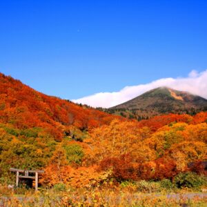
Mikurahana, where the legend of Lake Hachirogata remains, was visited many times by Masumi Sugae
Mikurahana is a small hill along Lake Hachirogata, and is a historical landmark connected to the legend of Hachirotaro ("The Legend of the Three Lakes of Lake Hachirogata"), from which the name Hachirogata is derived. From the observation deck, you can see the old Lake Hachirogata, which has been reclaimed and now covered in rice fields. There is also a monument ("Lake Hachirogata Reclamation Survey Memorial Tree") that was planted by Professor Jansen and Engineer Volker, Dutch reclamation experts who visited to conduct research before the Hachirogata reclamation project began
Most of the coast of Lake Hachirogata is flat, but at Mikurahana the mountain slope drops directly into Lake Hachirogata, making it a bit of a challenge on the highway that passes along the eastern shore of Lake Hachirogata to Noshiro and Tsugaru. However, Mikurahana is a scenic spot with lush pine trees and Lake Hachirogata stretching out before your eyes, so it is said that many people used this highway from the Edo to Meiji periods, and the Kubota domain maintained the road. Sugae Masumi also visited Mikurahana and left behind drawings
"Mikurahana" painted by Sugae Masumi. The shrine depicted, "Futono no Iwakura" (Cave of the Husband), still remains today. (Masumi Travelogue [Volume 40 (Volumes 27-29] Ogano no Harukaze) Collection: National Diet Library
Mount Chikushi is a small hill on the opposite side of the JR Ou Main Line, which runs east of Mikurahana, and the area at the base of the mountain has been developed by Hachirogata Town as "Hizuraoka Park." At the back of the park there is an area that is still used as a quarry, and in one part of the quarry there are remains that appear to have been carved out for Hachirogata
My love of travel led me to work for a travel magazine some time ago, and now I work as a travel writer for an online publication. I have visited all 47 prefectures in Japan, focusing on the Tohoku region, and I enjoy soaking in hot springs and experiencing traditional Japanese culture, including old townscapes, lifestyles, and performing arts and crafts