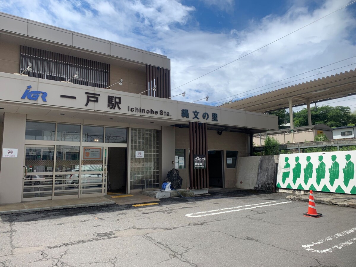
What is the mystery behind the place names with "to" in them, from Ichinohe to Kunohe? Exploring the origins of the numerical place names scattered throughout the former Nanbu territory!
table of contents
- 1 Place names with "He" in them scattered throughout the former Nanbu territory
- 2 The theory that the name comes from the Nanbu clan's "Kumaki"
- 3 The theory that it was built as a defense against the Emishi
- 4 The theory that it originated from a ranch run by the Oshu Fujiwara clan
- 5 Theory that the Kiyohara clan, which existed before the Fujiwara clan, originated
- 6 summary
- 7 Special feature on "place names with 'to' in them" from 1 to 9
The area stretching from the Sanpachi-Kamikita region of Aomori Prefecture the Nanbu domain, known as Nukanobu.
In this area, there are place names that start with "he" and are numbered from Ichinohe to Kunohe
These "To" characters, which are not found in other regions, remain in the names of cities, towns, and villages to this day, with the exception of Shinohe. However, there are various theories about their origins, and the truth is not well understood. In this article, we will introduce various theories about the origins of place names that include "To"
Place names with "He" in them scattered throughout the former Nanbu territory
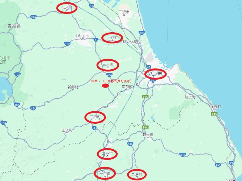
As of June 2024, these place names remain as the names of cities, towns, and villages in Aomori and Iwate prefectures
Iwate Prefecture has Ichinohe Town, Ninohe City, and Kunohe Village, while Aomori Prefecture has Sannohe Town, Gonohe Town, Rokunohe Town, Shichinohe Town, and Hachinohe City
Of these, only Shinohe no longer exists as a city or town, and there are various theories as to where it was located, so it is not clear
There is a theory that there is a family within the Nanbu clan that uses the surname Yone, and that the area where their descendants have their castles is called "Yone," but there is no definitive proof of either theory
Why aren't there a row of one to nine houses?
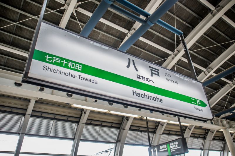
From Ichinohe to Shichinohe, the towns are lined up in numerical order from south to north along the Oshu Kaido road, but the town of Hachinohe, next to Shichinohe, is a port city on the Pacific coast, heading southeast from there
Kunohe is located further south than Hachinohe, across Mt. Orikasa from Ichinohe and Ninohe, and there are several theories about this, including that "the area north of Shichinohe was not suitable for raising horses," that "a fence to protect against Emishi was also needed on the east side, so Hachinohe and Kunohe were added."
There is no definitive theory as to why it came to be called "~to," but among the various theories, the one introduced below is considered the most likely
The theory that the name comes from the Nanbu clan's "Kumaki"
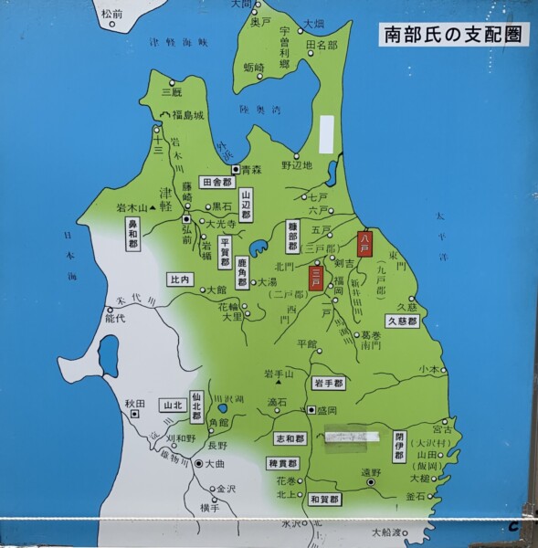
This area was once called Nukanobu and was divided into "Ichinobe" to "Kunobe," and it is said that there were seven villages with horse ranches in each section
In addition, it is said that the surrounding villages that did not belong to it were divided into four gates (kado) - east, west, north and south
This system, known as the "Kukabe Shimon" or "Shimon Kunohe" and one theory is that it originated from the ranches that produced Nanbu horses, known as the "Nanbu Kumaki."
It is said that the nine mounds were numbered clockwise: one and two at the south gate, three, four and five at the west gate, six and seven at the north gate, and eight and nine at the east gate, or that this is the order in which the Nanbu clan ruled their territories
The Nanbu clan who moved from Kai to Mutsu
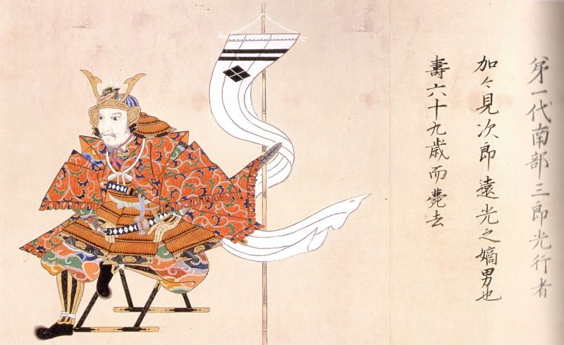
The Nanbu clan originated in Nanbu-go, Kai Province (Yamanashi Prefecture), but it is said that Nanbu Saburo Mitsuyuki, who was given Nukabe County by Minamoto no Yoritomo, built a castle in what is now Nanbu Town, Sannohe County, Aomori Prefecture, and ruled the area
Mitsuyuki, who expanded his power in Mutsu, had six sons. His eldest son, Yukitomo, was an illegitimate son and therefore became the founder of the Ichinohe clan, while his second son, Sanemitsu, succeeded the Sannohe Nanbu clan
Furthermore, it is said that the third son, Sanenaga, became the ancestor of the Hachinohe clan, the fourth son, Asaakira, the Shichinohe clan, the fifth son, Muneakira, the Yonnohe clan, and the sixth son, Yukitsune, became the ancestor of the Kunohe clan
The theory that it was built as a defense against the Emishi
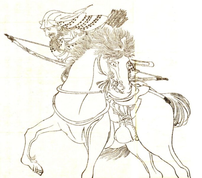
It is said that place names with the character "to" in them already existed in Nukabe during the Kamakura period, before it was ruled by the Nanbu clan
During the Kōnin era (810-824), Fun'yawatamaro set the Emishi, and built fences as advance bases from northern Iwate Prefecture to eastern Aomori Prefecture, and began development there.
According to this theory, the Sakato placed on the fence is said to be the origin of the place name "To," and this is supported by the fact that Sakato were placed at intervals that allowed the expeditionary force to march from the south to Shichinohe in approximately one day as they advanced north
It is said that the area around Sakado began to form a village, and the numbering of these villages led to the appearance of place names with "to" in them
The theory that it originated from a ranch run by the Oshu Fujiwara clan
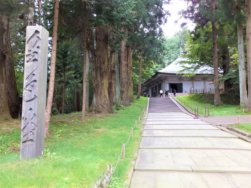
Nukabe County, the largest county in Japan, is said to have been established by the Fujiwara clan of Hiraizumi in the mid-12th century
The basis for this theory is that the first official appearance of the place name Nukabe is in the Azuma Kagami, where it is recorded that Fujiwara Motohira gave 50 Nukabe swift horses to Unkei, the sculptor of Buddhist statues who created the principal image of Motsuji Temple
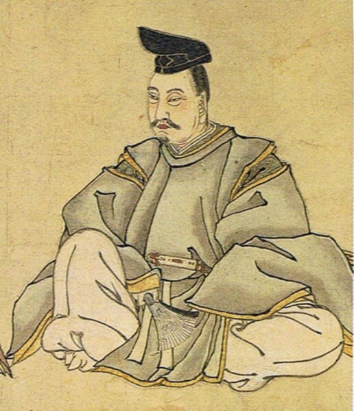
At that time, horses, a local specialty, "kume" and paid as annual tax, and it is said that the "to" was an administrative organization run by the Fujiwara clan to manage these horses.
Nukabe County is a vast area that includes Ninohe City, Ninohe County, and Kunohe County in Iwate Prefecture, and Kamikita County, Sannohe County, Hachinohe City, Misawa City, and Towada City in Aomori Prefecture, and it is said that the Fujiwara clan divided the area into nine ``government-run ranches'' and operated them
What is Nukanobu no Shunme?
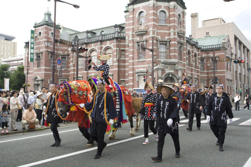
Nukabe has been known as a breeding ground for fine horses since the Heian period, and its horses were highly prized in the capital of Kyoto
There is a word called "Hedachi" which indicates the "To" where these horses were born, and the Azuma Kagami records that when Minamoto no Yoritomo presented horses to Emperor Goshirakawa, Emperor Goshirakawa showed interest in "Hedachi."
Additionally, the Genpei Jōsuiki also records that Kajiwara Kagesue and Sasaki Takatsuna , who fought for the vanguard in the Battle of Uji River in 1184, were Mitotate and Shichitotate, respectively.
Theory that the Kiyohara clan, which existed before the Fujiwara clan, originated
One theory is that the Nukabe County ranch began as a "government-run ranch" during the reign of Kiyohara Sanehira, who ruled this region before the rise of the Oshu Fujiwara clan
summary
The place name "He" (door) made up of Chinese numerals and consisting of the character for door, is found only in the territory of the Nanbu domain, which stretches from Aomori to Iwate prefectures, and is known as a "mystery spot" whose origin is unknown
Recently, pilgrimages to places with "to" in their names, which involve traveling from Ichinohe to Kunohe in order, have been gaining attention as they are perceived in a similar way to the "pilgrimages to sacred sites" in anime



![Place names containing "to" from 1 to 9 [Ichinohe and Ninohe edition] Ichinohe is the first town with Jomon ruins, but why is the ruins of Kunohe Castle located in Ninohe? IMG_5569](https://jp.neft.asia/wp-content/uploads/2024/07/IMG_5569-150x150.jpg)
!["Place names with 'to' in them" from 1 to 9 [Hachinohe and Kunohe Edition] The mystery of the arrangement where only the positions of 8 and 9 have different patterns Hachinohe Catch](https://jp.neft.asia/wp-content/uploads/2024/07/8737ae4878723e4fc7d713b6aed41d96-150x150.jpg)
!["Place names with 'To' in them" from 1 to 9 [Shichinohe Edition] The northernmost To, where the image of a horse breeding area remains strong Shichinohe Catch](https://jp.neft.asia/wp-content/uploads/2024/07/286d15017199ce278766930f20fcf2e8-150x150.jpg)

!["Place names with 'to' in them" from 1 to 9 [Mito Edition] Mito, the birthplace of the Nanbu clan, is a city of famous places, historical sites and cats Mito Catch](https://jp.neft.asia/wp-content/uploads/2024/07/68def385b00c53bbd560d023270a45ba-150x150.jpg)
