


How was the Tohoku region sung about in the third volume of the Railway Songs? (2) Shiraishi (Miyagi) - Nitta (Miyagi)

Continuing from the previous article , I will be discussing the third volume of "Railway Songs," "Oshu/Iwaki Edition," which was released in 1900
Last time, we explained the route from No. 1, which departs from Ueno Station in Tokyo Prefecture (at the time), to No. 24, which travels north along the Tohoku Main Line (*) to Shiroishi Station in Miyagi Prefecture. This time, we will start from No. 25, which is just past Shiroishi Station
...or so I'd like to say, but I forgot to mention number 24 in the previous article, so I'll start there (please note that I always include the pronunciation of stations on the Tohoku Main Line the first time they are mentioned)
*At the time, the Tohoku Main Line was treated as the "main line" or "Oshu Line" of the private railway company Nippon Tetsudo (Japan Railways), but for the sake of clarity, it is generally referred to as the "Tohoku Main Line."
In creating this article, I referred to this website for the lyrics. Please note that more than 70 years have passed since the deaths of all the authors of the Railway Song, and the copyright has expired in many countries, including Japan and the United States
Link - Railway Song / Oshu/Iwaki Edition (Wikisource)
Number 24: Shiraishi
Some people get off at Nagaoka and head to Iizaka for hot spring treatments, and I hear that beyond Kosugō, Shiroishi is already in the province of Rikuzen
(The kanji characters and kana spellings have been updated to reflect current usage.)
Shiroishi Castle
The 24th route, which I mentioned at the end of the previous article, ended when we entered Miyagi Prefecture and reached Shiroishi. About 1 km west of Shiroishi Station is Shiroishi Castle, a beloved symbol of Shiroishi City

When the "One Castle Per Province" decree was issued during the Edo period, according to the principle, all castles in the Sendai Domain, ruled by the Date clan, except for Sendai Castle where the lord resided, had to be demolished. However, Shiroishi Castle was permitted to remain standing, contrary to this principle (*). The Katakura clan, including Katakura Kagetuna, a senior retainer of Date Masamune, served as the castle lords for generations until the Meiji era


*However, it seems that the Sendai Domain and its branch domain, the Ichinoseki Domain, had as many as 21 de facto castles referred to as "fortifications." One can only say that this is truly the work of the Date clan..
Shiroishi Castle<Information>
- Name: Shiroishi Castle
- Address: 1-16 Masuoka-cho, Shiroishi City, Miyagi Prefecture 989-0251
- Phone number: 0224-24-3030
- Opening hours: 9:00 AM - 5:00 PM (April - October) / 9:00 AM - 4:00 PM (November - March) *Last entry is 30 minutes before closing
- Closed: December 28th to December 31st
- Official URL:Shiroishi Castle – Shiroishi City Cultural and Sports Promotion Foundation
Google Map
Isn't Shiraishi in Iwaki, not Rikuzen?
As they enter Miyagi Prefecture, the lyrics "We are already in the land of Rikuzen" appear
The area that now comprises the prefectures on the Pacific coast of the Tohoku region, including Aomori Prefecture, was long known as the province of "Mutsu (or Michinoku)." However, in December of the first year of the Meiji era (January 1869), Mutsu was divided into five provinces: "Rikuo, Rikuchu, Rikuzen, Iwashiro, and Iwaki."
The Aizu region of Fukushima Prefecture and the Nakadori region, along which the Tohoku Main Line runs northward, largely correspond to Iwashiro (and partly to Iwaki). On the other hand, Rikuzen roughly corresponds to present-day Miyagi Prefecture. However, Miyagi Prefecture and Rikuzen are not exactly the same. For example, there are areas that were formerly part of Rikuzen but are now part of Iwate Prefecture, such as Rikuzentakata City in southeastern Iwate Prefecture
The same applies to southern Miyagi Prefecture; it's "not exactly the same."Areas like Shiroishi are in Miyagi Prefecture, but they're not in Rikuzen,they're in Iwaki (as you can see, the Railway Songoften contains lyrics that may not be factual). However, saying "Iwaki" strongly evokes the image of Fukushima Prefecture, where Iwaki City is located, so it's unlikely that present-day Shiroishi would be referred to as Iwaki anymore.
The actual entry into Rikuzen would be from Ōgawara Town in Shibata District, which is adjacent to the current city of Shiroishi. In terms of train stations, it would be from Ōgawara Station, which was the next station after Shiroishi in 1900. This station is not mentioned in the lyrics
No. 25: Abukuma River
The Abukuma River, which eventually flows into the eastern sea, is close to the window, and the joy of dancing comes forth, singing endless songs
After passing Shiroishi, the Tohoku Main Line runs parallel to the Shiroishi River. The Shiroishi Riverthe Abukuma River. The Abukuma River, in turn, flows into the Pacific Ocean in about 10 km.

The Abukuma River is a 239km-long Class A river that originates in Nishigo Village, Nishishirakawa District, Fukushima Prefecture, flows northward through the central part of Fukushima Prefecture, passing through cities such as Shirakawa, Sukagawa, Koriyama, and Fukushima (*), and empties into the Pacific Ocean at the border between Iwanuma City and Watari Town, Watari District, Miyagi Prefecture
*In other words, the Tohoku Main Line ran parallel to the Abukuma River for almost its entire length within Fukushima Prefecture, sowhy such a river doesn't appear in the lyrics even once until it enters Miyagi Prefecture.
Of course, historically speaking, it would be more accurate to say that the towns of Nakadori in Fukushima Prefecture were formed along the Abukuma River, rather than saying that the Abukuma River flows along Nakadori. The Abukuma River is also known as the "mother river of Fukushima Prefecture." There is no doubt that it has supported people's lives since prehistoric times, providing water for drinking and agriculture, and serving as a route for logistics via river transport.

As a river deeply rooted in the lives of people and running through Nakadori, it has also been the setting for historical events. It was on the banks of the Abukuma River that Date Terumune, the father of Date Masamune, met his tragic end

(This is completely off-topic, but my maternal grandfather was from Date, and for him, the Abukuma River was not a mother river at all, but rather a river where he nearly lost his life in his childhood... Of course, if he had lost his life, I would not have been born.)
As we approached the Abukuma River, the lyrics suddenly appeared: "The joy of singing and dancing." I'm not entirely sure what the author is trying to say, but perhaps the scenery was so beautiful that it made them want to sing. If so, I can understand the feeling
Number 26: Iwanuma
The bustling Iwanuma Station is like a horse market in spring and autumn. Who is it that pushes forward on a thousand-mile journey for the sake of the country?
The train arrived at Iwanuma Station . Iwanuma is also the terminus of the Joban Line , which connects Tokyo to Miyagi via the Pacific coast (the Joban Line had a different name at the time). The Joban Line will appear later in Volume 3, so I will leave the explanation for a later article.
As mentioned in the lyrics,Iwanuma was once a bustling center for horse markets. It is said that around the same time that Takekoma Shrine in Iwanuma was founded, in 842 AD (Jōwa 9), the provincial governor Ono no Takamura started a horse market there.

The horse market was held around Takekoma Shrine for 100 days starting from the shrine's first Horse Day (the 8th or 9th of the second month of the lunar calendar), but it was shortened to 50 days during the Edo period.the Sendai domain took the 50 days that were shortened from the Iwanuma domainholding a horse market, but this is not certain.
During the Meiji era, the Iwanuma horse market regained its prosperity. In 1871,Iwanumawas designated as a government-owned location for purchasing military horses. The lyrics mention "spring and autumn horse markets," so it is likely that the Iwanuma horse market during the Meiji era was held twice a year, in spring and autumn. However, the author has not been able to find any documents that definitively confirm this.
Furthermore, within the grounds of Takekoma Shrine,a museum called the "Equestrian Museum." Inside, it houses valuable materials such as the "Equestrian Plaster Statue of Date Masamune," which is a designated tangible cultural property of Iwanuma City.
Link – Iwanuma City Official Website
However, the Horse Museum isit is only open for limited periods, such as the Hatsuumasai and Akitsuki Taisai festivals. I suspect that the museum is only open during the times when the horse market used to be held.
Reference: Information on the 2026 Autumn Grand Festival (already concluded) Information on the Autumn Grand Festival of Takekoma Shrine, one of Japan's three major Inari shrines
The lyrics, "Who is it that pushes forward on a thousand-mile journey for the sake of their country?", likely mean that the horses from Iwanuma, which have become warhorses, are traveling a thousand miles (which translates to 3,927 km, but this probably doesn't represent a specific distance, but rathersomething like "a very long journey") for the sake of their country (to win the war).
It is said that after the Russo-Japanese War, which took place after the release of the Railway Song, ended in 1905, the demand for military horses increased, and the Iwanuma horse market flourished even more. With the end of World War II, the demand for military horses disappeared, and the Iwanuma horse market came to an end
However, horses from Iwanuma have continued to play important roles even after the war. The horses that pulled the carriage during the ceremony in which the current Emperor Emeritus became Crown Prince in 1952, and the horses that participated in the wedding parade with Empress Michiko (now Empress Emerita), were purchased from Iwanuma. Also, the horse that the current Emperor rode when he began riding as a child was donated from Iwanuma. Furthermore, the Emperor, when he was Crown Prince, visited Iwanuma in June 2011, which was devastated by the Great East Japan Earthquake
Takekoma Shrine<Information>
- Name: Takekoma Shrine
- Address: 1-1 Inarimachi, Iwanuma City, Miyagi Prefecture 989-2443
- Phone number: 0223-22-2101
- Opening: 6:00 / Closing: 17:00
- Official URL:Takekoma Shrine, one of Japan's three major Inari shrines
Google Map
Number 27: Sendai
Sendai City, known as the largest city in Tohoku, had its division stationed in the castle built by Date Masamune
We have arrived in Sendai, the largest city in the Tohoku region, both in the past and present .
Sendai Castle , also known as Aoba Castle , built by Date Masamune , was the headquarters of the Second Division of the Imperial Japanese Army during the Meiji era. Until 1945, Sendai was not only the largest city in the Tohoku region but also one of Japan's leading military cities. Other collections of the Railway Song also mention army divisions in Osaka, Hiroshima, Kumamoto, and other cities.


The current population of Sendai City is approximately 1.09 million, meaning about half of Miyagi Prefecture's residents live there.the only city in the Tohoku region with a population of over one million, andalso the only designated city in the region. In addition to its large population, Sendai City is home to numerous government offices and branches of major corporations, solidifying its position as the central city of the Tohoku region.
Number 28: Sendai
The buried wood from the Abukuma River and the hakama fabric from Sendai-hira are all products of this land. Take a look around here for a day
Number 28 describes local specialties of Sendai
"Buried wood" refers to trees that were buried approximately 5 million years ago and have carbonized, becoming fossilized.
The lyrics mention "buried wood from the Abukuma River," but the Abukuma River basin is quite far from Sendai City. In reality, it seems that buried wood excavated from lignite layers in the Aobayama and Yagiyama areas of Sendai was commonly used in Sendai
Traditional crafts that utilize the wood grain remaining in buried wood arecalled "umegi-zaiku" (buried wood crafts) andare a specialty of Sendai.
Link – Miyagi Prefecture Official Website
Link – Owl Forest, Takashi Kotake, Museum of Buried Wood Crafts
Furthermore, "Sendai-hira" is a silk fabric that developed under the patronage of the lord of the Sendai domain. Sendai-hira hakama (traditional Japanese trousers) were favored by high-ranking samurai and became famous throughout the country.

Although Sendai-hira was manufactured by private companies even after the Meiji era, currently only one company, Sendai-hira Limited Partnership, carries on the tradition of manufacturing Sendai-hira. A characteristic of Sendai-hira hakama is that it has a plump and dignified appearance when seated, and returns to its original shape like a bamboo blind when standing, and can withstand all movements
Link – Sendai-daira Official Website

Number 29: Sendai
The trees on Mount Atago are green, the waters of the Hirose River are white, and in Sakuragaoka Park, there are flowers, young leaves, moon, and snow
Number 29 introduces famous places in Sendai
Mount Atagois a 78-meter-high mountain located south of downtown Sendai, on the right bank of the Hirose River. As its name suggests, Atago Shrine is built on the mountaintop. It has long been a popular mountain to climb, offering panoramic views of Sendai.


The Hirose Riveris a 45km-long Class A river that flows through the center of Sendai City.the mother river of Sendai City. The Hirose River is a tributary of the Natori River, and the two rivers merge in Wakaba Ward in eastern Sendai City. The Natori River is a 55km-long Class A river that flows through Sendai City and Natori City.
Next, it mentions "Sakuragaoka Park," but the"Sakuragaoka Park" currently located in Sakuragaoka 8-chome, Aoba Ward, is completely different from the "Sakuragaoka Park" that appears in the Railway Song.
The park mentioned in the Railway Song is located in Sakuragaoka Park 3-chome, Aoba Ward, on the left bank of the Hirose River across from the Sendai Castle ruins. Its current name is " Nishi Park "
As the lyrics suggest, it used to be called "Sakuragaoka Park." Later, when Tsutsujigaoka Park was opened on the east side of Sendai Station, Tsutsujigaoka Park was given the nickname "East Park," and Sakuragaoka Park was given the nickname "West Park." However, for some reason, Tsutsujigaoka Park stuck with its original name, while Sakuragaoka Park's new nickname, West Park, became more established
Nishi Park is said to be the oldest park in Sendai City , having opened in 1875. Not only is it a famous spot for cherry blossoms, but as mentioned in the lyrics, it is a park where you can enjoy the scenery of each season, from fresh green leaves and autumn leaves to snowscapes.
Nishi Park<Information>
- Name: Nishi Park
- Address: 3 Sakuragaoka Park, Aoba-ku, Sendai City, Miyagi Prefecture 980-0823
- Official URL:Nishi Park | Sendai City
Google Map
The lyrics about Sendai continued for three verses, but we'll finally resume our journey in the next verse
No. 30: Iwakiri, Shiogama
Near the Taga monument, I disembark at Iwakiri and change trains. The train is at Shiogama Chika Bay. Come ashore, boat, to Matsushima!
Tagajo

"Taga no Ishibumi" likely refersthe Tagajo Monument. While the nearest station is currently Kokufu-Tagajo Station, the nearest station at the time, as indicated in the lyrics, was Iwakiri Station.
Tagajo Monument<Information>
- Name: Tagajo Monument
- Address: 16 Ichikawadayaba, Tagajo City, Miyagi Prefecture 985-0864
- Telephone number: 022-368-5094 (Cultural Properties Section, Planning and Management Department, Tagajo City)
- Official URL:Cultural Properties of Tagajo City / National Treasure "Tagajo Monument"
Google Map

Tagajo Castle was founded in the first year of the Jinki era (724 AD) and served as the provincial capital and garrison of Mutsu Province. As a castle, it was undoubtedly a military base, but it also served as the administrative center, similar to a prefectural office, for the region that now comprises Fukushima, Miyagi, Iwate, and Aomori prefectures

Taga Castle Ruins<Information>
- Name: Taga Castle Ruins
- Address: Ichikawa, Tagajo City, Miyagi Prefecture, 985-0864
- Telephone number: 022-368-5094 (Cultural Properties Section, Planning and Management Department, Tagajo City)
- Official URL:Tagajo Ruins – Miyagi Prefecture Official Website/Cultural Properties of Tagajo City / Special Historic Site Tagajo Ruins with Temple Ruins
Google Map
Transfer to the Shiogama Line at Iwakiri Station
The lyrics of verse 30 say, "Get off at Iwakiri and change trains," but no matter how much you look at the current route map, you won't understand why you would need to change trains at Iwakiri to get to Shiogama on the Tohoku Main Line
Reference:Southern Tohoku Railway Route Map | JR East
On the current route map, in addition to the line going towards Morioka (the main route of the Tohoku Main Line), Iwakiri Station is also served by a line that terminates at Rifu Station, commonly known as the Rifu Branch Line.Until a certain period, this terminating line was actually the Tohoku Main Line (the old route of the Tohoku Main Line).
The question "How can this be the Tohoku Main Line when it ends at Rifu?" is understandable, but previously there were tracks running from Rifu Station to Shinai-numa Station. After the new line through Shiogama opened in 1944, the old line from Rifu Station to Shinai-numa Station was abandoned in 1962
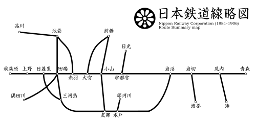
Meanwhile, by 1900, a line had also been opened from Iwakiri to Shiogama (located in a different place from the current Shiogama Station, near where the Hon-Shiogama Station on the Senseki Line is now). This line would later be called the Shiogama Line. The line that was mentioned in the Railway Song, where passengers transferred at Iwakiri Station, is this Shiogama Line
During the time when the provincial capital of Mutsu Province was located in Tagajo, there was a port for the provincial capital called "Kozu" in Shiogama.The place name Kozu-machi in present-day Shiogama City is believed to be a variation of the spelling of Kozu.
With the establishment of Kōzu, it was a reasonable idea to build a railway line to Shiogama, which had long been a representative port on Matsushima Bay. At the planning stage, the Shiogama Line was intended to be part of the Tohoku Main Line. However, when the Tohoku Main Line was further extended, it was constructed by branching off at Iwakiri, just before Shiogama, and passing through Rifu, away from the sea
The inland route had steep gradients, which made train operations difficult, so a new route via Shiogama was established. When the new Tohoku Main Line (the current route) opened in 1944, the western part of the Shiogama Line (up to the vicinity of the current Kokufu-Tagajo Station) was repurposed for the new line
The new line was initially for freight trains only, but later passenger trains also began using it, eventually leading to the closure of the old line (between Rifu and Shinainuma) in 1962. This marked the realization of the concept envisioned during the construction of the Tohoku Main Line
On the other hand, the eastern section of the Shiogama Line was kept as a freight train line before being discontinued in 1997
Take a boat from Shiogama/Chiga-no-ura to Matsushima Bay
The lyrics describe taking the Shiogama Line, arriving at Shiogama Station, and thenboarding a boatto sail out into Matsushima Bay. At that time, the Tohoku Main Line (the old line) did not run along the coast, and the Senseki Line did not yet exist. Therefore, it can be inferred that the main way to visit Matsushima by train was to travel to Shiogama on the Shiogama Line and then take a boat from there.
Currently, if you're sightseeing in Matsushima,it's convenient to get off at Matsushima-Kaigan Station on the Senseki Line. Trains on the Tohoku Main Line and the Senseki-Tohoku Linedo not pass through Matsushima-Kaigan Station, so if you're taking a train from Sendai Station, you'll need to board from the Senseki Line platform located underground at the station.

The Railway Song is interrupted at verse 30, and a song called "Matsushima Boat Trip," treated as an appendix, is inserted for four verses. Even though you depart from Sendai, you make another detour after only one verse
Matsushima boat trip
Row, row, come on, boatman, On the mirror-like sea, The shadows of the 800 islands floating on the waves are fascinating,
changing as you watch, The shape of the pines, the shape of the rocks The island that stands before us is now far behind, shrouded in mist, On a snowy morning,
on a moonlit night, What kind of people are playing there? No matter how far we look, there is
no end to it With the evening scene of Futagojima's Godaido on our right, Near the forest of Zuiganji, The boat has arrived at the shore, Not even for a moment
Matsushima is the collective name for approximately 260 islands scattered in and around Matsushima Bay in northeastern Miyagi Prefecture. The lyrics of the Matsushima boat trip song mentioned above refer to "eight hundred islands," but there aren't actually 800 islands. It's likely that 800 is used as a "large and auspicious number," similar to "eight million gods."
Matsushima is known as one of Japan's three most scenic spots , along with Amanohashidate in Kyoto Prefecture and Miyajima in Hiroshima Prefecture

The boat that departed from Chiga-no-ura in Shiogama passed near the twin islands (Kujira-jima and Kame-jima) in the northwest of Matsushima Bay, and arrived at the shore with Godaido and Zuiganji temples on its right. It seems they landed on the shore near present-day Matsushima Town, close to Matsushima-kaigan Station on the Senseki Line. The commentary says it was "not even a short while" (it was over in a flash), so they must have enjoyed the scenery
Godaido is believed to have been built in the early 9th century by Sakanoue no Tamuramaro during his eastern campaign, and the current building was rebuilt by Date Masamune.the oldest existing Momoyama-period building in the Tohoku region.
Zuiganji Temple is also said to have been founded in the early 9th century. The current main hall was also built by Date Masamune
Link – Matsushima Tourism Association

This article features "Date Masamune" 12 times (excluding this one →). It seems that the history of Miyagi Prefecture cannot be told without mentioning this man
As explained in the commentary for number 30, Matsushima-Kaigan Station on the Senseki Line is currently the most convenient station for sightseeing in Matsushima. However, in 1900, not only had the Senseki Line not yet been opened, but the Tohoku Main Line was also an old line that ran far from the sea
So, how did they get back on their Tohoku Main Line journey after the "Matsushima Boat Trip"? Did they walk to Matsushima Station? Incidentally, Matsushima Station was located on the old line, so its location is different from the current station, about 3 km to the north-northwest
Or did they take another boat back to Shiogama, and then take the Shiogama Line back to Iwakiri? The method of their return is unknown as it is not described in the lyrics
Currently, the Tohoku Main Line runs along the coast, so if you want to resume your Tohoku Main Line journey from Matsushima Kaigan, it's best to walk to Matsushima Station or take a taxi. If a Senseki Line train bound for Ishinomaki arrives at Matsushima Kaigan Station at the right time, you could also take it to the next station, Takagimachi, and walk about 1km from there to Matsushima Station. At Takagimachi, you can transfer to the Senseki Tohoku Line bound for Sendai, and then at the next stop, Shiogama, transfer to the Tohoku Main Line bound for Morioka
31st: Kashimadai, Kogota, Nitta
Even on the train, the conversation was lively with talk of Matsushima, Kashimadai, Kogota is near the shrine, and Nitta has a beautiful marshy landscape
Now that we've returned from the ship to the train, the railway song will resume
Noisy in Kashimadai
Assuming the narrator boarded a Tohoku Main Line train from Matsushima Station, the next station at that time would have been Kashimadai. The lyrics describe other passengers talking about Matsushima even after boarding the train. They were probably excitedly expressing their admiration for the beautiful scenery. It's also worth noting that the station name "Kashimadai" seems to be a pun on "kashimashi" (a Japanese word meaning "noisy" or "boisterous")
Kogota Mountain Shrine
The next station after Kashimadai is Kogota, as Matsuyama-machi was not yet open at the time. Currently, Kogota Station is served by three lines: the Tohoku Main Line, the Rikuu East Line, and the Ishinomaki Line, and some trains on the Kesennuma Line also stop there, making it a major transportation hub. However, at that time, only the Tohoku Main Line was in operation
The " Kami no Miya" in Kogota likely refers to the Yamanokami Shrine, located about 1.7 km north of the station . Incidentally, Kogota Station was relocated to its current location around 1910. Before the relocation in 1900, it was located further north, closer to the Yamanokami Shrine.

Yamajinja Shrine is said to have been established in 1141. The main deity enshrined there is Konohanasakuya-hime no Mikoto, a figure from Japanese mythology. She is considered the goddess of the mountains who protects them and gives birth to their blessings. It is said to bring good fortune in relationships, conception, safe childbirth, and child-rearing
Yamajinja Shrine (Kogota Yamajinja Shrine) –<Information>
- Name: Yamajinja (Kogota Yamajinja)
- Address: 37 Ushikai Sainodai, Misato-cho, Toda-gun, Miyagi Prefecture 987-0004
- Phone number: 0229-33-2082 (Reception hours: 9:00 AM - 4:00 PM)
- Official URL:Yamanokami Shrine | The mountain god of Kogota for safe childbirth and fertility
Google Map
Swamp near Nitta Station
The next station mentioned, Nitta Station, is located near a marsh, or rather, surrounded by a marsh, just as the lyrics describe. Izunuma Marsh, located north of the station, is a place where greater white-fronted geese (a national natural monument) and whooper swans come to visit, and it remains a popular spot for birdwatching enthusiasts

Izunuma Marsh and the nearby Uchinuma Marsh were registered under the Ramsar Convention in 1985. The Ramsar Convention is an international treaty established in 1971 with the aim of conserving wetlands. In Japan, it was the second to be registered under the Ramsar Convention, following the Kushiro Marsh in Hokkaido, which was registered in 1980
Link – Ministry of the Environment
Our trip through Miyagi Prefecture, where we enjoyed Sendai, the largest city in the Tohoku region, and Matsushima, one of Japan's three most scenic spots, has come to an end. We will now enter Iwate Prefecture on the next train, number 32. That's all for today
Series <Railway Song>


A former railway engineer and current freelance writer who has loved trains since childhood, his dream is to make train travel his career
Please support NEFT's article creation!
NEFT gathers and publishes articles about the history, culture, and tourism information of various regions in Tohoku
If you enjoyed this article, we would be grateful if you would consider supporting our future interviews, article creation, and website management
*Clicking "Tip" will open the tip sending screen for the external service "codoc"
Other articles

Historical heritage remaining in Tsuruoka, a port of call for Kitamae ships [Yamagata Prefecture]

[Miyagi Prefecture] Enjoy delicious Amazake from the rice-producing region!

[Kitakata, Fukushima Prefecture] Kitakata, with its delicious water, is not just famous for ramen...

Mount Iwate is an active volcano! The base of the mountain is covered in black lava flow "Yakihashiri"...

[Miyagi Prefecture] Naruko Onsen, visited by Minamoto no Yoshitsune and Matsuo Basho...

[Miyagi Prefecture] Please learn the Miyagi dialect! "So...

Experience the tranquility and bustle of Sendai Toshogu Shrine! [Miyagi Prefecture]

Enjoy the view of Akita City from above! Port Tower Serio...

[Yamagata Prefecture] Recommended for winter outings! Yamagata Sound and Light Festival...

[Shonai Region, Yamagata Prefecture] A beloved restaurant in the Shonai region that warms both body and soul...

Local Report: First foray into Tohoku! A comfortable "comfort hotel" with an innovative concept...
