


Recommended scenic driving routes in Tohoku! The autumn foliage around Hakkoda Mountains, Oirase Gorge, and Lake Towada is just coming to an end! National Route 103 (Aomori City to Lake Towada) [Aomori Prefecture/Akita Prefecture]

National Route 103 is a national highway with a total length of 141.6 km, starting in Aomori City, Aomori Prefecture, passing through mountains (Hakkoda Mountain Range), rivers (Oirase Gorge), and lakes (Lake Towada), all famous for their autumn foliage, before ending in Odate City, Akita Prefecture
In particular, the approximately 62km section from Aomori City to Lake Towada is affectionately known as the "Hakkoda-Towada Gold Line."
This time, we bring you a driving report on the Hakkoda-Towada Gold Line, which will soon be at the peak of its autumn foliage season (please note that the prices mentioned in this article are inclusive of tax as of September 29, 2026)
Akita Prefecture, Aomori City to Hakkoda Ropeway Station

National Route 103 begins at the "National Route NTT Intersection" on National Route 4, and as it leaves the urban area near Nojiri in the city, the amount of greenery along the road increases

The road starts to climb about 15 minutes from the starting point as you enter the Moya district, and from around "Link Station Hills Moya Hills," it becomes a real uphill drive
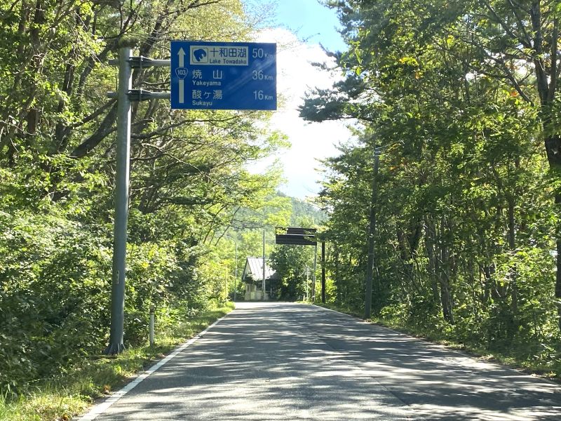
Further on, near the Iwakiyama Observatory, the road becomes more winding and the incline steeper. After driving for about 10 minutes along the tree-covered mountain road, you will arrive at the Hakkoda Ropeway base station


A little detour, part 1: Iwaki Mountain Observatory

From this observation deck, located about 20 minutes from the starting point, you can enjoy a view of Mount Iwaki, which is more than 20km away
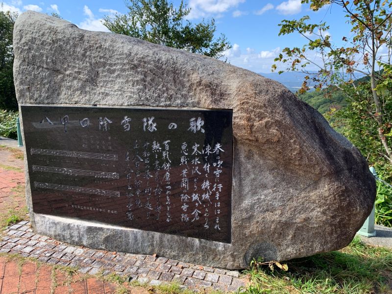
However, due to the cloudy weather that day, Mount Iwaki was not visible, and the autumn leaves in the surrounding area had not yet changed color. (As of September 29th)
Iwaki Mountain Observatory <Information>
- Name: Mt. Iwaki Observatory
- Address: Yamabuki, Kumotani, Aomori City, Aomori Prefecture
Google Map
A little detour, part 2: Hakkoda Ropeway
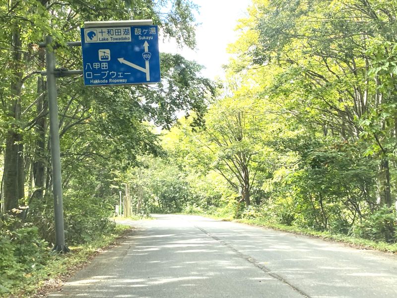
From the ropeway, you can enjoy panoramic views of not only the Hakkoda mountain range, but also Aomori city, Mutsu Bay stretching out beyond, the Tsugaru Peninsula and Shimokita Peninsula, and even Mount Iwaki
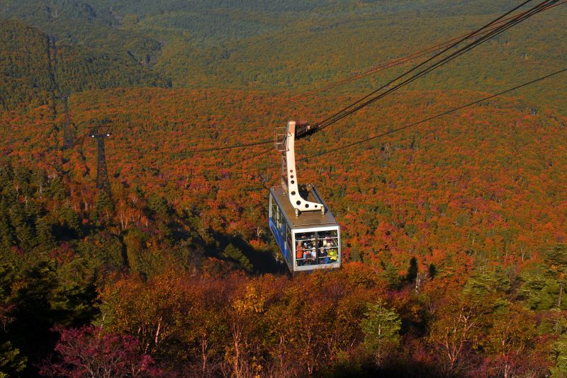
I had planned to take the ropeway to the mountaintop park station and back, but it was closed that day due to strong winds near the station. The autumn foliage visible from the ropeway will soon be at its peak

The ropeway will be suspended during severe weather conditions, including wind speeds of 25 m/s or higher. It is recommended to check the operating status on the official website
The journey takes about 10 minutes one way. The fare is 1,550 yen one way for adults (junior high school age and older) (2,500 yen round trip), 450 yen for children (elementary school age and older) (700 yen round trip), and free for preschool children
Hakkoda Ropeway <Information>
- Name: Hakkoda Ropeway - Base Station
- Address: 1-12 Arakawa Kansuizawa, Aomori City, Aomori Prefecture
- Phone number: 017-738-0343
- Opening hours: 9:00 AM - 4:20 PM (until 3:40 PM from mid-November to February)
- Closed days: Open all year round, however, service will be suspended in case of strong winds (wind speed of 25 m/s or more) or bad weather
- Official URL:Hakkoda Ropeway Official Website
Google Map
Hakkoda Ropeway - Base Station to Sukayu Onsen

The 5.5km (approximately 10-minute) drive from the base station to Sukayu Onsen is a pleasant, gently uphill route, and autumn leaves, just beginning to change color, were starting to appear on both sides of the road

National Route 102 merges with National Route 394, which connects Hirosaki City and Mutsu City, near Hotel Jogakura, and then the two routes overlap for a while before arriving at Sukayu Onsen, which is at an altitude of approximately 900m
A little detour, part 3: A truly famous spot for autumn foliage! Jogakura Bridge

Before arriving at Sukayu Onsen, I visited the famous autumn foliage spot, "Jogakura Ohashi Bridge," located just off National Route 394, to check the progress of the autumn colors

The view from the parking lot at the foot of the bridge was wonderful, but the leaves hadn't changed color yet. As usual, the peak of the autumn foliage will probably be from mid-to-late October
Jogakura Ohashi Bridge <Information>
- Name: Jogakura Ohashi Bridge
- Address: Arakawa Kansuizawa, Aomori City, Aomori Prefecture
Google Map
A little detour, part 4: Sukayu Onsen, a hot spring in a heavy snowfall area

Sukayu, which has been a popular hot spring resort for centuries, was designated as the "No. 1 National Health Resort Hot Spring" in 1954 (Showa 29), and is famous for its 160-tatami mat mixed-gender bathhouse, "Hiba Sennin-buro," which is made entirely of cypress wood

This highly acidic sulfur spring (pH 1.5-2.0) is very irritating to the skin, and its therapeutic properties have been recognized
Aomori's local specialty: "Ginger Miso Oden"

Additionally, you can take out ginger miso oden (radish, konjac, and fish cakes) from the souvenir shop next to the entrance, starting from 220 yen

"Ginger miso oden," topped with a sweet miso sauce containing grated ginger, is a type of oden that warms you from the inside out thanks to the effects of ginger

This ginger miso oden was originally created by a food stall near Aomori Station to warm the bodies of passengers on the Aomori-Hakodate Ferry, and has now become a popular local delicacy in Aomori

Additionally, the hot spring resort's restaurant, "Soba-dokoro Kimen-an," offers dishes such as "Sukayu Onsen Egg Soba" and "Mountain Vegetable Soba" during lunchtime
Sukayu Onsen <Information>
- Name: Sukayu Onsen Ryokan
- Address: Arakawa Minami Arakawayama National Forest, Sukayuzawa, Aomori City, Aomori Prefecture
- Phone number: 017-738-6400
- Opening hours: Check-in 15:00-22:00, Check-out 10:00 the following day
- Opening hours: Day-use bathing - 9:00 AM - 5:00 PM
- Opening hours: Souvenir shop 7:00 AM - 8:00 PM
- Opening hours: Soba restaurant Kimen-an 10:00 - 16:30 (Last order 16:15)
- Regular closing days: None (Temporary closures may occur due to facility maintenance, etc.)
- Official URL:Sukayu Official Website
Google Map
Sukayu Onsen ~ Oirase Keiryu Hotel

The approximately 9km stretch from Sukayu Onsen to the entrance of Yachi Onsen offers a pleasant drive, passing scenic spots such as Kasamatsu Pass, where a "snow corridor" appears in spring, and Jigoku-numa and Suiren-numa
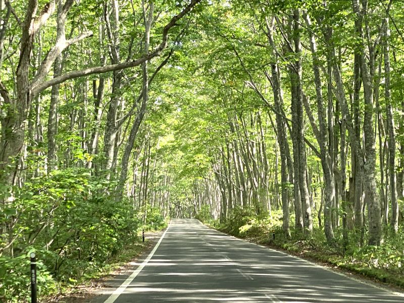
Near the entrance to Yachi Onsen, you separate from National Route 394, which you had been using in parallel, and enter the "Hakkoda Beech Secondary Forest," where beech trees that have regenerated after being felled stand tall on both sides of the road, and a mystical tunnel of beech trees appears
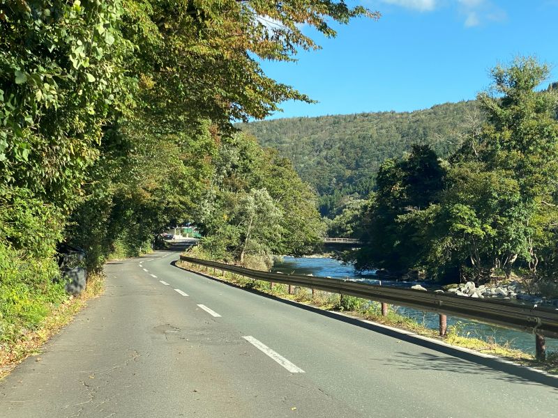
After that, head south along the Tsutagawa River for about 20 minutes, and when you reach the point where the Tsutagawa River and the Oirasegawa River meet, where it overlaps with National Route 102, you will see the "Oirase Keiryu Hotel"
Hoshino Resorts "Oirase Keiryu Hotel"

Located about 30 minutes (approximately 20 km) from Sukayu Onsen and 25 minutes from Lake Towada, this is the only luxury resort hotel in the Oirase Gorge
There are plenty of activities available to enjoy the seasonal nature of the Oirase Gorge and Mount Hakkoda, making it a popular base for enjoying hot springs and the beauty of the gorge
Oirase Keiryu Hotel <Information>
- Name: Hoshino Resorts Oirase Keiryu Hotel
- Address: 231 Okuse Tochikubo, Towada City, Aomori Prefecture
- Phone number: 050-3134-8094
- Accommodation: Check-in 15:00, Check-out 12:00 the following day
- Closed on: None (Closed on facility maintenance days)
- Winter closure: From late November to mid-April of the following year
- Official URL:Oirase Keiryu Hotel Official Website
Google Map
Oirase Stream Hotel ~ Oirase Stream ~ Konokuchi
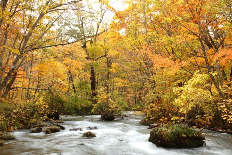
The Oirase River, which flows from Lake Towada's Nenokuchi to Yakiyama (near the Oirase Keiryu Hotel), stretches for approximately 14 km and is known as the "Oirase Gorge." A walking path is maintained along the gorge, allowing visitors to stroll and enjoy the scenic beauty of the river, rocks, and waterfalls
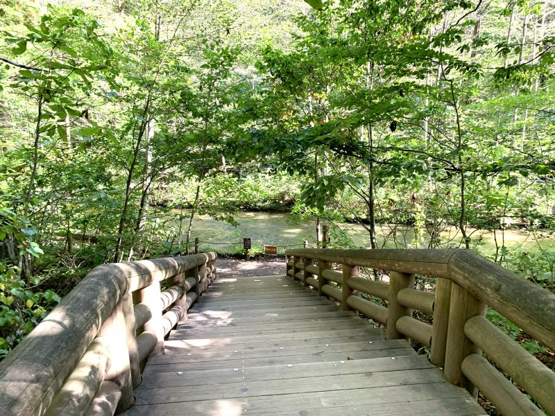

However, a drawback of driving along this section of National Route 103 (102) is the lack of parking spaces at the numerous tourist spots scattered along the mountain stream
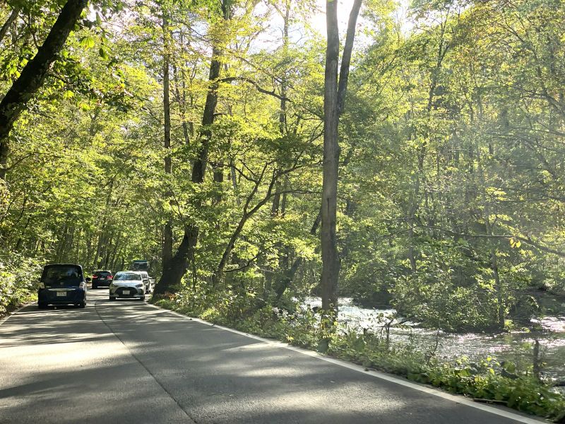
Among these locations, the Ishigeto rest area, about 10 minutes from the Oirase Keiryu Hotel, offers a valuable parking space where you can get out of your car and enjoy a close-up view of the stream
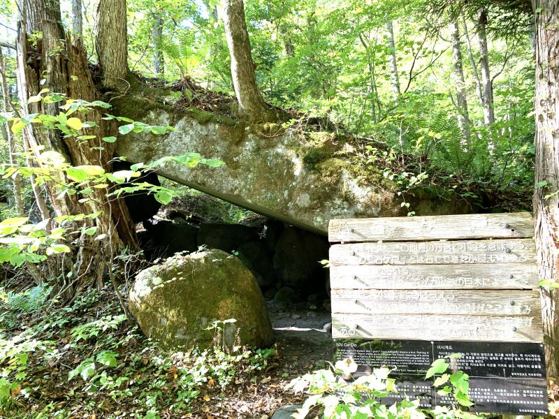
A little detour, part 3: Ishigato Rest Area


Near the rest area, along the shoulder of the national highway, there is a designated area marked with ropes where cars can park in a row (approximately 50 spaces), and it is free to use
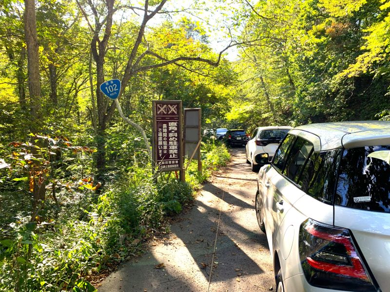
However, it gets very crowded on Saturdays, Sundays, and public holidays, and even when I visited on a weekday (Tuesday) around 2 PM, the parking lot was almost full
The area is expected to get even more crowded during the autumn foliage season, so it's recommended to go early in the morning to guarantee a parking spot
Ishigato Rest Area <Information>
- Name: Ishigeto Rest Area
- Address: 1-12 Okuse, Towada City, Aomori Prefecture
- Phone number: 0176-74-2355
- Business hours: 8:30-16:30
- Closed: New Year's holidays (December 31st - January 1st)
- Official URL:Towada Lake Hometown Revitalization Corporation Official Website
Google Map
Lake Towada - Konokuchi to Lake Towada - Yasumiya

From Ishigato Rest Area, it takes about 15 minutes to reach Konokuchi on the eastern shore of Lake Towada. After that, we planned to proceed counterclockwise, visiting observation decks and other spots on the northern shore, and then enjoy seasonal Himemasu (landlocked salmon) dishes at the restaurant district of Yasumiya on the southern shore

However, we arrived at Konokuchi a little late, and the restaurants were about to close, so we headed to Yasumiya on the shores of Lake Towada via the shortest route from the south
Himemasu (landlocked salmon) dishes from Lake Towada

Himemasu is a freshwater fish belonging to the salmon family. It has a mild flavor and a delicate sweetness, and its fatty, pink flesh makes it delicious when prepared as sashimi, grilled with salt, or pan-fried

I arrived in the Yasumiya district a little before 3 PM, but most of the shops were already closed, and the ones that were still open had closed for the day. Only one shop was open, but they had sold out of kokanee salmon

To be sure to enjoy kokanee salmon at Lake Towada, we recommend going to a restaurant early in the lunch hour
Lake Towada, Yasumiya - Michi-no-Eki Towada Lake

Unable to give up on the idea of eating Himemasu (landlocked salmon), I drove for about 10 minutes to "Michi-no-Eki Towada-ko" (Roadside Station Towada Lake), which had Himemasu Tempura Donburi (tempura rice bowl with landlocked salmon) on its menu, but the restaurant had already closed at 3 PM

Having no other choice, I took a short break at a roadside rest area before crossing the Hakka Pass and heading home
A little detour, part 4: Towada Lake Roadside Station

The roadside station, which opened in October 2024, is nicknamed "Himemasu no Sato Wainai" and has an attached "Towada Lake Himemasu no Sato Exhibition Room" where exhibits are displayed about the formation of Lake Towada and materials related to Sadayuki Wainai, who succeeded in farming Himemasu salmon

In addition to selling local products from Lake Towada, the shop offers gourmet food such as "Himemasu Tempura Donburi" and "Kosakamachi Katsu Ramen," as well as the popular "Lake Blue Soft Serve Ice Cream," which is yogurt-flavored and as blue as the lake
Roadside Station Towada Lake <Information>
- Name: Michi-no-Eki Towada-ko
- Address: 1-2 Oide, Towadako, Kosaka-machi, Kazuno-gun, Akita Prefecture
- Phone number: 0176-27-1229
- Opening hours: Shop 9:00-17:00
- Opening hours: Cafeteria 11:00-15:00 (Drinks and soft serve ice cream 9:00-17:00)
- Closed days: Open every day (however, closed for winter from mid-November to mid-April; dates subject to change)
- Official URL:Michi-no-Eki Towada Official Website
- Official URL:Kazuno Tourism and Products Corporation, Kazuno DMO Promotion Office Official Website (Regional DMO)
Google Map
summary
During the winter, National Route 103 is passable from Aomori City to Sukayu Onsen, but the approximately 8km section from Sukayu Onsen to Towada-ko Yachi is closed to traffic
If you're planning a drive in late November, it's a good idea to check the winter road closure information for National Route 103 before you go
National Route 103 (Aomori City to Lake Towada) Driving Map
- In front of NTT Aomori Branch Office
- Kayano Plateau
- Iwaki Mountain Observatory
- Hakkoda Ropeway Base Station
- Jogakura Bridge
- Sukayu Onsen Ryokan
- Oirase Keiryu Hotel by Hoshino Resorts
- Ishigedo Rest Area
- Tochino Chaya Restaurant
- Roadside Station Towada Lake
Google Map

I'm a former Edoite (Tokyoite) who loves Morioka and the six prefectures of Tohoku, and I'm a big fan of history, gourmet food, travel, sports, alcohol, and choral singing.
I'll introduce you to interesting things, delicious food, and great places in Tohoku!
Please support NEFT's article creation!
NEFT gathers and publishes articles about the history, culture, and tourism information of various regions in Tohoku
If you enjoyed this article, we would be grateful if you would consider supporting our future interviews, article creation, and website management
*Clicking "Tip" will open the tip sending screen for the external service "codoc"
Other articles

[Tome City, Miyagi Prefecture] A thousand-year-old history of worshipping Hachiman...
Iwadeyama's Arahagihaba Shrine | Has it been enshrined here for 2,000 years? (Referring to the place name...).

[Mount Chokai-Tobishima Geopark: Yuza and Sakata] From Mount Chokai...

[The History of Hachirogata Lagoon Reclamation ①] Japan's second largest lake...

Aomori Hiba: A rare resource | Aomori Hiba: A man who wanted to become a cypress but couldn't...

Obon in southern Aomori Prefecture is a little different! Back protectors and 48 lanterns...

[Iwate] Experience mountain village life with "Maburito"...

Hachiro Kiyokawa, the creator of the Shinsengumi | The anti-foreigner patriot who opened the curtain on the end of the Edo period...

The local train and bus between Morioka and Miyako have been competing for 40 years...

[History of Hachirogata Reclamation ③] The land is below sea level...water is our lifeline...

[Iwate Prefecture] Why is Morioka in Iwate called that? The origin of the place name...
